Loading the model
This device cannot show the 3D model. You can read the guide steps below as text.
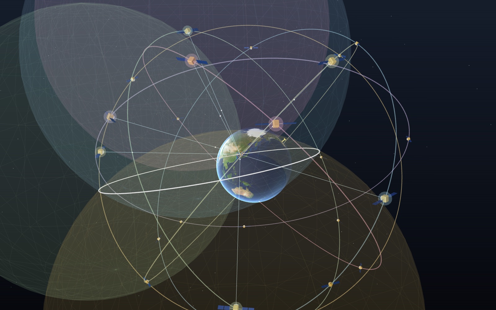
1 / 8 24 satellites in six planes Each plane holds four baseline satellites about 20,200 km up, and each one goes round twice a day. The phone in Seoul sees between 5 and 10 of the 24 slots at any moment. The readout and the phone map follow the controls.
Drag to turn. Scroll or pinch to zoom.
Guide Parts Controls
01 24 satellites in six planes Each plane holds four baseline satellites about 20,200 km up, and each one goes round twice a day. The phone in Seoul sees between 5 and 10 of the 24 slots at any moment. The readout and the phone map follow the controls.
02 One satellite gives a sphere The satellite sends the time and the phone notes when it arrives. The trip takes about 70 ms, and 70 ms times 299,792 km/s is about 21,000 km. That range puts the phone anywhere on the blue sphere.
03 Two satellites give a circle A second range adds a second sphere. Where the two meet is a circle, and the phone could be anywhere on it. The white ring is that circle.
04 Three satellites and a bad clock Three spheres meet at two points; the one out in space is dropped. But the phone's clock is 100 µs off, so every range is 30 km too long and the dot misses by tens of kilometres. Try the Phone clock error slider.
05 The fourth satellite fixes the clock Four ranges give four equations for four unknowns: x, y, z and the clock error. The solver finds the 100 µs on its own in a few rounds, and the error drops to a few metres.
06 Turn relativity off The satellite clocks run 38.6 µs a day fast: 45.7 from weaker gravity minus 7.2 from their speed. Without the correction the clocks drift apart and the fix wanders by kilometres within hours.
07 Tall buildings and reflections Here the street is lined with tall buildings. Satellites low across the street are blocked, and some reach the phone only after bouncing off a wall. The longer path adds tens of metres to the range.
08 Where the satellites sit matters Four satellites close together in the sky measure almost the same thing. PDOP rises, and each metre of range error moves the dot several times further on the map. Turn the bunching off to compare.
Earth Held still, so the orbit planes turn around it once a sidereal day. Drawn as a sphere 6,371 km in radius. Map: NASA Blue Marble. Six orbit planes Planes A to F, 60° apart and tilted 55° to the equator. Radius 26,560 km, true to scale with the Earth (SPS Performance Standard 2020). GPS satellites The 24 baseline slots of Table 3.2-1, each going round twice a sidereal day at 3.87 km/s. The ones in use are drawn larger. On this scale each model is nearly 3,000 km across the panels. Signal path Each satellite sends the time on its atomic clock. The light pulse shows the trip, about 67 ms from straight overhead and 86 ms from the horizon. Range sphere All the places that lie at the measured range from one satellite. Its radius is the travel time times the speed of light, phone clock error included. Where two spheres meet Two ranges leave a circle. The phone is somewhere on it, and the circle is thousands of kilometres across. Position fix With three satellites, the two points where three spheres meet (orange near the ground, grey out in space). With four or more, the point the solver settles on. Phone A receiver at Seoul City Hall (37.57°N, 126.98°E). Its quartz clock is far worse than the satellites' atomic clocks, so its error is solved as a fourth unknown. Street canyon A north–south street 24 m wide between 30 to 50 m buildings, drawn 14,000 times life size. Low satellites are hidden or reach the phone off a wall. Master control station Schriever Space Force Base, Colorado. It tracks the satellites through 16 monitoring sites and uploads their orbits and clock corrections.