FIG. 74How It Works
How GPS works: why your phone needs four satellites
A GPS signal takes about 70 thousandths of a second to fall 20,200 km to your phone, and a millionth of a second of error moves you 300 m.
This device cannot show the 3D model. You can read the guide steps below as text.
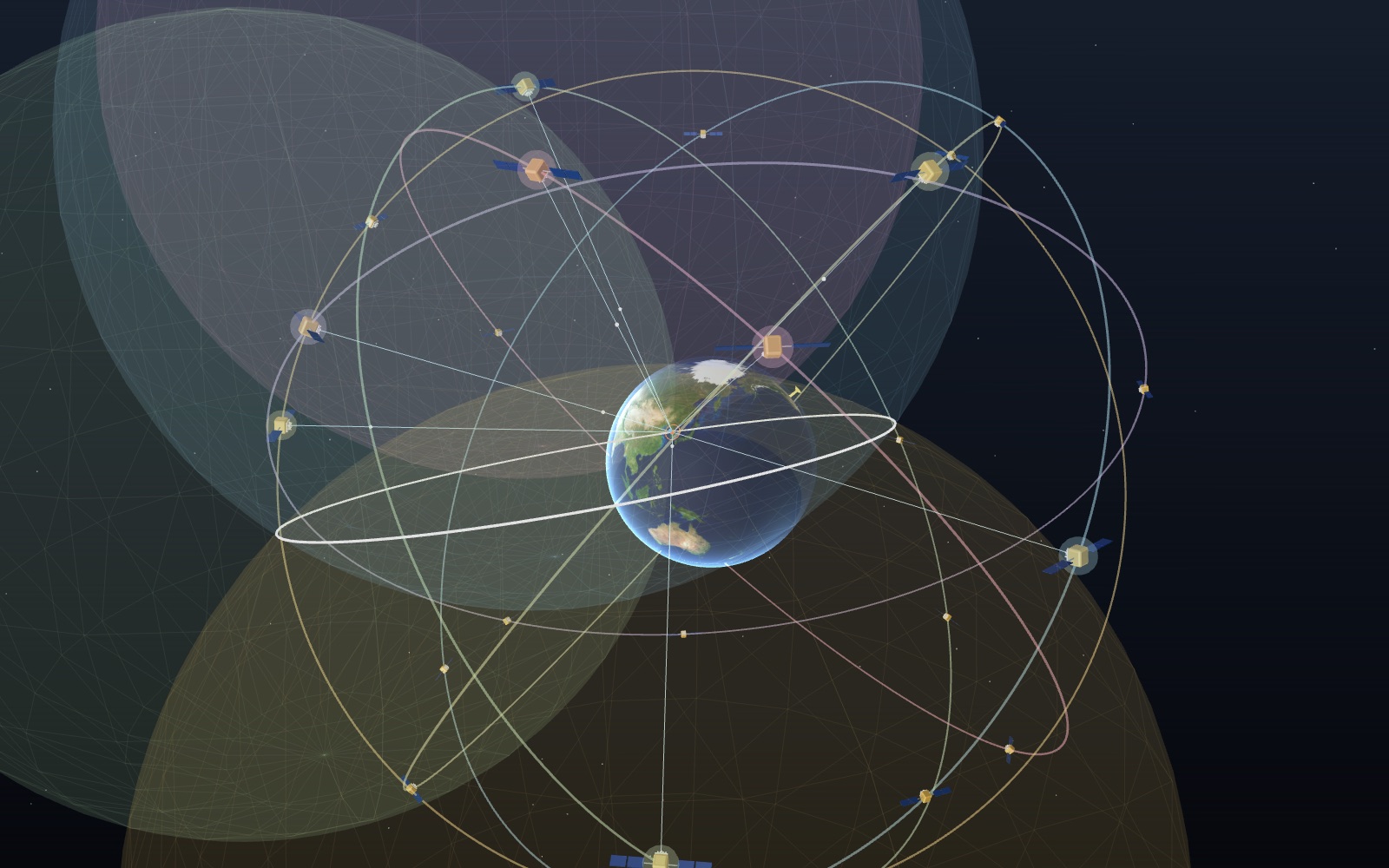
1 / 8 24 satellites in six planesEach plane holds four baseline satellites about 20,200 km up, and each one goes round twice a day. The phone in Seoul sees between 5 and 10 of the 24 slots at any moment. The readout and the phone map follow the controls.
Drag to turn. Scroll or pinch to zoom.
What the model shows
GPS normally needs at least four satellites to solve for a receiver’s position and its clock error. Each signal gives a distance estimate, and the receiver finds where those distances agree. Your phone listens to the broadcasts; it does not send a signal back to the satellites.
Open a map app on a phone and a blue dot appears, usually within a few metres of where you are standing. The phone did not ask anyone where it was. It listened to a handful of satellites about 20,200 km overhead, timed their signals and worked the position out by itself. This exhibit follows that sum step by step.
The Earth sits in the middle and is held still, so the six orbit planes turn slowly around it, once in a sidereal day. The satellites are placed in the 24 baseline slots published in the GPS Standard Positioning Service Performance Standard (2020), and they move from the slot positions at the table's epoch to the present moment. Distances in space are true to scale: the orbit radius is 4.17 times the Earth's radius, as it is in the sky. The satellite models, the phone and the city block are drawn far larger than life, or they would be invisible.
A phone at Seoul City Hall does the measuring. The readout in the top left shows how many satellites it uses, how long the first signal took to arrive, the range that gives, the phone's clock error as the solver finds it, the relativity setting, the PDOP (a number for the satellite geometry, explained below) and the final position error. The small phone screen in the bottom right draws the true spot as a cross and the computed position as a blue dot, with the scale changing from 40 m to thousands of kilometres as the error grows.
On the Controls tab you can choose from one to eight satellites, set the phone's clock error from 0 to 1,000 microseconds, switch the relativity correction off, put the phone in a street between tall buildings and make it use satellites that are bunched together in the sky. The guide walks through the same controls in order.
Turning a time into a distance
Each GPS satellite carries atomic clocks and broadcasts, over and over, what time it is on board and where the satellite is. Radio waves travel at the speed of light, 299,792,458 m/s. So if the phone knows when a signal left and notices when it arrived, the gap times the speed of light is the distance to the satellite.
The numbers are small. From a satellite straight overhead, 20,189 km above the ground in this model, the signal takes 67.3 thousandths of a second. From a satellite on the horizon, 25,780 km away, it takes 86.0 ms. A timing slip of one microsecond (a millionth of a second) is 299.8 m of range, and a slip of one nanosecond is 30 cm. That is why the clocks matter more than anything else in GPS, and why the satellites carry atomic ones.
The readout shows the travel time of the first satellite in use, which is always the highest one in the sky, and the range that follows from it.
One sphere, then a circle, then two points
One range on its own says very little. The phone is 21,000 km from a satellite, but in which direction? Every point at that distance qualifies, and together they make a sphere around the satellite. That is the blue shell in the second guide step. It is large: its radius is close to the orbit radius, so the sphere swallows the Earth and passes through the phone.
A second satellite gives a second sphere. Two spheres that overlap meet in a circle, drawn in white. The phone is somewhere on that circle, which is thousands of kilometres across and crosses the Earth in two places.
A third sphere cuts the circle at two points. This is trilateration, the same idea a surveyor uses with a tape measure, only with three distances in three dimensions. One of the two points is near the Earth's surface. The other is far out in space, and in the model it sits about 27,600 km from the phone and some 26,900 km above the ground. A receiver on the ground simply drops it. The model shows both: the orange ball is the one a phone would keep, the grey one is the other answer.
Why the phone needs a fourth satellite
Three satellites would be enough if the phone's clock were as good as the satellites'. It is not. A phone keeps time with a small quartz crystal, and nobody sets it to the nanosecond. If the phone's clock is 100 µs ahead, every signal seems to have taken 100 µs longer, and every range comes out 30 km too long. The three spheres still meet, but in the wrong place.
The fourth guide step shows the result. With a 100 µs clock error and three satellites, the dot lands tens of kilometres from the true spot; at the moment checked for this page (03:00 UTC on 17 October 2026) it is 28.9 km off. A 1 µs error still costs 288 m.
The way out is to treat the clock error as one more unknown. The position needs three numbers (x, y and z) and the clock error is a fourth, so the phone needs four ranges, and so four satellites. The trick is that the clock error is the same for all of them, because they are all timed against the one clock in the phone. A wrong clock makes the four spheres miss each other, and there is only one clock setting at which they meet at a single point. Finding that setting fixes the clock and the position together. Ranges that still contain the unknown clock error are called pseudoranges.
This is also why a GPS receiver doubles as a very good clock. Once it has a fix it knows GPS time to within a fraction of a microsecond, which is what phone networks and power grids use it for.
How the phone solves the equations
The four equations are not straight lines, so there is no simple formula to read off. The receiver guesses, checks and corrects. The model uses the standard method, iterative least squares (Gauss–Newton):
- Start from a guess. The model starts on the Earth's surface under the middle of the satellites in use, with the clock error at zero.
- For each satellite, work out the range the guess predicts and compare it with the measured pseudorange.
- Work out how the predicted ranges would change if the guess moved a little in x, y or z, or if the clock changed a little. These are the unit vectors toward each satellite, plus a 1 for the clock.
- Solve for the small move that best removes the differences, apply it, and repeat.
Each round cuts the error by a large factor. With exact ranges and a 100 µs clock error, the model's solver lands within a millimetre in at most six rounds at every moment tested over a day, and the clock error comes back as 100.00 µs. With five to eight satellites there are more equations than unknowns, and least squares picks the point that fits all of them best. That is why more satellites help even when four are enough. The same steps were also worked through by hand and give the same numbers.
Clocks in orbit run fast: 38.6 µs a day
Relativity enters through the satellite clocks. Two effects pull in opposite directions. A clock deeper in a gravity well runs slower, so a satellite clock 20,200 km up, where gravity is weaker, runs faster than one on the ground: 45.7 µs a day faster using the orbit radius and the Earth's mass. A moving clock runs slower, and at 3.87 km/s that costs 7.2 µs a day. The net is about 38.5 µs a day fast.
The GPS interface specification, IS-GPS-200, sets the satellite clock rate offset at −4.4647 × 10⁻¹⁰, which is 38.6 µs a day. The satellites' 10.23 MHz reference is set to 10.2299999954326 MHz, so that it reads 10.23 MHz as seen from the ground. Multiplied by the speed of light, 38.6 µs a day is 11.6 km of range a day.
Switch Relativity correction off and the model lets each satellite clock gain 38.6 µs a day since it was last set. The model sets each satellite's clock once a day at a different hour, so at any moment the clocks disagree by up to 38.6 µs. A shared clock error would be absorbed by the fourth unknown, but clocks that disagree with each other cannot be fixed that way, and the dot drifts by kilometres. At the checked moment the error with eight satellites is 2.7 km. Richard Pogge's course notes at Ohio State put the same point plainly: without the relativity corrections a fix would be false within two minutes, and the error would grow by about 10 km a day.
Buildings, reflections and satellite geometry
Under open sky a phone does well. GPS.gov gives a typical smartphone accuracy of 4.9 m (16 ft) radius in the open. The signal in space is better than that: the government commits to a global average user range error of no more than 2.0 m 95% of the time, and the measured figure on 20 April 2021 was 0.643 m. The rest of the error comes from the air, the receiver and the surroundings.
Cities are the hard case. Turn on Street with tall buildings and the phone stands in a north–south street 24 m wide between buildings of 30 to 50 m. Satellites low in the east or west are hidden behind the rooftops. Some of them still reach the phone by bouncing off a wall, and the phone cannot tell a bounced signal from a direct one. The bounce lengthens the path, so that range comes out too long by tens of metres. This is multipath, and it is the reason a map dot jumps around between office towers. At the checked moment the error with eight satellites grows from 1.4 m to 24 m.
Geometry matters too. If the satellites in use all sit in one part of the sky, their spheres cross at shallow angles and a small error in any range moves the crossing point a long way. The number for this is the dilution of precision. PDOP (position DOP) multiplies the range error to give the position error. Four well-spread satellites give a PDOP between about 2 and 3; turn on Satellites bunched together and four satellites close to each other can give 7 or 12. The Performance Standard promises a PDOP of 6 or less, with a 5° mask angle, over at least 98% of the world.
From four ranges to a dot on the map
A phone does more than the model shows before the dot appears. It must first find each satellite's signal, which is weaker than the radio noise around it and shifted in frequency by the satellite's motion, and then read the orbit data each satellite broadcasts. That data comes in at only 50 bits a second, so a receiver starting from nothing has to wait for it. A phone usually gets help from the mobile network, which hands it the orbit data and a rough time, so the first fix comes much sooner.
The position comes out as x, y and z in an Earth-centred frame, which the phone turns into latitude, longitude and height and passes to the map app. The map draws the dot and a pale circle around it, the app's own estimate of how wrong the dot might be. The phone screen in the model draws that circle from HDOP times 2.5 m. Many phones also mix in Wi-Fi, mobile masts and motion sensors, which is why the dot keeps moving in a tunnel.
Behind all of this sits the control segment: a master control station at Schriever Space Force Base in Colorado, an alternate master control station, 11 command and control antennas and 16 monitoring sites. The monitoring sites track the satellites, and the master control station works out their orbits and clock errors and uploads corrections, so that the positions and times the satellites broadcast stay right.
A short history
The programme began in 1973 as a joint civil and military project, combining earlier American navigation work such as TRANSIT and TIMATION. The first Navstar satellite went up in 1978, and the 24-satellite system became fully operational in 1993. Until May 2000 the public signal was deliberately degraded by a feature called Selective Availability; President Clinton ordered it turned off on 1 May 2000, and the United States has said it will not use it again. In June 2011 the constellation was expanded so that it now works as 27 slots, and the Space Force has kept about 31 satellites in service.
What the model leaves out
The orbits are circles placed at the nominal slot positions, not the real satellites of today, and there are 24 of them where the Space Force flies 31. The Earth is a sphere rather than the WGS 84 ellipsoid. The signal is treated as arriving at the same instant it leaves, without the Earth's rotation during the 70 ms trip (the Sagnac correction). The range errors under open sky are a smooth stand-in of about a metre or two per satellite. The ionosphere switch adds a simple single-layer delay with an assumed gradient, and the troposphere is left out. The relativity-off case assumes daily clock settings at staggered hours; real satellites also have a small periodic relativity term from their slightly elliptical orbits, which receivers correct with a formula in IS-GPS-200.
A timing calculation you can check
Take a deliberately rounded travel time of 67 ms. Convert it to seconds before multiplying: 0.067 s × 299,792,458 m/s = 20,086,094.686 m, or about 20,086 km. This is a distance along the signal path, not the altitude of the satellite. A satellite away from the zenith has a longer sloping path to the receiver than an overhead satellite at the same altitude. The rounded example therefore need not match the first satellite shown in the readout. Use that satellite's displayed time to reproduce its own range instead.
Now consider a delay error of 1 ns. Multiplying 0.000000001 s by the same speed gives 0.299792458 m, approximately 30 cm. That is a range error before the receiver combines its measurements. It is not a promise that the final map position moves exactly 30 cm. Satellite geometry and the clock solution determine how the individual range errors turn into errors along the ground or in height. The same distinction applies when a wall lengthens a signal path.
The Ohio State University explanation gives rounded daily relativistic contributions of −7 µs from motion and +45 µs from weaker gravity. Their sum is +38 µs per day. Multiplying 0.000038 s by the speed of light gives 11,392.113404 m, roughly 11.4 km of range drift per day. This is the scale behind the often quoted daily error of about 10 km. These rounded teaching values do not replace the model's more precise clock-rate setting. Nor does a common offset on all satellites automatically cause that much position error: a receiver can absorb a common clock offset. Differences among satellite clocks are what prevent that simple cancellation.
Why satellite geometry multiplies error
Imagine drawing two circles on paper to find a position from distances to two landmarks. Where the circles cross at a large angle, moving either circle a little moves the crossing a little. Where they almost touch, the same small range change can move the crossing a long way. The receiver faces the spatial version of this problem with intersecting range surfaces and an additional clock unknown. DOP describes this sensitivity using the directions to the satellites, rather than their signal strength.
For a worked example, assume independent range errors of equal size with a standard deviation of 2 m. With PDOP 2, the approximate combined spatial position uncertainty is 4 m; with PDOP 6 it becomes 12 m. These are assumed inputs for explaining the multiplication, not measured performance guarantees. PDOP is dimensionless. HDOP concerns horizontal coordinates, while VDOP concerns the vertical coordinate. A phone may have a good horizontal fix but less certain height because the available satellites all lie above it, rather than surrounding it evenly in every direction.
Adding another satellite often helps, but counting satellites alone cannot tell you the result. Another satellite close to those already being used supplies much less independent directional information than one in an open part of the sky. Conversely, a very low satellite might improve the angles while bringing more atmospheric delay or reflections. Real receivers can weight or reject observations rather than treat all ranges as equally trustworthy. The exhibit's clustered-satellite control isolates the geometry lesson; it does not implement every selection rule in a commercial receiver. Compare PDOP and position error separately, because a geometry factor is not itself a measured error in metres.
What a reflected signal does to the answer
Suppose a reflected path is 30 m longer than the direct path. Dividing by the speed of light gives an extra delay of about 100 ns. The receiver can mistake that late arrival for additional satellite distance. This is an illustrative path difference, not a fixed penalty imposed by every building. The length depends on where the wall, satellite and antenna are. A nearby reflection and a signal received only after a long detour are different measurement problems, even though both are common in streets with tall buildings.
If a direct signal and a reflected copy both reach the antenna, their combination can distort the receiver's estimate of arrival time. If the direct signal is blocked altogether, the receiver may lock onto an indirect path. Waiting longer does not necessarily remove either bias. Averaging is effective against some fluctuating noise, but it does not magically reveal a missing direct path. Antenna design, signal processing and observations on several frequencies can help, without guaranteeing an accurate fix behind every obstruction.
The atmosphere causes a different kind of delay. The ionosphere contains free electrons, so its effect depends on radio frequency; comparing signals at different frequencies lets a receiver estimate much of that contribution. The neutral lower atmosphere also delays the signal and requires a separate treatment. Neither delay should be confused with relativity or with the receiver clock bias. GPS.gov lists atmospheric effects, blockage, satellite geometry and receiver quality among the reasons the user's accuracy differs from the broadcast signal's accuracy. The street switch in this exhibit is a simplified obstruction and reflection experiment. It is not a weather or ionospheric forecasting tool, so do not interpret its added metres as a universal atmospheric error budget.
How survey receivers reach centimetres
A navigation message supplies timing and orbit information, but a radio wave also has a repeating carrier. A surveying receiver can measure changes in that carrier phase much more finely than the ordinary code-based range. The difficulty is that a repeating wave does not label which whole cycle reached the antenna. The receiver must resolve that unknown whole-cycle count before the fine measurement can support a reliable precise position. Fine resolution of a repeating pattern alone is not the same as knowing an absolute distance.
Real-time kinematic positioning, usually called RTK, combines carrier-phase observations with corrections from a reference station or a network. A reference station at a known location observes many of the same satellite errors as the moving receiver. Comparing the observations cancels much of their shared error. The correction link can use a local radio or an internet connection. That link is separate from the satellite navigation broadcast. A rover sending data to a correction service is not evidence that every ordinary phone sends its position to GPS satellites.
GPS.gov says that augmentation and high-end receivers can support real-time positioning within a few centimetres. This does not mean any phone can claim that precision after waiting for more satellites. Carrier tracking, a suitable antenna, usable reference data and resolved ambiguities all matter. Trees, walls, a lost correction connection or interrupted tracking can force a precise receiver back to a less certain solution. A survey report therefore records the solution status and quality checks, not merely the number of decimal places in latitude. This exhibit solves simplified pseudoranges; it has neither a reference station nor a carrier ambiguity solver. Its blue dot demonstrates the ordinary position solution, not an RTK accuracy claim.
Four global systems and two regional ones
GPS is not alone in the sky. Russia's GLONASS, the European Union's Galileo and China's BeiDou also cover the whole Earth, and Japan's QZSS serves East Asia and Oceania. Korea is building its own regional system, KPS. The Controls tab of the exhibit lets you add each one to the sky over Seoul and see how many satellites the phone could use.
| System | Height | Tilt | Nominal satellites | Notes |
|---|---|---|---|---|
| GPS | 20,200 km | 55° | 24 in six planes | 31 operational (GPS.gov) |
| GLONASS | 19,100 km | 64.8° | 24 in three planes of eight | period 11 h 15 min 44 s |
| Galileo | 23,222 km | 56° | three planes | 28 usable on 27 Oct 2026 (GSC) |
| BeiDou (BDS-3) | 21,528 km | 55° | 24 MEO, 3 IGSO, 3 GEO | GEO at 80°E, 110.5°E, 140°E |
| QZSS | figure-of-eight, 42,165 km from the centre | 41° | 7 planned | four in service since 2018 |
| KPS | 5 inclined, 3 geostationary | not published | 8 planned | first launch 2029 |
The heights differ because each operator chose a different repeat pattern. A GPS satellite goes round twice in a sidereal day, so its ground track repeats every day. GLONASS sits a little lower and goes round in 11 h 15 min 44 s; the GLONASS Information and Analysis Center notes that this period lets the orbits stay stable without correcting pulses. Galileo is the highest of the four and takes about 14 hours per orbit. BeiDou mixes three kinds of orbit: medium Earth orbits like the others, plus satellites at geostationary height. Three of those hang over the equator, and three move on inclined geosynchronous orbits that trace a figure of eight over Asia.
QZSS takes the inclined idea further. Its quasi-zenith orbits are tilted about 41° and slightly elliptical (eccentricity 0.075), with the far end of the ellipse over the northern hemisphere. A satellite therefore slows down above Japan and spends hours high in the sky: seen from near Tokyo, one stays above 70° elevation for eight hours. Three of them take turns, so one is almost always close to overhead, which is what a street between tall buildings needs. In the exhibit you can switch QZSS on and watch one of its satellites climb past 60° in the sky view over Seoul as well.
More systems do not change the principle of the fix. Each system keeps its own time scale, so a receiver that mixes systems solves for one extra clock offset per system. The model's comparison does the same: with GPS, GLONASS, Galileo, BeiDou and QZSS together it uses five clock unknowns. Even so, the extra satellites help. At one sample time over Seoul the model counted 8 GPS satellites with a PDOP near 2, and 45 satellites from all five systems with a PDOP below 0.8. The model places each satellite along its orbit with an assumed starting phase, so these counts show the shape of the sky rather than today's real satellite positions.
KPS is still a plan. The Korea AeroSpace Administration signed a launch contract in September 2025 for the first satellite, due in September 2029, and plans eight satellites by 2035: five on inclined geosynchronous orbits and three geostationary. The orbit slots have not been published, so the exhibit lists KPS in the table but does not draw it.
Error sources one at a time
The Error sources panel switches the main causes of error on and off and draws a bar for each one alone, with the satellites the phone is using at that moment. The bars use a logarithmic scale because the errors run from tens of centimetres to tens of kilometres.
The ionosphere is the upper layer of the atmosphere where sunlight splits gas into ions and free electrons. Free electrons slow the signal's code by 40.3 × TEC / f² metres, where TEC is the number of electrons in a column one metre square along the path and f is the frequency. One TEC unit is 10¹⁶ electrons per square metre, which delays the GPS L1 signal (1,575.42 MHz) by 0.162 m and the lower L5 signal (1,176.45 MHz) by 0.291 m. A signal from a low satellite crosses the layer at a slant and picks up more delay. If every satellite were delayed equally, the receiver would simply read the delay as a clock offset. The model therefore makes the electron count rise toward the equator by 4% per degree of latitude, an assumed gradient, so part of the delay survives into the position.
Because the delay depends on frequency, a receiver with two frequencies can measure it. The ionosphere-free combination of L1 and L5 cancels the first-order delay, at a price: it multiplies the receiver's own noise by about 2.6. That is why the second-frequency switch can make the error slightly larger under a calm ionosphere and much smaller under a disturbed one. NOAA's Space Weather Prediction Center describes the same trade: single-frequency receivers are good to about a metre in calm conditions, a severe geomagnetic storm can push that to tens of metres, and dual-frequency receivers remove most of it.
Selective Availability was a deliberate error. Until May 2000 the satellites wobbled their clocks so that civil readings could be wrong by as much as 100 m. GPS.gov says that the day it was switched off, civil accuracy improved about tenfold, and GPS III satellites are built without the feature. The model's version is a slow wobble of about 30 m per satellite, a size chosen to give errors of the order GPS.gov describes, not the real dither pattern, which was never published.
The remaining switches repeat experiments from the guide: reflections between buildings, satellites bunched in one part of the sky, and a fix from three satellites that trusts the phone's clock. Seen side by side, the bars show the order of things. Receiver noise and the ionosphere are metres, reflections tens of metres, Selective Availability tens of metres, and a clock error with only three satellites is kilometres.
Outages, interference and storms
Satellite navigation also fails as a system. On 12 July 2019 a fault in Galileo's ground infrastructure stopped its navigation and timing services for all satellites; the European GNSS Service Centre announced the outage at 01:50 UTC and declared service restored on 17 July. Galileo's search and rescue function kept working throughout. Russia's GLONASS fell to seven satellites in 2002 after its funding was cut in the 1990s, too few even for Russian territory, before a federal programme rebuilt it.
Radio interference is a steady concern. GPS.gov lists radio emissions in nearby bands, intentional or unintentional jamming and space weather as sources. In the United States jammers are illegal to use, and the Federal Communications Commission acts against their sale. Ground augmentation has also changed: the U.S. Nationwide Differential GPS service ended on 30 June 2020, because the permanent end of Selective Availability and the new GPS III satellites made it unnecessary for most users. Reference networks now carry the precise work. NOAA's network of continuously operating reference stations publishes free data that let surveyors reach a few centimetres after processing, and QZSS broadcasts centimetre-level corrections from the sky.
The catalogue in the Controls tab lists 36 events and uses of satellite navigation, from the first Soviet navigation satellite in 1967 to the planned KPS, each with the agency page it comes from. Entries with a button change the stage: a system entry adds that system to the sky, the 2000 entry turns Selective Availability on, and the storm entry raises the ionosphere.
Comparing settings on the screen
Start with the relativity correction enabled and the street and clustering options disabled. Choose four satellites, then change only the phone clock error. The receiver clock readout should recover the introduced offset while the position stays much closer to the true cross than an uncorrected range would suggest. Return to three satellites and repeat. The missing clock equation explains the much larger displacement; it is not a failure of light-speed arithmetic.
Restore four satellites before testing the clustered arrangement. Note both PDOP and position error, then turn clustering off without changing the other settings. Finally enable the street and compare again. This separates a change in measurement quality from a change in satellite geometry as far as the simplified controls allow. It is not a controlled field survey: the satellites keep moving with time, so readings taken far apart need not be identical. Record the time if you want to repeat an observation. The small phone map can also change scale, so compare its numeric scale before deciding that a smaller-looking separation means a smaller error.
Questions
How many satellites does a phone need?
Four for a position and the time, because there are four unknowns: three for position and one for the phone's clock error. With three it can only work if it assumes its height or its clock. Phones normally track many more, often from other satellite systems as well.
Does my phone send anything to the satellites?
No. GPS is one-way. The satellites broadcast and the phone only listens, which is why any number of users can share the system and why it works without a phone signal.
Why do the satellites need atomic clocks but my phone does not?
The satellite clocks must agree with each other to a few nanoseconds, because each nanosecond is 30 cm of range. The phone's clock error is the same for all the satellites it hears, so it can be solved as the fourth unknown and does not need to be good to begin with.
Is the relativity correction really needed?
Yes. The net effect is 38.6 µs a day, set out in IS-GPS-200, and it is built into the satellite clocks. Without it, ranges would drift by about 11.6 km a day.
Why is GPS worse in cities?
Buildings block low satellites and reflect others. A reflected signal arrives late, so its range is too long, and the phone cannot easily tell. Fewer visible satellites also means poorer geometry and a larger PDOP.
How high are GPS satellites and how fast do they go?
About 20,200 km above the ground. They go round twice a sidereal day, in 11 hours 58 minutes, at about 3.87 km/s, so a satellite comes back to the same place in the sky about four minutes earlier each day.
Why does the blue dot have a circle around it?
The circle is the phone's estimate of how far off the dot may be. It grows when fewer satellites are in view, when they are badly placed or when the signals look reflected.
Does a larger PDOP mean a stronger signal?
No. PDOP describes geometry, not received radio power. A strong group of signals from nearly the same direction can still give poor geometry.
Will averaging remove a building reflection?
Not reliably. A persistent indirect path can keep a range biased even while random noise averages down. Open sky or better measurement rejection may matter more than waiting.
Is the model demonstrating RTK?
No. RTK needs carrier-phase measurements and reference corrections. This model uses pseudoranges and has no reference station, so its position readout is not a centimetre-level surveying result.
Can a receiver use GLONASS, Galileo and BeiDou as well as GPS?
Yes, if it is built for them. The International GNSS Service runs more than 530 stations that track all of them together. A receiver that mixes systems solves for one extra clock offset per system, and the extra satellites lower PDOP.
What is KPS and when will it work?
KPS is the Korean Positioning System. The first satellite is due to launch in September 2029, and the Korea AeroSpace Administration plans eight satellites by 2035 to serve the Korean Peninsula and nearby regions.
Why does a second frequency remove the ionosphere?
The ionosphere delays a radio signal by an amount that depends on its frequency (40.3 × TEC / f²). Measuring the same range on two frequencies gives two equations, and the receiver can solve out the delay. The cost is more receiver noise.
Was GPS really made less accurate on purpose?
Yes. Until 2 May 2000 Selective Availability degraded civil signals so that readings could be off by up to about 100 m. It was switched off by presidential order, and GPS III satellites cannot use it.
Terms
- Pseudorange: a range worked out from travel time that still contains the receiver's clock error.
- Trilateration: finding a position from distances to known points.
- Receiver clock bias: how far the receiver's clock is from GPS time, solved as the fourth unknown.
- Orbital slot: a nominal position in the constellation, defined by the plane and the place along it.
- Sidereal day: one turn of the Earth relative to the stars, 23 h 56 min 4 s.
- Multipath: a signal reaching the antenna by more than one path, such as off a wall.
- DOP, PDOP, HDOP: dilution of precision; how satellite geometry multiplies range error into position error (in 3D or horizontally).
- URE: user range error, the error of the range from the signal in space.
- Control segment: the ground stations that track the satellites and upload orbit and clock data.
- TEC: total electron content, the number of free electrons in a column one metre square along the signal path.
- IGSO: inclined geosynchronous orbit, one turn a day on a tilted plane, tracing a figure of eight over the ground.
- Selective Availability: the deliberate degradation of civil GPS accuracy, switched off in May 2000.
Sources
- GPS.gov, "Space Segment" (altitude about 20,200 km, six planes, 24 slots, 27-slot expansion in 2011, 31 operational satellites). https://www.gps.gov/space-segment (checked 2026-10-17)
- GPS.gov, "Control Segment" (master control station at Schriever SFB, 11 antennas, 16 monitoring sites). https://www.gps.gov/control-segment (checked 2026-10-17)
- GPS.gov, "GPS Accuracy" (4.9 m smartphone accuracy, URE ≤2.0 m and 0.643 m, multipath). https://www.gps.gov/gps-accuracy (checked 2026-10-17)
- GPS.gov, "Global Positioning System" overview. https://www.gps.gov/gps (checked 2026-10-17)
- GPS.gov, "Selective Availability". https://www.gps.gov/selective-availability (checked 2026-10-17)
- GPS.gov, "GPS and Telling Time". https://www.gps.gov/gps-and-telling-time (checked 2026-10-17)
- U.S. Department of Defense, "Global Positioning System Standard Positioning Service Performance Standard", 5th edition, April 2020 (Tables 3.2-1, 3.2-3 and 3.8-1). https://www.gps.gov/sites/default/files/2025-07/2020-SPS-performance-standard.pdf (checked 2026-10-17)
- "IS-GPS-200N, Navstar GPS Space Segment/Navigation User Segment Interfaces" (§3.3.1.1 clock rate offset −4.4647 × 10⁻¹⁰, 50 bps navigation data). https://www.gps.gov/sites/default/files/2025-07/IS-GPS-200N.pdf (checked 2026-10-17)
- NASA, "Global Positioning System" (first satellite 1978, 24-satellite system operational 1993). https://www.nasa.gov/directorates/somd/space-communications-navigation-program/gps/ (checked 2026-10-17)
- Federal Aviation Administration, "Global Positioning System (GPS)" (programme started 1973). https://www.faa.gov/about/office_org/headquarters_offices/ato/service_units/techops/navservices/gnss/gps (checked 2026-10-17)
- Richard Pogge, The Ohio State University, "Real-World Relativity: The GPS Navigation System". https://www.astronomy.ohio-state.edu/pogge.1/Ast162/Unit5/gps.html (checked 2026-10-17)
- Neil Ashby, "Relativity in the Global Positioning System", Living Reviews in Relativity 6, 1 (2003). https://link.springer.com/article/10.12942/lrr-2003-1 (checked 2026-10-17)
- NIST, "Speed of light in vacuum" (299,792,458 m/s). https://physics.nist.gov/cgi-bin/cuu/Value?c (checked 2026-10-17)
- NASA Space Science Data Coordinated Archive, "Earth Fact Sheet" (mean radius 6,371 km). https://nssdc.gsfc.nasa.gov/planetary/factsheet/earthfact.html (checked 2026-10-17)
- Calculations on this page: GM = 3.986004418 × 10¹⁴ m³/s², orbit radius 26,559.8 km, solver and DOP, checked moment 03:00 UTC on 17 October 2026, receiver at 37.5665°N, 126.978°E.
- GPS.gov, "GPS Modernization" (Selective Availability off in May 2000, tenfold improvement, GPS III without SA). https://www.gps.gov/gps-modernization (checked 2026-10-27)
- GPS.gov, "Other Global Navigation Satellite Systems" (BeiDou 35 satellites, GLONASS 24+, QZSS 7+). https://www.gps.gov/other-global-navigation-satellite-systems-gnss (checked 2026-10-27)
- GPS.gov, "Augmentation Systems" (IGS network of 530+ stations, NDGPS ended 30 June 2020). https://www.gps.gov/augmentation-systems (checked 2026-10-27)
- GPS.gov, "Spectrum and Interference". https://www.gps.gov/spectrum-interference-issues (checked 2026-10-27)
- GLONASS Information and Analysis Center, "About GLONASS" (24 satellites, 3 planes, 64.8°, 19,100 km, 11 h 15 min 44 s; 7 satellites in 2002). https://glonass-iac.ru/en/about_glonass/ (checked 2026-10-27)
- ESA, "What is Galileo?" (23,222 km, 56°, three planes, Initial Services 15 December 2016). https://www.esa.int/Applications/Satellite_navigation/Galileo/What_is_Galileo (checked 2026-10-27)
- European GNSS Service Centre, "Constellation Information" (28 usable satellites). https://www.gsc-europa.eu/system-service-status/constellation-information (checked 2026-10-27)
- European GNSS Service Centre, NAGU 2019026 and 2019027 (Galileo service outage 12 to 17 July 2019). https://www.gsc-europa.eu/notice-advisory-to-galileo-users-nagu-2019026 (checked 2026-10-27)
- China Satellite Navigation Office, "BeiDou Navigation Satellite System Open Service Performance Standard", version 3.0, 2021, §4.1. http://en.beidou.gov.cn/SYSTEMS/Officialdocument/202110/P020211014595952404052.pdf (checked 2026-10-27)
- China Satellite Navigation Office, "System" (three-step development: 2000, 2012, 2020). http://en.beidou.gov.cn/SYSTEMS/System/ (checked 2026-10-27)
- Cabinet Office, Government of Japan, "Quasi-Zenith Satellite System Performance Standard (PS-QZSS-003)", Tables 3.1-2 and 3.1-3. https://qzss.go.jp/en/technical/download/pdf/ps-is-qzss/ps-qzss-003.pdf (checked 2026-10-27)
- Cabinet Office, "Why is QZSS required today?" (QZS-1 on 11 September 2010, four-satellite service since November 2018). https://qzss.go.jp/en/overview/services/sv02_why.html (checked 2026-10-27)
- Cabinet Office, "Orbit" (eight hours above 70° elevation near Tokyo). https://qzss.go.jp/en/technical/technology/orbit.html (checked 2026-10-27)
- Cabinet Office, "QZSS is Becoming a Seven-satellite Constellation". https://qzss.go.jp/en/overview/services/seven-satellite.html (checked 2026-10-27)
- Cabinet Office, "Centimeter Level Augmentation Service (CLAS)". https://qzss.go.jp/en/overview/services/sv06_clas.html (checked 2026-10-27)
- Korea AeroSpace Administration, "KASA and SpaceX Join Forces for the First KPS Satellite Launch" (30 September 2025). https://www.kasa.go.kr/prog/bbsArticle/BBSMSTR_000000000041/view.do?bbsId=BBSMSTR_000000000041&nttId=B000000002274Uo9qE9 (checked 2026-10-27)
- NOAA Space Weather Prediction Center, "Space Weather and GPS Systems". https://www.swpc.noaa.gov/impacts/space-weather-and-gps-systems (checked 2026-10-27)
- NOAA National Geodetic Survey, "CORS Network". https://geodesy.noaa.gov/CORS/ (checked 2026-10-27)
- Federal Aviation Administration, "Wide Area Augmentation System (WAAS)". https://www.faa.gov/about/office_org/headquarters_offices/ato/service_units/techops/navservices/gnss/waas (checked 2026-10-27)
More exhibits
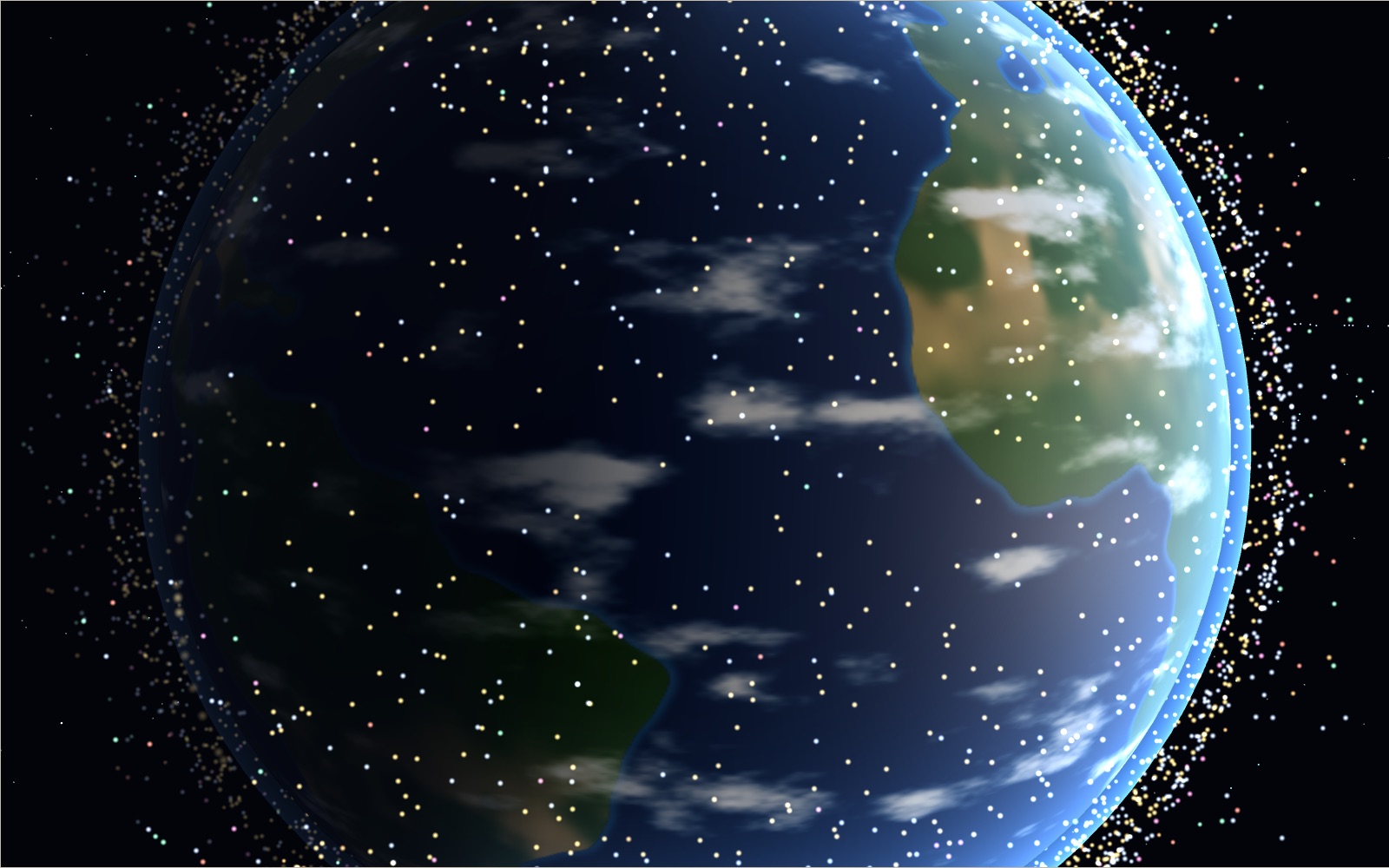
Satellites orbiting Earth right now
On 20 October 2026 the public catalogue listed 16,768 working satellites, and two in every three belonged to one company's internet network.
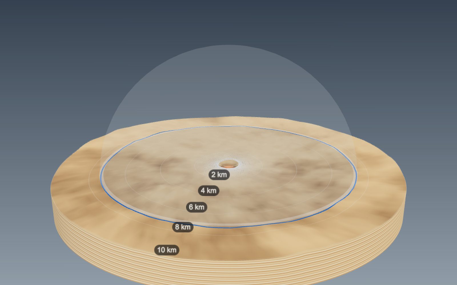
How big a crater would an asteroid make, and how craters form
The 1.2 km wide Meteor Crater in Arizona was dug by an iron asteroid only a few tens of metres across.
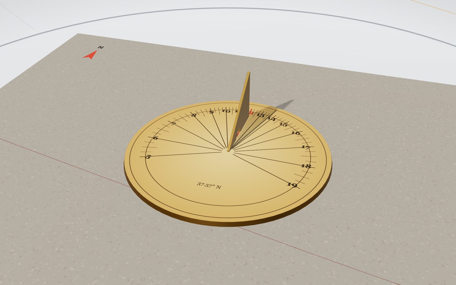
Sundial: interactive model, how to read the time
In Seoul a sundial reads about half an hour behind the clock, because the city lies 8° west of the meridian that sets Korean time.
Why we have seasons: tilted Earth, changing daylight
The Earth is closest to the Sun in the first week of January, in the middle of the northern winter.
Moon phases: why a crescent is not Earth’s shadow
The Moon passes between the Earth and the Sun every 29.5 days, so why is there no solar eclipse every month?
Walk the Apollo landing sites
Standing on the Moon with your eyes 1.6 m up, the horizon is only about 2.4 km away. All six Apollo landing sites are here, from Tranquility Base to Taurus-Littrow.