Loading the model
This device cannot show the 3D model. You can read the guide steps below as text.
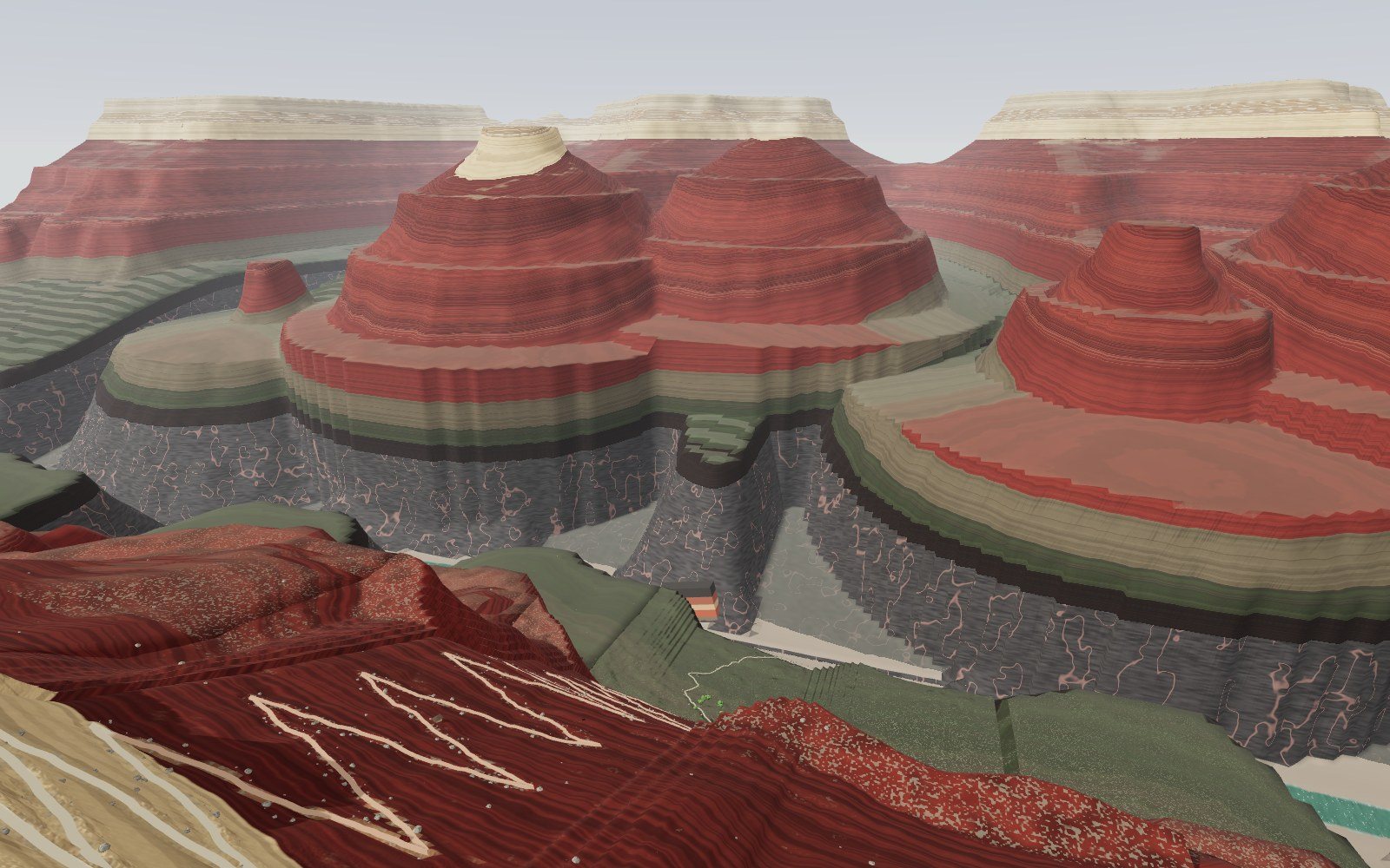
1 / 18 The drop You stand on the South Rim, 2,091 m above the sea. The Colorado River is 1,360 m below your feet, and the far wall is the North Rim, about 300 m higher. The column on the left is the rock under your feet; it follows you all the way down.
Drag to turn. Scroll or pinch to zoom.
Guide Parts Controls
01 The drop You stand on the South Rim, 2,091 m above the sea. The Colorado River is 1,360 m below your feet, and the far wall is the North Rim, about 300 m higher. The column on the left is the rock under your feet; it follows you all the way down.
02 A column at your feet This is the Bright Angel Trail. Every rock layer you walk through shows in the column with its age and the time one metre of it took to build up. Press 2 to hike six times faster, or click a depth on the section at the top left.
03 The rim was a sea floor The Kaibab Formation, about 270 million years old, was laid down in a shallow sea with sponges, brachiopods and sharks. It is the youngest rock here. On the Trail of Time along the rim, one metre stands for one million years.
04 A desert in the wall The pale cliff is the Coconino Sandstone: desert dunes about 280 million years ago. With Then turned on, the dunes are around you. Its only fossils are footprints.
05 Rivers and ferns The red Hermit Formation came from rivers and swamps about 285 million years ago. Ferns, a few insect wings and tracks are found in it. Then shows the swamp.
06 The oldest footprints Near Three-Mile Resthouse a boulder fell from the Manakacha Formation. A hiker spotted two trackways on it in 2016: animals that walked on a dune 313 million years ago, the oldest vertebrate tracks in the canyon.
07 The Redwall is grey The trail gets down the Redwall where the Bright Angel Fault breaks the cliff. This limestone formed in a tropical sea about 340 million years ago. Its red is a stain washed down from the layers above.
08 164 million years in a crack At the base of the Redwall the Muav is 504 million years old: about 164 million years are missing between them, with only patches of 385-million-year-old Temple Butte rock in between. The glowing lines mark the gaps.
09 A Cambrian sea floor Havasupai Gardens sits on the Bright Angel Formation, a muddy sea floor about 506 million years ago with trilobites and burrows. Then puts you on that sea floor.
10 How deep, in people The red and white pole stands from the river to the rim; each band is one person tall. It takes about 800 of you. Across the gorge, the North Rim is higher than the South Rim.
11 The Great Unconformity The gold line is the contact between the Tapeats Sandstone, 508 million years old, and the Vishnu Schist, 1,750 million years old. One step here crosses about 1.2 billion years.
12 Roots of old islands The dark schist and pink granite of the inner gorge formed deep in the crust under volcanic islands about 1.75 billion years ago. These rocks are not layered, so they have no years per metre.
13 The river The Colorado here is about 90 m wide. Since Glen Canyon Dam its big floods have stopped. In hard basement rock the canyon now widens faster than it deepens.
14 Filling the canyon back in The time slider runs the cutting backwards. In the young canyon view, most of the canyon was cut in the last 5 to 6 million years; at 3 million years ago it was about half as deep.
15 The other view Turn on the old canyon view: rivers cut to within a few hundred metres of today's depth about 70 million years ago (Flowers and Farley 2012). Karlstrom and others (2014) answered that some segments are old but the canyon as a whole is 5 to 6 million years old.
16 On the water Back to today and onto a raft. The current carries you west between walls more than a kilometre high.
17 Tilted layers In the eastern canyon, tilted layers of the Grand Canyon Supergroup, 1,255 to 729 million years old, sit between the basement and the flat layers. The model puts a piece of them by the river: stromatolites and lava.
18 From above Fly over the canyon. The section at the top left shows where you are; the field guide lists 100 rocks, fossils, places and living things. Turn on All name tags to read the far wall.
Kaibab Formation The rim rock: limestone and sandstone laid down in a shallow sea about 270 million years ago, with brachiopods, sponges and shark teeth. Toroweap Formation A slope of limestone, siltstone and gypsum from a coast by a shallow sea, a little like the Persian Gulf today. Coconino Sandstone The pale cliff below the rim: desert dunes turned to stone about 280 million years ago. The only fossils are tracks. Hermit Formation Red siltstone and sandstone from rivers and swamps. Fossil ferns, insect wings and tracks. Esplanade Sandstone The top of the Supai Group, about 290 million years old: red sandstone from a dry coast with dunes. Wescogame Formation Supai Group, about 300 million years old. Horsetails and seed ferns; in 2024 the first Paleozoic vertebrate bones from the canyon. Manakacha Formation Supai Group, about 315 million years old. A boulder from it beside the trail carries 313-million-year-old footprints. Watahomigi Formation The base of the Supai Group, about 320 million years old, from coastal lowland and shallow sea: brachiopods and shark teeth. Redwall Limestone A cliff about 160 m tall from a tropical sea about 340 million years ago: crinoids, corals and brachiopods, and many caves. Grey under a red stain. Muav Formation Limestone and dolostone from a tropical sea like the Bahama Banks, about 504 million years old. Bright Angel Formation Green-grey mudstone from a muddy sea floor about 506 million years ago, with trilobites and burrows. Its slope forms the Tonto Platform. Tapeats Sandstone Brown sandstone from beaches and river sand about 508 million years ago, lying straight on the basement rock. Vishnu Schist Dark metamorphic rock of the inner gorge, about 1,750 million years old: lava and sediment of volcanic islands squeezed deep in the crust. Rim overlook The start: a stone wall on the rim edge with the drop below. Trailhead The head of the Bright Angel Trail. First tunnel The first tunnel, with red deer pictographs above. Coconino switchbacks Switchbacks down the Coconino cliff. Three-Mile Resthouse Three-Mile Resthouse and the trackway boulder. Redwall switchbacks Switchbacks through the Redwall. Havasupai Gardens The oasis on the Tonto Platform. Plateau Point The edge of the Tonto Platform above the inner gorge. Great Unconformity The contact at the base of the Tapeats. Inner gorge Dark schist and pink granite. River beach The beach by the Colorado River. Silver Bridge The suspension bridge over the river. Tilted Supergroup Tilted Supergroup layers by the river. People for scale Smooth 1.7 m figures at the viewpoints; type your height under Me. Pole of people A pole from the river to the rim in bands one person tall.