FIG. 106Walk-throughs
Walk down the Grand Canyon rock layers
Walk 1,360 m down the Bright Angel Trail through 13 rock layers, from a 270-million-year-old sea floor on the rim to 1.75-billion-year-old schist by the river.
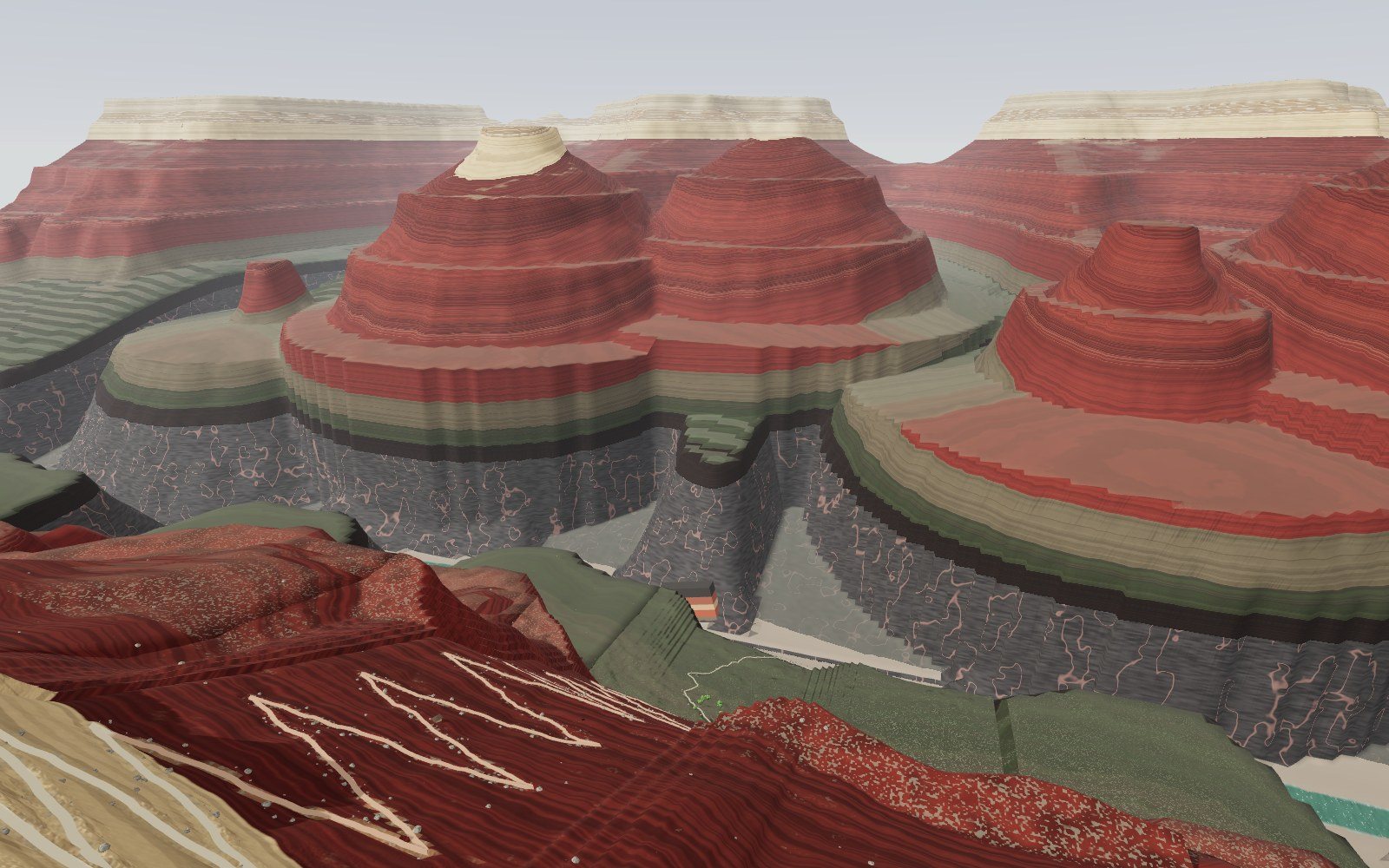
This device cannot show the 3D model. You can read the guide steps below as text.
1 / 18 The dropYou stand on the South Rim, 2,091 m above the sea. The Colorado River is 1,360 m below your feet, and the far wall is the North Rim, about 300 m higher. The column on the left is the rock under your feet; it follows you all the way down.
Drag to turn. Scroll or pinch to zoom.
What you are walking through
Most photographs of the Grand Canyon are taken from the rim, and from the rim the walls look like a painted backdrop. The colours are there, but the size is hard to believe. This exhibit puts you on the South Rim at the head of the Bright Angel Trail and lets you walk down it, all the way to the Colorado River, through every rock layer the trail crosses.
The model is built from one column of rock, with 13 layers stacked between the rim and the river, from the Kaibab Formation, about 270 million years old, at your feet on the rim, to the Vishnu Schist, about 1,750 million years old, beside the water. Their ages are the "best numeric ages" that the National Park Service publishes for Grand Canyon rocks. Their thicknesses come from the park's Geologic Resources Inventory, which gives a range for each layer; the model picks one value inside each range so that the stack adds up to the 1,360 m drop from the trailhead to the river.
As you walk, a column at the bottom left of the screen follows you down. It shows the layer under your feet, how old it is, what kind of place it formed in, and roughly how many years one metre of it took to build up. A section of the whole canyon at the top left shows where you are on the wall. You can walk at a normal pace, hike six times faster, fly above the rim or float on the river.
Three more things change what you see. A time-lapse slider fills the canyon back in, to the flat plateau the river started from, under two competing scientific views of when that happened. A "Then" switch puts the place each layer formed in around you: a warm sea, a field of dunes, a swamp with ferns, a beach, or the hot rock deep in the crust. And a "Missing time" switch lights up the lines in the wall where rock is missing, which in this canyon covers most of the time.
The first ten seconds
You start behind a low stone wall on the rim. The tour steps you to the edge and tilts your view down. Below the wall the Kaibab cliff falls away, then the pale band of the Coconino Sandstone, then slope after slope of red rock, then a grey cliff stained red, then a broad green bench, and finally a dark slot with the river in it. The river is 1,360 m below your eyes. Across the canyon, the far rim is higher than the one you stand on.
That last point is real. The North Rim stands about 1,000 ft (300 m) higher than the South Rim. It is the coolest and wettest weather station in the region, while Phantom Ranch, at the bottom, has recorded 120 °F (49 °C). In the model the rock layers on the north side rise toward the North Rim, so the same layers sit higher over there.
How deep is it?
The National Park Service gives several numbers, and each one is right for a different place. Near Grand Canyon Village, it is "a vertical mile (about 5,000 feet / 1524 m)" from rim to river, and about 7 miles (11.3 km) by trail. At its deepest point the canyon is 6,000 ft (1,829 m) deep. It is 277 river miles (446 km) long and about 10 miles (16 km) wide from rim to rim at the Village.
The Bright Angel Trail starts at the Village and ends at the river near Phantom Ranch. The river there is about 2,400 ft (730 m) above sea level. The model uses 1,360 m for the drop from the trailhead to the river, and its trail is 11.1 km long. The published stops along the trail fall where they should:
| Stop on the trail | Below the rim (NPS) | Along the trail: NPS / model | Layer in the model |
|---|---|---|---|
| Second Tunnel | 180 m | 1.45 km / 1.43 km | Coconino Sandstone |
| Mile-and-a-Half Resthouse | 340 m | 2.4 km / 2.7 km | Hermit Formation |
| Three-Mile Resthouse | 645 m | 4.8 km / 5.1 km | Watahomigi Formation, on top of the Redwall |
| Havasupai Gardens | 925 m | 7.2 km / 7.4 km | Bright Angel Formation |
| Plateau Point | 940 m | spur trail / 7.5 km | Bright Angel Formation |
| The river | 1,360 m | about 11.3 km / 10.8 km | Vishnu Schist |
To make the depth easier to hold in your head, turn on "Pole of people". A red and white pole stands on the Tonto Platform from the river to the rim. Each band is the height of one person, 1.7 m. It takes 800 of them, one on another's head, to reach the rim. If you type your own height under "Me", the people along the trail change to your height and the count changes with you.
Reading the column at your feet
The column at the bottom left is the most important thing on the screen. Its top is the rim and its bottom is the river, drawn to scale. Each coloured band is one layer, and the zig-zag lines are contacts where rock is missing. A red arrow marks your feet. You can click anywhere on the column to go to that depth on the trail.
Beside it are five lines of text:
- the layer under your feet;
- its age, from the NPS list of best numeric ages;
- the kind of place it formed in, from the same NPS series;
- how far you are below the rim, your height above the sea, and how much warmer it is than on the rim;
- the time one metre of this rock took to build up.
The last line needs an explanation. The NPS list gives each sedimentary layer an age range as well as a central age. The Kaibab, for example, is 270 million years old with a range of 269 to 273 million years. If you treat that range as the time the layer took to accumulate, and divide by the layer's thickness, you get years per metre: 4 million years for 90 m of Kaibab is about 44,000 years per metre. This is an estimate, and the exhibit labels it so. Part of an age range is uncertainty in the dating rather than time spent laying down rock, and no layer built up at an even rate. For the Redwall Limestone NPS says only that deposition "likely occurred over a period of a few million years", so the model uses 3 million years.
Even so, the numbers are useful for comparing layers. One metre of Redwall represents about 19,000 years. One metre of the Watahomigi Formation, a thin layer of the Supai Group, represents about 150,000 years. The difference is the difference between a sea that piled up lime mud quickly and a coast where little sediment stayed put.
The Vishnu Schist gets no number at all. It is not a stack of beds but rock that was squeezed and cooked so hard that its original layers now stand on end. You cannot read time from its thickness.
Press "Show by time" and the column changes scale. The top is now 270 million years ago and the bottom is 1,750 million years ago. Every layer becomes a thin band at its age, and most of the column turns blank. That blank is time with no rock here to show for it.
13 layers from the rim down
| Layer | Age (million years) | Model thickness | Published range | Formed in | Shape in the wall |
|---|---|---|---|---|---|
| Kaibab Formation | 270 | 90 m | 73 to 107 m | shallow sea | cliff |
| Toroweap Formation | 275 | 70 m | 60 to 76 m | coast by a shallow sea | slope |
| Coconino Sandstone | 280 | 100 m | 9 to 122 m | desert dunes | cliff |
| Hermit Formation | 285 | 160 m | 158 to 195 m | rivers and swamps | slope |
| Esplanade Sandstone | 290 | 110 m | 107 to 122 m | dry coast and dunes | cliff |
| Wescogame Formation | 300 | 37 m | 34 to 40 m | dry coast and dunes | ledges |
| Manakacha Formation | 315 | 53 m | 53 m | dry coast and dunes | ledges |
| Watahomigi Formation | 320 | 33 m | 30 to 37 m | coastal lowland and sea | slope |
| Redwall Limestone | 340 | 160 m | 152 to 167 m | tropical sea | cliff |
| Muav Formation | 504 | 97 m | 97 to 115 m | tropical sea | cliff |
| Bright Angel Formation | 506 | 60 m | 60 to 90 m | muddy sea floor | slope |
| Tapeats Sandstone | 508 | 60 m | 0 to 91 m | beaches and river sand | cliff |
| Vishnu Schist | 1,750 | 330 m exposed | not layered | deep crust | inner gorge |
The four layers from the Esplanade to the Watahomigi make up the Supai Group, and the Muav, Bright Angel and Tapeats belong to the Tonto Group. A fourteenth unit, the Temple Butte Formation, about 385 million years old, appears only as patches and channel fills between the Muav and the Redwall, so it has no thickness on the trail.
The rim: a Permian sea
The rock under the parking lots and the rim path is the Kaibab Formation. It formed on the floor of a shallow sea about 270 million years ago, which NPS compares with the Persian Gulf today. Brachiopods, bryozoans, sponges and molluscs lived on that sea floor, and sharks and other fish swam over it; their teeth turn up in the rock. It is the youngest rock in the canyon walls. The surface you stand on has 270 million years missing above it, because everything laid down afterwards in this spot has been worn away.
That includes the age of the dinosaurs. There are no dinosaur fossils in the Grand Canyon. Its rocks are older than the oldest dinosaurs, and the layers from their time, which NPS estimates at 4,000 to 8,000 ft thick, have been eroded from the canyon area. A hidden card near the trailhead explains this, and one of the "next" doors at the bottom left leads to the dinosaurs.
Just below the Kaibab is the Toroweap Formation, a slope of limestone, siltstone and gypsum from a coast beside the same kind of sea. The white beds in the model's Toroweap are gypsum, the mineral that is left when seawater evaporates.
Along the rim you can also find the Trail of Time, a real exhibit on the South Rim. Bronze markers are set one metre apart, and each metre stands for one million years. The 2,000 steps between the Yavapai Geology Museum and Grand Canyon Village cover the 2 billion years of rock in the canyon. The model has a short stretch of it east of the trailhead. The scale is worth remembering, because the canyon wall below is close to the same scale turned on its side: averaged over the whole 1,360 m, gaps included, one metre down the wall stands for a little over a million years.
A desert in the wall
About 160 m below the rim the trail reaches a pale cliff. This is the Coconino Sandstone, sand dunes from about 280 million years ago turned to stone. NPS compares the setting with the Arabian Desert. The cliff is cross-bedded, with sloping lines inside each bed where the faces of the dunes were buried one after another. The trail's Second Tunnel is cut through it.
The Coconino has no body fossils at all, no shells and no bones. What it has are trackways, footprints left by animals with and without backbones walking over the sand. They have been studied for more than 100 years. A hidden card in the switchbacks shows a slab with a line of prints.
Turn on "Then" while you stand in the Coconino and the dunes come back around you, with the haze of a dry wind. It is one of the challenges.
Red beds, ferns and the first dune walkers
Below the Coconino the wall turns red. The Hermit Formation, about 285 million years old, is red siltstone and sandstone laid down by rivers and swamps in a dry land; NPS compares it with the Nile Delta. Much of the colour in the canyon comes from small amounts of iron oxide, either in the rock or as a stain on its surface. The Hermit holds the most complete ecosystem in the upper canyon: fossil ferns and many other plants, invertebrate and vertebrate tracks, and a few rare insect wings from groups related to dragonflies and cockroaches.
Below the Hermit come the four formations of the Supai Group, between about 320 and 290 million years old. The Esplanade Sandstone at the top forms a cliff and a bench. The Wescogame and Manakacha formations are ledges of red sandstone from an arid coast with dunes, which NPS compares with Namibia. The Watahomigi at the bottom still met the sea, and it contains brachiopods and shark teeth.
The Manakacha is where the trail has its most famous fossil. In 2016 a geology professor hiking with his students noticed a boulder lying beside the Bright Angel Trail with footprints on it. The boulder had fallen from a nearby cliff of Manakacha Formation. A study published in 2020 dated the tracks to 313 million years, give or take 500,000 years, and found two trackways made by early animals related to reptiles walking across the slope of a sand dune. They are the oldest vertebrate tracks in the canyon and the earliest evidence of vertebrates walking on sand dunes. The footprints also record a lateral-sequence walk, the gait a dog or cat uses when it walks slowly. NPS says the block is not far from Three-Mile Resthouse, and that is where the model puts it.
In 2024 the first Paleozoic vertebrate bones from the canyon were reported from the Wescogame Formation. The Manakacha and Wescogame also contain fossils of horsetails and seed ferns.
The Redwall: a grey cliff stained red
At Three-Mile Resthouse the trail stands on top of the Redwall Limestone, a cliff 160 m tall in the model and 152 to 167 m in the park's survey. Cliffs like this stop most routes into the canyon. The Bright Angel Trail gets through because it follows the Bright Angel Fault, a large fault that breaks the cliffs. The model's trail crosses the Redwall in tight switchbacks in that broken zone.
The Redwall is a limestone from a tropical sea about 340 million years ago, compared by NPS with the Java Sea. It holds crinoids (sea lilies), corals, bryozoans, brachiopods, nautiloids and shark teeth. In the model, small discs of crinoid stem are one of the hidden finds.
The name is a little misleading. The rock is grey. Where the cliff looks red, its surface is stained by mud washed down from the red Supai and Hermit layers above. An NPS route description for South Canyon puts it plainly: there the limestone "is not 'painted' red but gray which is actually its natural color". A USGS guidebook from 1915 described the Redwall as "light blue-gray, massive, surface mostly stained red". The model shows the stain on the face of the cliff and a grey break where you can see inside.
Limestone dissolves in water, and the Redwall is full of caves. NPS keeps all of the park's caves closed to visitors. Dry caves have kept a record of the last 50,000 years: remains of extinct Shasta ground sloths, including bones, fur and dung, an extinct mountain goat, and California condors, which still fly over the canyon. People left something in them too. Split-twig figurines, deer and bighorn sheep folded from a single split twig of willow or cottonwood, were placed in remote Redwall caves between about 2,000 and 4,000 years ago, often under small cairns. Because of where they were found, archaeologists do not think they were toys.
164 million years in a crack
At the base of the Redwall the trail crosses a contact that is easy to walk past. The Redwall above is 340 million years old. The Muav Formation below is 504 million years old. About 164 million years are missing between them. The Ordovician and Silurian periods, and the early Devonian, left no rock here.
In places, patches of the Temple Butte Formation, about 385 million years old, fill old channels at this contact. The Temple Butte holds the oldest vertebrate fossils known from the park, armoured fish called placoderms, and the park's oldest coral. NPS points out that corals with hard parts became widespread in the Ordovician, one of the periods missing from the canyon, so early corals are not found here at all.
There is a smaller gap at the top of the Redwall too, about 20 million years between the Redwall and the Watahomigi. In some places the Surprise Canyon Formation, about 325 million years old, fills sinkholes and hollows in the old karst surface of the Redwall.
Turn on "Missing time" and these contacts glow on every wall of the canyon.
The Cambrian sea
Below the Muav the slope eases into the broad green bench of the Tonto Platform, and the trail reaches Havasupai Gardens, an oasis 925 m below the rim with cottonwood trees and water. The Havasupai people lived and farmed here until the national park was established; the place was formerly called Indian Garden.
The bench is the Bright Angel Formation, green-grey mudstone from a muddy sea floor about 506 million years ago. NPS compares it with the Gulf of Mexico. Trilobites lived on it, and the Bright Angel and Muav formations hold trilobite bodies and traces, early brachiopods and echinoderms, and small bivalved arthropods called bradoriids that died out after the Cambrian. The traces include tracks, trails, worm burrows and feeding marks.
In 2025 researchers described something smaller and more unusual from the same layer: carbon films of soft-bodied animals a millimetre or so across, including priapulid worms with comb-like teeth, crustaceans and molluscs. Fossils of soft tissue are rare, and most come from seas short of oxygen; these come from a well-oxygenated sea floor full of burrowing animals.
Below the Bright Angel is the Tapeats Sandstone, brown sand from beaches and river bottoms about 508 million years ago. Together these layers record the sea moving inland across the continent. Their ages were recalibrated with zircon dating in 2018 and 2020, and the Tonto Group was redefined: the Sixtymile Formation was added at its base, the Frenchman Mountain Dolostone at its top, and the Bright Angel Shale and Muav Limestone were renamed formations because they contain more than one kind of rock. On the revised ages, the sea that laid down most of the Tonto Group advanced from Nevada across Arizona into Colorado in about 10 million years, which NPS calls remarkably fast.
The Great Unconformity
At the bottom of the Tapeats the trail steps onto dark rock. This contact is the Great Unconformity, recognised by John Wesley Powell, who explored the canyon by boat in 1869. Above the line is Tapeats sand 508 million years old. Below it is Vishnu Schist about 1,750 million years old. About 1.2 billion years of rock record are missing, roughly a quarter of the age of the Earth. In the model a gold line marks the contact on the trail, and one of the challenges is to walk down and touch it.
The Grand Canyon has one of the most complete rock records anywhere, and still, as an NPS diagram puts it, more time is missing than preserved. Turn the column to "Show by time" while you stand at this contact and you can see what that means: the Tapeats and the Vishnu are two thin bands with an empty stretch between them that is longer than everything above.
Where did the missing rock go? Part of the answer is visible in the eastern canyon, where tilted layers of the Grand Canyon Supergroup, 1,255 to 729 million years old, sit between the basement and the Tapeats. They were laid down, tilted, and mostly eroded away before the Tapeats arrived. The park's geology report describes the Great Unconformity as several unconformities that merge into one where the Supergroup is missing. Why so much rock was removed across so much of the world at about the same time is still argued. One proposal, published in 2019, is that ice sheets of the "Snowball Earth" glaciations, 717 to 635 million years ago, scraped much of it away; other researchers argue for erosion in many separate episodes. The exhibit marks this as an open question.
The basement
The inner gorge is cut into the Vishnu Basement Rocks, a name NPS uses for every crystalline rock at the bottom of the canyon. The Vishnu Schist and its neighbours began as lava and sediment on the flanks of volcanic islands. When those islands collided with ancestral North America about 1.75 billion years ago, the rocks were buried as deep as 25 km, squeezed and heated until their layers stood on end, and invaded by magma.
The magma became the pink Zoroaster granite, 1,740 million years old, which shows as veins through the dark schist. Later granites and pegmatite dikes followed, from 1,713 down to 1,375 million years old. The oldest dated rock in the canyon is the Elves Chasm pluton, 1,840 million years old, give or take one million.
In the model the gorge is dark schist with pink veins. It is the only part of the wall that is not layered, so the column shows no years per metre while you are in it. Turn on "Then" and you see the place it formed: deep, hot crust with no sky at all.
The tilted Supergroup
Upstream from the beach the model sets a wedge of tilted layers into the north wall. In the real canyon you see the Grand Canyon Supergroup in the east, for example from Lipan Point on Desert View Drive, not on the Bright Angel Trail. The model brings a piece of it to the river so that you can see the three sets of rocks that NPS describes: the basement, the tilted Supergroup, and the flat layered rocks above.
The Supergroup is about 12,000 ft (3,600 m) thick where it is complete. Its lowest layer, the Bass Formation, was lime mud in a shallow sea; an ash bed in it is dated 1,255 million years. The Bass contains stromatolites, mounds built by colonies of cyanobacteria, which are the oldest fossils in the canyon you can see without a microscope. Higher up, the Cardenas Basalt is a stack of lava flows more than 300 m thick, erupted 1,082 million years ago when the continent began to split apart and then stopped. The Chuar Group above, 775 to 729 million years old, holds vase-shaped microfossils interpreted as the shells of single-celled amoebae. Today the Supergroup layers tilt at about 20 degrees, but they were laid down flat.
Why the wall is a staircase
The canyon wall is a staircase because the layers resist erosion differently. Hard sandstones and limestones, such as the Coconino and the Redwall, break off in vertical cliffs. Softer shales and siltstones, such as the Hermit and the Bright Angel, weather into slopes and benches. The hard basement rocks at the bottom make the narrow, steep inner gorge. An NPS geology leaflet calls this the "stepped-pyramid look" of the canyon.
The model builds the wall the same way. Each layer has a wall angle: about 70 degrees for the cliffs of the Coconino, Redwall and Tapeats, 30 to 40 degrees for the Hermit, Toroweap and Watahomigi, and a gentle 7 degrees for the Bright Angel, which spreads into the Tonto Platform. Real cliffs are closer to vertical; the model eases them a little because its 26 m terrain grid draws a vertical wall as a jagged step. Along the trail, where the Bright Angel Fault breaks the cliffs, the walls lean back to about 50 degrees. The Esplanade and the top of the Redwall leave benches. Side canyons and isolated buttes come from the same rules: a butte is a piece of wall that has been cut off all round, capped by whatever hard layer happens to be at its top.
How old is the canyon?
The rocks are old; the canyon is young. Of everything in the exhibit, this is often the hardest part to take in. The Kaibab on the rim is 270 million years old, but the canyon cut into it is much younger. NPS describes the sequence in three steps: the rocks formed; between 70 and 30 million years ago the whole region was lifted into the high, flat Colorado Plateau; and then, beginning 5 to 6 million years ago, the Colorado River carved its way down.
Whether any part of the canyon is much older has been argued for about 150 years. Move the "Time-lapse" slider to see two published views.
In the young canyon view, most of the canyon was carved by the Colorado River in the last 5 to 6 million years. Karlstrom and others (2014) dated four of the canyon's five segments with apatite fission tracks and helium. They found that two middle segments have older histories, one 70 to 50 million years old and one 25 to 15 million years old, but that the two end segments, Marble Canyon and the westernmost canyon, were cut in the last 5 to 6 million years, so the canyon as a whole formed when the river joined older pieces together. In the model, the young canyon view carves today's depth evenly over 6 million years.
In the old canyon view, rivers flowing in other directions had already cut a canyon to within a few hundred metres of today's depth about 70 million years ago. Flowers and Farley (2012) argued this from the helium in apatite crystals in the western canyon, and Wernicke (2011) proposed an east-flowing "California River" that did much of the carving. Turn on "Old canyon view" and the model carves to within 200 m of today's depth between 80 and 70 million years ago.
Karlstrom and colleagues replied in 2013 that the old canyon data can be reconciled with a young canyon, and that geologic evidence such as the age of the oldest Colorado River gravels points the same way. NPS today describes the canyon as carved in the last 5 to 6 million years. The model shows both views; neither curve is a measurement of the river's actual progress.
One more number helps. If the 1,360 m at the Bright Angel Trail were all cut in 6 million years, the river would have deepened its bed by an average of about 0.23 mm a year, less than the thickness of a fingernail. Studies of incision along the canyon, such as Karlstrom and others (2008), find that the rate varies from place to place and through time.
The river today
The Colorado River through the Grand Canyon averages about 300 ft (91 m) across and 40 ft (12 m) deep, NPS says, and its average flow is 12,000 to 15,000 cubic feet per second. During floods it could carry 300,000 cubic feet per second, and big rocks with it. Some geologists suggest that at the close of the last ice age the flow may have reached a million cubic feet per second.
Glen Canyon Dam, completed in 1963 upstream of the park, changed that. The river no longer floods in spring and no longer drops to 500 to 1,000 cubic feet per second in late summer, and the large annual floods that carried hundreds of thousands of tons of sediment a day are gone. The name Colorado comes from the Spanish for reddish, after the sediment the river once carried; the model shows today's clearer water.
The canyon is still changing, but NPS says it is getting wider faster than it is getting deeper. Side streams fed by rain and snowmelt keep cutting the walls back, while at the bottom the river is cutting hard basement rock with a gentler slope than before. The river near Phantom Ranch is about 2,400 ft above sea level, and sea level is the lowest it can ever cut.
Heat on the way down
The column shows how much warmer it is than on the rim. NPS gives a rule of thumb for the canyon: the temperature rises about 5.5 °F for every 1,000 ft you go down. That is about 1 °C for every 100 m, so the river is about 13 °C warmer than the rim at the same moment. On summer days the river often passes 100 °F (38 °C). NPS warns hikers that the climb back up takes at least twice as long as the walk down.
Your height in rock
Open "Me" and type your height. The panel turns it into time:
- in the layer under your feet, how long your height of that rock took to build up;
- in the Redwall, one of the fastest layers, and in the Watahomigi, one of the slowest;
- averaged over the whole wall with the gaps included;
- how many of you it takes to stack from the river to the rim;
- how much time your height covers on the Trail of Time, where one metre is one million years.
For a person 1.7 m tall, the Redwall gives about 32,000 years and the Watahomigi about 260,000 years. Averaged over the whole wall, from the 270-million-year-old Kaibab to the 1,750-million-year-old Vishnu, the same 1.7 m stands for about 1.85 million years, because the average includes all the missing time. All of these are estimates, built from published ages and thicknesses, not measurements of any single bed.
Life on the trail today
The model plants pinyon pine and Utah juniper on the rim, shrubs on the slopes and the Tonto Platform, cottonwoods at Havasupai Gardens and willows by the river. NPS describes pinyon-juniper woodland hugging the rims; pinyon pines grow up to about 15 m tall and junipers up to about 6 m. Ponderosa pines, which can reach 60 m, grow higher up on the rims.
The field guide also lists animals you could meet. Ravens, with a wingspan of about 1 m, are among the few birds that can fly upside down. Ringtails live from rim to river but come out at night. Mule deer are found in every habitat in the park. The Grand Canyon rattlesnake, a subspecies of the western rattlesnake, blends into the rock, and the muscles in its rattle fire up to 50 times a second. In the river only eight fish species are native, six of them found nowhere outside the Colorado River basin, and five are still in the park, including the humpback chub. The park has more than 90 species of mammals, more than Yellowstone. California condors fly over the canyon, and their fossil bones are found in its dry caves.
People in the canyon
The trail follows a route that people have used for thousands of years. Just past the first tunnel, high on the cliff under an overhang, a row of deer is painted in red. The site, known as Mallery's Grotto, dates from between 4,000 years ago and 1950 and has Archaic and Cohonina elements, with later charcoal inscriptions attributed to the Havasupai. The model hides a card there.
Pioneers built a trail here in 1891 to reach mining claims at what is now Havasupai Gardens, then ran it as a toll road. The National Park Service took it over in 1928. It is now the park's most popular hiking trail, with resthouses, seasonal water and emergency phones, and NPS asks hikers to consult a ranger before heading below Havasupai Gardens to the river.
How the model differs from reality
The heights are right; the widths are not. Every layer sits at its true depth along the trail, but horizontal distances are shortened. On this side of the canyon the real distance from the rim to the river is several kilometres; in the model it is about 1.6 km from the overlook. Walls and slopes therefore look steeper than they are, and the canyon looks narrower from rim to rim.
The column is one column. Real thicknesses change from place to place: the Coconino is anywhere from 9 to 122 m thick, and the Tapeats is missing altogether in places. The model picks one value per layer, inside the published range, so that the stack adds up to 1,360 m and the trail stops fall in the right layers.
The terrain is built by rule, not from a survey. The side canyons, spurs and buttes come from the same profile rules, so they look like Grand Canyon landforms but do not match any real map. The trail is laid out by a similar rule: switchbacks wherever the slope is steeper than the trail's grade, straight down where it is gentle. Its stops sit at their published depths, but the turns are not the real turns.
The North Rim layers rise about 300 m toward the far rim, which matches the height difference between the rims. The real reasons the plateau surface and the layers stand at different heights across the region are more complicated than one smooth rise.
The Supergroup wedge is placed by the river for comparison. On the Bright Angel corridor the Tapeats rests directly on the basement; you would see the Supergroup from the rim in the eastern canyon.
The "Then" scenes are impressions of the environment NPS gives for each layer, not reconstructions of a particular place. The time-lapse shows two published views as simple curves: an even carving over 6 million years, or carving to within 200 m of today's depth by 70 million years ago. Neither is a model of erosion, and the filled-in canyon of an earlier time is the present canyon filled up to a V-shaped notch, not a reconstruction of an ancient landscape.
Moving around
On a computer, use W A S D or the arrow keys to walk, drag to look, and click the ground to walk there. Shift hurries. The number keys change how you travel: 1 walks, 2 hikes at six times the pace, 3 flies 230 m above the rim, and 4 puts you on a raft on the river, where the current carries you west. On a phone, the left thumb walks and the right thumb looks.
You cannot walk off a cliff. The trail is open, and so is gentle ground such as the rim, the benches and the Tonto Platform; anything steeper stops you. To get somewhere quickly, click a depth on the section at the top left or on the column at the bottom left, or use the field guide's "Go there" buttons.
The panel beside the stage has the guided tour, the parts list with every layer and viewpoint, and the controls: the time-lapse, the old canyon view, "Then", "Missing time", the time of day, the haze in the air, people for scale, the pole of people and all name tags.
Challenges and hidden finds
Nine challenges ask you to find the oldest rock, pick out the layers that formed in the sea, estimate the missing time at the Great Unconformity, find the trilobites, work out your height in Redwall, touch the Great Unconformity, reach the river, see the land before the canyon, and stand in a desert inside the wall. Solved challenges stay solved on your device.
There are 24 hidden finds along the trail. Walk close and look at one and a card opens with its sources. Seven of them are "Actually..." cards that turn a common idea around: the Grand Canyon is not the deepest canyon, there are no dinosaurs in it, the Redwall is grey, the canyon is far younger than its rocks, more time is missing than preserved, the canyon is widening faster than it deepens, and the far rim is the higher one.
The field guide lists 100 entries: every rock unit in the NPS table of numeric ages, 29 fossils and traces, 16 places on the trail and 13 living things. You can search, filter by kind or rock set, and sort by age. Opening a card counts it as seen, and the guide shows how many you have opened.
Questions
How deep is the Grand Canyon?
It depends where you measure. Near Grand Canyon Village it is about a vertical mile, roughly 1,500 m, from rim to river. At its deepest it is 6,000 ft (1,829 m). The Bright Angel Trail in this exhibit drops 1,360 m from the trailhead to the river.
How old are the rocks at the bottom?
The Vishnu Schist in the inner gorge is about 1,750 million years old. The oldest dated rock in the canyon is the Elves Chasm pluton, 1,840 million years old.
How old is the canyon itself?
Much younger than its rocks. NPS describes the canyon as carved by the Colorado River beginning 5 to 6 million years ago. Some researchers have argued that parts of it are far older, up to about 70 million years; the time-lapse in this exhibit shows both views.
What is the Great Unconformity?
It is the contact at the base of the Tapeats Sandstone where 508-million-year-old sand lies on 1,750-million-year-old schist. About 1.2 billion years of rock record are missing there. John Wesley Powell described it after his 1869 expedition.
Why are the rocks in layers?
Most of the walls are sedimentary rock: sand, mud and lime that settled in seas, rivers and deserts, one layer on top of another, and later hardened. Older layers lie below younger ones. The basement rocks at the bottom are different; they were squeezed and heated so much that their original layers now stand on end.
Are there dinosaur fossils in the Grand Canyon?
No. The canyon's rocks are older than the oldest dinosaurs. Rock from the age of dinosaurs once covered the area but has been worn away.
What fossils can you find there?
Mostly sea animals: trilobites, brachiopods, crinoids, corals, sponges and bryozoans. The red Hermit Formation has plants and insect wings, and several layers have footprints. Collecting fossils in the park is illegal; NPS asks visitors to photograph them instead.
Why is the Redwall red if it is limestone?
Its surface is stained by iron-rich mud washed down from the red layers above. The limestone itself is grey.
Why is the North Rim higher?
The North Rim stands about 1,000 ft (300 m) higher than the South Rim, and the rock layers rise toward it, so the same layers sit higher on that side. It is also the coolest and wettest weather station in the region.
Is the canyon still getting deeper?
Slowly. NPS says it is getting wider faster than it is getting deeper, because the river is now cutting hard basement rock with a gentler slope, and the dam has stopped the big floods. The river near Phantom Ranch is about 2,400 ft above sea level, and it cannot cut below sea level.
How long is the hike to the river?
NPS gives about 7 miles (11.3 km) by trail from the South Rim near the Village to the river, with a drop of about 1,400 to 1,500 m depending on where you start. NPS does not recommend going below Havasupai Gardens and back in one day, and says the climb out takes at least twice as long as the walk down.
How hot does it get at the bottom?
NPS says the temperature rises about 5.5 °F for every 1,000 ft of descent, and summer highs at the river often pass 100 °F (38 °C). Phantom Ranch has recorded 120 °F (49 °C).
What does "years per metre" mean in this exhibit?
It is the time a layer took to build up divided by its thickness, using the NPS age range of each layer as its duration. It is an estimate meant for comparing layers, not a measured rate for any single bed.
Why is so much time missing?
Rock is laid down only where sediment collects, and it is removed again when the land rises and erodes. In the Grand Canyon long periods of erosion removed earlier layers or left no new ones, so the walls skip from 1,750 to 508 million years at the Great Unconformity and from 504 to 340 million years at the base of the Redwall.
Can I see the Supergroup on the Bright Angel Trail?
Not on the trail itself, where the Tapeats lies directly on the basement. You can see the tilted Supergroup layers in the eastern canyon, for example from Lipan Point on Desert View Drive. The model places a piece of them by the river for comparison.
Who lived in the canyon?
People have used the canyon for thousands of years. Archaic hunters left split-twig figurines in caves 2,000 to 4,000 years ago, and later groups left pictographs and farm sites. The Havasupai people lived and farmed at what is now Havasupai Gardens until the park was established.
Terms
- Formation: a body of rock with a recognisable type and a name, the basic unit geologists map.
- Group, Supergroup: formations that belong together, such as the Supai Group or the Grand Canyon Supergroup.
- Unconformity: a contact where rock is missing because of erosion or no deposition. A nonconformity is layered rock on top of crystalline rock; a disconformity is a gap between parallel layers; an angular unconformity cuts across tilted layers.
- Schist: metamorphic rock with flat, shiny mineral grains lined up by heat and pressure.
- Cross-bedding: sloping layers inside a bed, made by the moving faces of dunes or ripples.
- Trace fossil: a record of behaviour, such as a footprint, trail or burrow, rather than a body part.
- Ma: mega-annum, a million years ago.
- Incision: the downcutting of a river into its bed.
Sources
- National Park Service, Numeric Ages of Grand Canyon Rocks (Telling Time at Grand Canyon series). https://www.nps.gov/articles/000/grcatime-numeric-ages.htm (checked 20 October 2026)
- National Park Service, Layered Paleozoic Rocks. https://www.nps.gov/articles/000/grcatime-layered-paleozoic-rock.htm (checked 20 October 2026)
- National Park Service, Grand Canyon Supergroup. https://www.nps.gov/articles/000/grcatime-grand-canyon-supergroup.htm (checked 20 October 2026)
- National Park Service, Vishnu Basement Rocks. https://www.nps.gov/articles/000/grcatime-vishnu-basement-rocks.htm (checked 20 October 2026)
- National Park Service, Grand Canyon's Three Sets of Rocks. https://www.nps.gov/articles/000/grcatime-grand-canyon-s-three-sets-of-rocks.htm (checked 20 October 2026)
- Karlstrom, K., Crossey, L., Mathis, A., Bowman, C. (2021). Telling time at Grand Canyon National Park: 2020 update. NPS Natural Resource Report NPS/GRCA/NRR-2021/2246. https://doi.org/10.36967/nrr-2285173 (checked 20 October 2026)
- Graham, J. P. (2020). Grand Canyon National Park: Geologic resources inventory report. NPS/NRSS/GRD/NRR-2020/2195. https://doi.org/10.36967/nrr-2279886 (checked 20 October 2026)
- National Park Service, Grand Canyon, Geology. https://www.nps.gov/grca/learn/nature/grca-geology.htm (checked 20 October 2026)
- National Park Service, Grand Canyon, Geologic Formations. https://www.nps.gov/grca/learn/nature/geologicformations.htm (checked 20 October 2026)
- National Park Service, Grand Canyon, Frequently Asked Questions. https://www.nps.gov/grca/faqs.htm (checked 20 October 2026)
- National Park Service, Bright Angel Trail. https://www.nps.gov/places/000/bright-angel-trail.htm (checked 20 October 2026)
- National Park Service, Bright Angel Trail (trail description, PDF). https://www.nps.gov/grca/planyourvisit/upload/bright_angel_trail.pdf (checked 20 October 2026)
- National Park Service, Journey Through Time: Grand Canyon Geology (PDF). https://www.nps.gov/grca/planyourvisit/upload/life_geology.pdf (checked 20 October 2026)
- National Park Service, Grand Canyon, Fossils. https://www.nps.gov/grca/learn/nature/fossils.htm (checked 20 October 2026)
- National Park Service, Case Study: Grand Canyon Evolution through the Ages. https://www.nps.gov/subjects/fossils/case-study-grand-canyon-evolution.htm (checked 20 October 2026)
- National Park Service, Cliff Collapse Reveals 313-million-year-old Fossil Footprints in Grand Canyon National Park (2020). https://www.nps.gov/grca/learn/news/cliff-collapse-reveals-313-million-year-old-fossil-footprints-in-grand-canyon-national-park.htm (checked 20 October 2026)
- National Park Service, Bright Angel Trackway. https://www.nps.gov/articles/bright-angel-trackway.htm (checked 20 October 2026)
- Rowland, S. M., Caputo, M. V., Jensen, Z. A. (2020). Early adaptation to eolian sand dunes by basal amniotes is documented in two Pennsylvanian Grand Canyon trackways. PLOS ONE 15(8): e0237636. https://doi.org/10.1371/journal.pone.0237636 (checked 20 October 2026)
- Mussini, G. and others (2025). Evolutionary escalation in an exceptionally preserved Cambrian biota from the Grand Canyon (Arizona, USA). Science Advances 11(30): eadv6383. https://doi.org/10.1126/sciadv.adv6383 (checked 20 October 2026)
- Karlstrom, K. E. and others (2020). Redefining the Tonto Group of Grand Canyon and recalibrating the Cambrian time scale. Geology 48: 425-430. https://doi.org/10.1130/G46755.1 (checked 20 October 2026)
- Karlstrom, K. and others (2018). Cambrian Sauk transgression in the Grand Canyon region redefined by detrital zircons. Nature Geoscience 11: 438-443. https://doi.org/10.1038/s41561-018-0131-7 (checked 20 October 2026)
- Dehler, C. and others (2024). The Cambrian of the Grand Canyon: refinement of a classic stratigraphic model. GSA Today 34: 4-11. https://doi.org/10.1130/GSATG604A.1 (checked 20 October 2026)
- Karlstrom, K. E. and others (2014). Formation of the Grand Canyon 5 to 6 million years ago through integration of older palaeocanyons. Nature Geoscience 7: 239-244. https://doi.org/10.1038/ngeo2065 (checked 20 October 2026)
- Flowers, R. M., Farley, K. A. (2012). Apatite 4He/3He and (U-Th)/He evidence for an ancient Grand Canyon. Science 338: 1616-1619. https://doi.org/10.1126/science.1229390 (checked 20 October 2026)
- Wernicke, B. (2011). The California River and its role in carving Grand Canyon. Geological Society of America Bulletin 123: 1288-1316. https://doi.org/10.1130/B30274.1 (checked 20 October 2026)
- Karlstrom, K. E. and others (2013). Comment on "Apatite 4He/3He and (U-Th)/He evidence for an ancient Grand Canyon". Science 340: 143. https://doi.org/10.1126/science.1233982 (checked 20 October 2026)
- Karlstrom, K. E. and others (2008). Model for tectonically driven incision of the younger than 6 Ma Grand Canyon. Geology 36. https://doi.org/10.1130/G25032A.1 (checked 20 October 2026)
- Keller, C. B. and others (2019). Neoproterozoic glacial origin of the Great Unconformity. PNAS 116: 1136-1145. https://doi.org/10.1073/pnas.1804350116 (checked 20 October 2026)
- Porter, S. M., Knoll, A. H. (2000). Testate amoebae in the Neoproterozoic Era: evidence from vase-shaped microfossils in the Chuar Group, Grand Canyon. Paleobiology 26: 360-385. https://doi.org/10.1666/0094-8373(2000)026<0360:TAITNE>2.0.CO;2 (checked 20 October 2026)
- Billingsley, G. H. (2000). Geologic map of the Grand Canyon 30' x 60' quadrangle, Coconino and Mohave Counties, northwestern Arizona. USGS I-2688. https://doi.org/10.3133/i2688 (checked 20 October 2026)
- Darton, N. H. and others (1915). Guidebook of the western United States, Part C: The Santa Fe Route. USGS Bulletin 613. https://doi.org/10.3133/b613 (checked 20 October 2026)
- National Park Service, South Canyon route description (PDF). https://www.nps.gov/grca/planyourvisit/upload/South_Canyon.pdf (checked 20 October 2026)
- National Park Service, NPS Geodiversity Atlas: Grand Canyon National Park. https://www.nps.gov/articles/nps-geodiversity-atlas-grand-canyon-national-park-arizona.htm (checked 20 October 2026)
- National Park Service, Grand Canyon, Archaeological Resources. https://www.nps.gov/grca/learn/historyculture/arch.htm (checked 20 October 2026)
- National Park Service, Pictograph Panel, Bright Angel Trail. https://www.nps.gov/places/000/rock-art-panel.htm (checked 20 October 2026)
- National Park Service, Walhalla Glades (PDF). https://www.nps.gov/grca/planyourvisit/upload/walhalla.pdf (checked 20 October 2026)
- National Park Service, Grand Canyon, Weather and Climate. https://www.nps.gov/grca/learn/nature/weather.htm (checked 20 October 2026)
- National Park Service, Grand Canyon, Cave / Karst Systems. https://www.nps.gov/grca/learn/nature/cave.htm (checked 20 October 2026)
- National Park Service, Grand Canyon, Trees. https://www.nps.gov/grca/learn/nature/trees.htm (checked 20 October 2026)
- National Park Service, Grand Canyon, Fisheries. https://www.nps.gov/grca/learn/nature/fish.htm (checked 20 October 2026)
- National Park Service, Grand Canyon, Mammals. https://www.nps.gov/grca/learn/nature/mammals.htm (checked 20 October 2026)
- National Park Service, Grand Canyon, Ravens, Ringtail, Mule Deer, Rattlesnakes and California Condor. https://www.nps.gov/grca/learn/nature/ravens.htm (checked 20 October 2026)
More exhibits
Why salt forms cubes: crystal structure and unit cells
A grain of table salt is a stack of cubes 0.564 nm on a side, with sodium and chlorine alternating along every edge.
Walk through Machu Picchu
Most of the work that holds Machu Picchu on its ridge, 60 per cent by one estimate, lies under the ground in foundations and drains nobody sees.
Giant sequoia forest: walk under the largest trees
Stand at the foot of the General Sherman Tree, 83.8 m tall and about 2,200 years old, then climb its trunk and see how hard the water up there is pulled.
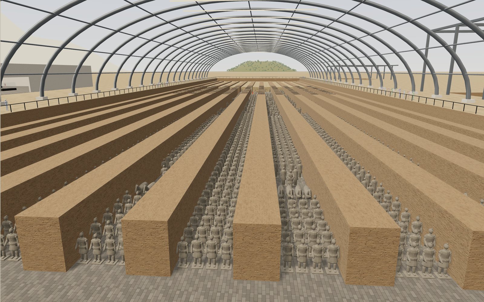
Walk through the Terracotta Army
Pit 1 of the Terracotta Army is 230 m long and holds an estimated 6,000 figures and horses, and every one of them was painted once.
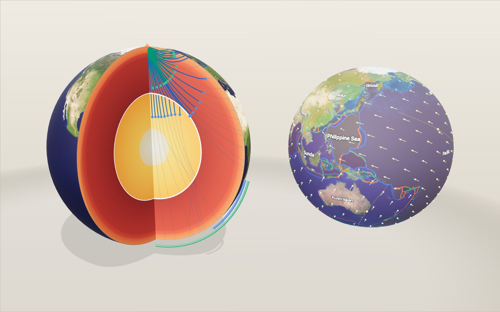
Layers of the Earth: depth and density, interactive model
Nobody has drilled deeper than 12.3 km, yet we know the pressure at the centre to within a few per cent, because earthquakes shine through the planet.
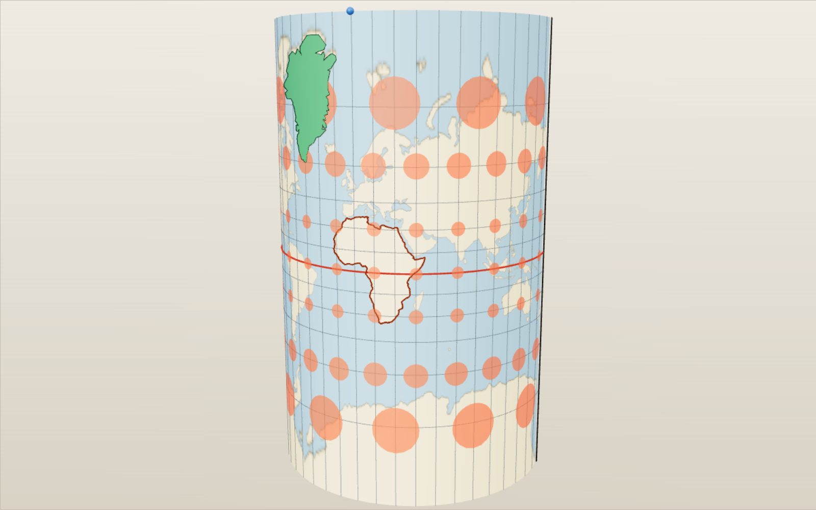
Map projections: why Greenland looks as big as Africa
On a Mercator map Greenland looks bigger than Africa, which is in fact about 14 times larger.