FIG. 114Walk-throughs
Walk through Machu Picchu
Most of the work that holds Machu Picchu on its ridge, 60 per cent by one estimate, lies under the ground in foundations and drains nobody sees.
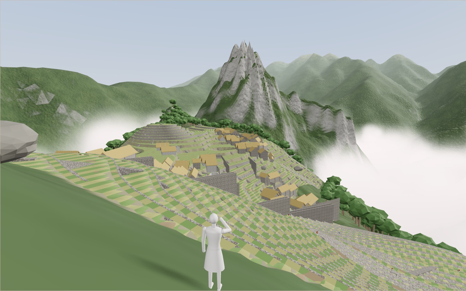
This device cannot show the 3D model. You can read the guide steps below as text.
1 / 15 The cloud liftsEarly morning on the upper terraces. The cloud parts and the town appears on its ridge, 2,430 m up, with Huayna Picchu behind it and the Urubamba about 450 m below. The orange figure is your height; the year bar changes the century.
Drag to turn. Scroll or pinch to zoom.
What you are walking through
Machu Picchu is an Inca town on a narrow ridge in the Andes of southern Peru, 2,430 m above the sea, with the Urubamba River winding round the foot of the ridge about 450 m below. Most people know it from one photograph: grey stone houses on green terraces, a saddle of land, and the steep cone of Huayna Picchu behind. This model lets you walk into that photograph and then keep going: down the farming terraces, through the gate, along the streets of the town, into the Temple of the Sun at sunrise on the shortest day of the year, and under the ground, where most of the work that keeps the town on its ridge is hidden.
The model stands on the real shape of the mountains. The ground comes from a radar survey of the Earth; the buildings, stairways and terrace walls of the town come from OpenStreetMap, the open map of the world. On top of that, a year slider moves the town through six centuries: the building site of about 1420, the royal estate of about 1500 with thatched roofs and crops, the empty town after the 1530s, the overgrown ruins that a farmer from the valley visited in 1902, the families who lived here when Hiram Bingham arrived in 1911, the clearing of 1912, and the sanctuary of today.
Everything else in the exhibit hangs on four questions people ask when they first see the place. How did anyone build a town up here? Why has it not slid off the mountain? What did the people who lived here know about the sky? And who were they? The sections below take them one at a time, with the numbers that engineers, archaeologists and the Ministry of Culture of Peru have published.
The first ten seconds
The exhibit opens on the upper terraces in the early morning, at the viewpoint of the Ministry of Culture's route 1-B, where the classic photo is taken. A veil of cloud hangs round the ridge and lifts in the first few seconds. Below it the valleys stay full of cloud; the switch "Sea of clouds" clears them.
The orange figure standing next to you is your own height. It appears in several places: at the viewpoint, at the foot of the Torreon, by the Sacred Rock and under a terrace wall. Under "Me" you can enter your real height and your birthday. The height scales the figure. The birthday is used later, at the Temple of the Sun.
Where the town stands
The ridge runs roughly north to south between two mountains: Huayna Picchu to the north and Machu Picchu Mountain to the south. Kenneth Wright, the civil engineer whose team studied the water works of the site from 1994, describes the ridge as a block of land dropped between two regional geologic faults, a graben, with the uplifted peaks on either side. The faults matter twice in this story. They broke the granite into blocks that could be quarried on the spot, and they made the spring that gave the town its water.
The sides of the ridge are steep, and Wright puts the rainfall at nearly 2,000 mm a year. Those two facts are the engineering problem of Machu Picchu: a town on slopes that steep, in that much rain, ought to wash away. It has not, and most of the reasons are underground.
Around the town lies the Historic Sanctuary of Machu Picchu, created by the government of Peru on 8 January 1981. The decree gave it 32,592 ha; a new survey of the boundary in 2015 measured 37,302.58 ha. UNESCO inscribed the sanctuary in 1983 as a mixed World Heritage site, for its culture and for its nature. The Ministry of Culture's master plan counts 60 archaeological monuments in the sanctuary. The town itself, which the Ministry calls the llaqta, is one of them.
A royal estate
For most of the last century the date of Machu Picchu came from Spanish chronicles. In them the Inca ruler Pachacuti came to power in 1438 and began his conquests afterwards, so the town was thought to have been started around 1450 to 1460. Wright gives 1430 to 1450 for its start as a royal estate of Pachacuti, and the Ministry of Culture's master plan places the start of the building in Pachacuti's reign, carried on by Tupac Inka Yupanqui and Huayna Cápac.
Radiocarbon has moved the date. In 2021 Richard Burger and colleagues published accelerator mass spectrometry dates on bones and teeth of 26 people buried in caves at four cemeteries round the town. The dates show the site in use from about 1420 to 1532, two decades earlier than the chronicles' date for Pachacuti's rise. A separate study by Mariusz Ziółkowski and colleagues dated material from the town and from two nearby sites, Chachabamba and Choqesuysuy, and also argues for revising the old chronology. The exhibit therefore calls its first stop "about 1420" and its second "about 1500". The dates are a range, and the sources do not agree on a single year.
What kind of place was it? Not a city in the modern sense, and not a fortress. The genome study of 2023 describes it as a palace within the estate of the emperor Pachacuti. Wright estimates that about 300 people lived here all year and up to 1,000 when the ruler and his court were in residence.
How the town is laid out
The Ministry of Culture's master plan divides the core of the site into a farming zone to the south and an urban zone to the north, with 193 rooms grouped in compounds divided by streets and passages. In the model you start in the farming zone, on the upper terraces, and enter the town through the main gate, which the Ministry's routes call the Llaqta Punku.
Inside, the town has two halves with a long open space between them. The main plaza is a set of broad lawns on low terraces running down the middle of the ridge. West of it stand the temples: the Sacred Plaza with the Principal Temple and the Temple of the Three Windows, and above them the terraced hill of the Intihuatana. East of it stand groups of houses round courtyards, among them the group the Ministry calls the Three Doorways. At the south end, near the gate, lies the royal quarter with the Torreon and the finest houses. At the north end stands the Sacred Rock, where the path to Huayna Picchu begins.
Since 1 June 2024 visitors follow one of three circuits, divided into ten routes, under a regulation of the Ministry of Culture meant to spread the crowds and protect the stones. In 2024, 1,433,000 people entered the town. The Ministry's route descriptions are one of the sources of this model: when the exhibit names a sector "the quarry" or "the water mirrors", it uses the Ministry's names.
The terraces
The farming terraces of Machu Picchu cover 4.9 ha. Bingham photographed them in 1912 with their walls intact after nearly 400 years without care, and Wright's team set out to find out why. Their soil tests showed that the terraces were built for drainage. At the bottom of each terrace lies a layer of stones, above it gravel, then sandy material, and on top the topsoil. Rain soaks down through the topsoil and the loose layers below carry it away, so the soil never turns to mud heavy enough to push the wall over. The surfaces slope a little toward drainage channels that run beside the stairways.
Open the ground under a terrace with "See underground" and turn on the rain to watch it. The colours of the layers follow the order Wright describes; their thicknesses in the model are model values, not measurements.
Terraces are everywhere at Machu Picchu, not only in the farming zone. Wright writes that narrow, steep terraces climb every possible slope, including the pyramid of the Intihuatana and the crown of Huayna Picchu, to keep the soil in place. In the model every slope inside the site is stepped: one terrace wall for each 2.4 m of height, drawn along the contour lines of the height map. That spacing is a model value. The real terrace walls, as mapped in OpenStreetMap, appear as thin green lines on the map in the corner of the screen. They run in the same directions as the model's walls, but not on exactly the same lines.
Did the terraces feed the town? Wright's team worked out what the terraces could grow from the climate and the soil. Their answer was food for about 55 people a year, while about 300 lived here all year. Food must therefore have come up from the floodplain of the Urubamba below and from farther away. The terraces held the town in place more than they fed it.
Sixty per cent under the ground
The sentence that stays with most people after reading Wright's work is this one: the engineering of Machu Picchu is not only what is visible to the eye, but also the 60 per cent of the building effort that lies underground, in foundations and subsurface drainage. The figure is his estimate of effort, not a measured volume of stone, but it changes how you look at the site. What you see is the smaller part.
A test pit dug in the main plaza showed what that means. Under the lawn lay soil, lenses of sand, an early wall, and a thick zone of granite chips, waste from the stoneworking, laid as a drain. Under its lawns, the plaza is a drainage field.
The town walls are pierced by 129 formal drainage outlets. Wright stresses that they are not ordinary holes in a wall but planned openings, sized for the runoff from thatched roofs and packed surfaces, and set at the level of the floor inside so that water runs out. The largest work of all is the main drain, a trench that separates the farming zone from the town and follows a geologic fault. In the model it runs from near the gate down to the east side of the ridge.
With "See underground" you can also cut the ground open beside a house wall. Below the visible wall the model shows footing courses and a bed of stone chips. The thicknesses are again model values; the 60 per cent is Wright's.
The spring, the canal and the sixteen fountains
Water came from a spring on the north slope of Machu Picchu Mountain. Wright's team found that the Machu Picchu fault had crushed the granite there and made a natural spring, and that the Inca had built a collection system to get more from it: a permeable stone wall set into the hillside and a collecting trench behind it. They measured the yield of the spring at 23 to 125 litres a minute, depending on the season, and estimated that the area feeding it through the fault is about half again as large as the visible slope above it.
From the spring a canal 749 m long runs along the mountainside on a steady slope of about 3 per cent. Its channel of cut stone is typically 13 cm by 12 cm in section, enough for up to 300 litres a minute, more than twice the usual flow of the spring. In places it runs on a narrow terrace held up by a wall 4 m high. The route of the canal in the model follows the height map from fountain 1 back up the slope for 749 m; it is a model route, and its far end is only roughly where the real spring is.
The canal ends at fountain 1, at 2,437 m, next to the Temple of the Sun and the entrance to the royal residence. Wright points out what follows from that: whoever lived in the royal residence had the first use of the pure spring water, and the line of the canal fixed where the royal residence and the rest of the town could stand. From fountain 1 the water drops through fifteen more fountains down a stairway toward the Temple of the Condor. The fountains were designed for flows between 10 and 100 litres a minute; above 100, a control opening in fountain 4 spills the excess onto the stairway. The spout of each fountain is cut so that a clay water jug, an aryballo, can be filled under it. The last fountain, number 16, sits behind high walls and is reached from the Condor side. As no one drank downstream of it, a drain runs straight into its basin.
When the year slider shows water (about 1500, 1902, 1911 and today), the sheets of water in the fountains move. The 1911 setting has water because the families who lived here drank from an Inca channel that still ran.
The quarry and the granite
The town sits on its own quarry. Between the western temples and the houses near the gate lies a field of broken granite boulders, which the Ministry's routes call the quarry sector. The granite belongs to the Vilcabamba batholith, a large body of granite that the Ministry's route 1-B points out from the upper terraces.
How do you shape granite without iron tools? Jean-Pierre Protzen, an architect who studied Inca quarries and walls for years, went to find out. Stones, he found, were picked from rock falls or broken out of the rock face with bars, then dressed by pounding with hammerstones: river cobbles harder than the stone being worked. He tried it himself and reproduced the Inca surface, pitted with the marks of the blows, with nothing but hammerstones, and the marks on his blocks matched those on the walls.
In the setting "about 1420" workers in the quarry carry and pound stones, and a half-shaped block lies among the boulders.
Joints a knife will not enter
The finest walls of Machu Picchu are fitted so closely that a knife blade cannot be pushed into the joints. That is how Protzen opens his article on Inca stonemasonry, and it is true. What his work added is what lies behind the joint. The tight fit is along the face of the wall. Behind it, the faces of the blocks are cut back, so that only the rim of each block touches its neighbour. The gaps inside were packed: the chronicler Bernabé Cobo wrote in the 17th century that the stones were laid dry on the outer face, but that a sticky red clay filled the spaces inside.
The fit itself was made by trial. A block was lowered onto the ones already laid, lifted again, and the high points that showed where it had touched were pounded down until it sat. It is slow work, but it needs no secret technique.
The Stone lab lets you try the knife. Choose fine masonry and push the blade: it stops at once. Choose fieldstone and it slides into the clay between the stones. The top view shows the face of the joint and the hollow behind it. How far the blade goes is drawn, not measured. In the town, the tight joint of the Torreon is one of the hidden finds.
Most walls at Machu Picchu are not fine masonry. The houses and terraces are built of rougher fieldstones; the dressed blocks are kept for the temples and the royal quarter. The model uses one stone texture for each kind.
Doors, niches and the lean of the walls
Walk through a doorway and look back: it is narrower at the top than at the bottom. The niches in the inside walls have the same trapezoid shape. Wright notes that Inca building groups, single buildings, doorways and niches follow the same standards of shape, style and spacing across the empire, thousands of kilometres apart, and that the uniform batter of the walls, the inward lean as they rise, helped them stand.
The model draws every building of the map with the same rules: walls about 75 cm thick leaning inward, one trapezoidal doorway on the side facing downhill, rows of trapezoidal niches inside, and in the Inca years a gabled roof of thatch. Those rules are a model. The real doorways, niches and windows are not all where the model puts them.
Earthquakes
Peru has large earthquakes, on the subduction zone off the coast and on faults inside the Andes. Inca walls are often called earthquake-proof, and the trapezoidal doorways and the leaning walls are often given as the reason. The research is less certain than the stories.
In 2020 Miguel Ángel Rodríguez-Pascua and colleagues published the first study of earthquake damage at Machu Picchu. In the Temple of the Sun, the Principal Temple and the Temple of the Three Windows they recorded 142 deformation features: shifted blocks, broken corners, gaps between blocks that once fitted. After separating the effects of the slow creep of the slope, they found two directions of ground movement, N020°E and N110°E, and concluded that at least two earthquakes struck the town while it was being built. In a wall of the Three Doorways sector, the displaced blocks belong to a first building phase of fitted masonry; above them a second phase of simpler stone is undamaged. Construction went on after the quakes, in a cheaper style.
Another group of researchers, writing about Inca sites round Cusco in 2022, notes that scholars long regarded Inca masonry as the product of earthquake-resistant knowledge, but that very few studies have tested how these structures behave in an earthquake. The exhibit follows that line. The "Earthquake" switch shakes the camera along the two directions of the study. It does not claim that the walls were designed for earthquakes, and one reversal card says why.
The Temple of the Sun
The Torreon, also called the Temple of the Sun, is the curved building above the royal quarter. A wall of the finest masonry wraps round a natural granite rock that rises inside it; the tower stands on that rock, and below the rock opens a cave lined with fine stonework, usually called the Royal Tomb. The model builds the tower as a curved wall on a stone podium, with a straight wall and a doorway on the west, the rock inside and two windows in the curve.
In 1983 David Dearborn and Raymond White proposed that the Torreon was a solar observatory. Its east window, they showed, faces the sunrise of the June solstice, and as the solstice approaches, the shadow cast through the window comes to lie parallel to a straight edge cut into the rock. They also suggested that the tower could have been used to watch constellations and the approach of the day when the sun passes overhead. In 2020 Mariusz Ziółkowski and Jacek Kościuk surveyed the tower with laser scanning and tested these proposals. Their conclusion is more cautious: the builders certainly laid out the tower according to solar directions, but not as an astronomical observatory in the way the cave of Intimachay and the Mirador of Inkaraqay were. One of the reversal cards tells this story.
Solstices south of the equator
Here is something that surprises many visitors from the northern hemisphere. Machu Picchu lies at 13 degrees south. Its shortest day, its winter solstice, comes in June, and its longest day in December.
The Sun panel of the exhibit sets any date and any hour. The sun's position comes from the general solar equations published by the US National Oceanic and Atmospheric Administration, for 13.16°S, 72.55°W and local time five hours behind Greenwich. Sunrise, though, is not the moment the sun crosses a flat horizon. Machu Picchu is surrounded by mountains, so the model finds the moment when the upper edge of the sun clears the real mountains of the height map, seen from the east window of the Torreon.
The result, as the model computes it: on 21 June the sun clears the mountains at about 07:20 local time, at an azimuth of about 61°, already about 14° above the true horizon. Over a flat horizon it would rise near 65°. The east window of the model is turned to the azimuth the model computes for that sunrise, and the same azimuth comes out when it is worked out again from scratch. Inside the Torreon at that moment, the light of the window lands on the rock. On other days the sunrise moves along the mountains (the graph in the Sun panel shows how far through the year) and the patch of light falls beside the rock or not at all.
"My birthday" in the Sun panel uses the date from "Me": it sets your birthday and the hour of its sunrise, takes you into the Torreon, and the panel tells you how far your birthday sunrise is from the line of the window.
Intimachay and the other sky places
Intimachay is a cave at Machu Picchu whose entrance the Inca built up with precise masonry and a window. In 1987 Dearborn, Katharina Schreiber and White showed that the structure admits the light of the rising sun only for a brief period before and after the December solstice, and suggested that it played a part in Capac Raymi, the Inca ritual of that season. Ziółkowski and Kościuk, who reviewed the possible astronomical places of Machu Picchu in 2022, agree that Intimachay meets the requirements of an instrument for precise observations; they think it was used to follow the cycles of the sun and the moon.
The same review finds the Mirador of Inkaraqay, with two observation tubes, the only such case in Inca architecture, probably built to watch the Pleiades and Venus. The so-called mortars, two round basins cut in the rock that the Ministry's routes call the water mirrors, came out the other way: an astronomical use is doubtful. The Temple of the Condor, the Intihuatana, a carved stone by the river and the site of Llactapata across the valley all show documented alignments, with a preference for the June solstice sunrise.
In the model, Intimachay sits in an outcrop on the east side of the town. Its position is approximate; its window faces the December solstice sunrise that the model computes there, about 112°. The challenge "The other solstice" asks you to find it.
The Sacred Plaza, the Principal Temple and the Three Windows
On the west side of the main plaza, below the Intihuatana, lies a small square closed on three sides by temples. The Principal Temple has three walls of large fitted blocks and opens onto the square. The Temple of the Three Windows has an east wall with three large trapezoidal windows looking out over the main plaza, and is open on the side of the square. A smaller building beside the Principal Temple is mapped as the House of the Ornaments.
These temples carry the earthquake damage described above, and the Principal Temple also stands on a slope that creeps slowly downhill, which has pulled at its walls. The hidden find "A block that moved" is here.
The Intihuatana
At the top of the terraced hill west of the plaza stands a carved granite outcrop with a short post rising from it. Studies have found alignments to the June solstice sunrise here as at the other shrines; what the stone was for is still argued over. The height map is too coarse to show the hill, so the model raises it by 9 m and steps it into terraces. That is a model touch.
The Sacred Rock, the Condor and the eastern houses
At the north end of the plaza a broad flat rock stands on a low base, flanked by halls open on one side. The Ministry's routes call it the Sacred Rock. Beyond it the path leaves the town for Huayna Picchu and the Great Cavern on its north side.
On the east side, below the houses, the Temple of the Condor takes its modern name from its shape. The Ministry's royal circuit passes it, and its alignments have been measured with the other shrines. Fountain 16 is reached from here.
The eastern houses stand in groups round courtyards. One of them, the Three Doorways group, is where Rodríguez-Pascua and colleagues found the two building phases in one wall.
The people who lived here
Who carried the water, farmed the terraces and lived in the houses? For a long time there was little to go on. Burger and colleagues note that the people they dated show little sign of heavy building work, which fits the idea that they lived here after the town was built, when it served as a country palace.
In 2009 Bethany Turner and colleagues measured oxygen, strontium and lead isotopes in the teeth of people buried at Machu Picchu. The isotopes record where a person grew up, and they pointed to many people born elsewhere. In 2023 Lucy Salazar, Richard Burger and colleagues published genome-wide data for 34 individuals from Machu Picchu, believed to have been retainers serving the royal family, and for 34 people from Cusco for comparison. The retainers came from throughout the Inca empire and from Amazonia; people of different origins lived, had children and were buried together. In the setting "about 1500" the mannequins on the plaza, at the fountains and on the terraces wear tunics of many colours for that reason. Nobody in the model has a face.
The name
Machu Picchu is the name of the mountain south of the town. Was it also the name of the town? In 2021 Donato Amado Gonzales of the Ministry of Culture in Cusco and Brian Bauer of the University of Illinois Chicago compared Bingham's field notes, maps and atlases printed before 1911, and land documents of the 16th and 17th centuries. Their results all point the same way: the town was called Picchu, or more likely Huayna Picchu, after the peak next to it, and the name Machu Picchu became attached to the ruins with Bingham's publications from 1911. A late sixteenth-century document even records that people of the region thought of going back to live in the town they called Huayna Picchu. The Ministry of Culture's master plan of 2026 quotes an old name: "Pueblo Antiguo del Ynga Nombrado Guaynapicchu", the old town of the Inca named Huayna Picchu.
The empty years
When did people leave? The radiocarbon dates of Burger and colleagues end around 1532. Wright, writing in 1997, gives 1572 for the final abandonment. The two need not contradict each other: the last burials and the last use of the town need not fall in the same year. The model shows the setting "1530s to 1570s" with the roofs falling in and the forest coming back, and says that the sources differ.
1902 and 1911: never lost
The story of Machu Picchu is often told as the discovery of a lost city in 1911. The people of the valley never lost it. According to Peru's state news agency Andina, Agustín Lizárraga, a tenant farmer from the Cusco region, reached the site on 14 July 1902 with Gabino Sánchez, Enrique Palma and Justo Ochoa. They wrote their names on a wall of the Temple of the Sun; the writing was later erased. Andina adds that Lizárraga may have come earlier still, in 1894.
On 24 July 1911 Hiram Bingham, an American history professor leading the first Yale Peruvian Expedition, set out from Mandorpampa by the river and climbed the ridge. The Ministry of Culture's master plan names the men with him: Melchor Arteaga, the farmer who guided him, and Sergeant Fabián Carrasco of the Civil Guard. At the top they found two families, the Recharte and the Álvarez, who farmed the terraces on the south side and drank from an Inca channel that still ran. A boy of the Recharte family, Pablo, led Bingham through the undergrowth to the buildings.
What Bingham did was to recognise the importance of the place, come back with a team, study it and make it known to the world. Andina's article says so plainly, and the reversal card "It was never lost to the valley" says the same. Set the year to 1911 to see the families on the terraces.
Yale and after
Between 1912 and 1915 the Yale expeditions cleared the vegetation and excavated the burial caves round the town. In 1913 National Geographic published Bingham's long article, and Wright quotes its verdict that "the Inca were good engineers".
In 1981 the sanctuary was created and in 1983 UNESCO inscribed it. In 1994 the Peruvian government gave Wright's team the permit for its engineering survey. In early 2010 torrential rains flooded the sanctuary and cut the access between Aguas Calientes and Santa Teresa; UNESCO sent a technical mission and warned that soaked soils could bring more landslides. Today the Ministry of Culture sells tickets by circuit and route on its Tuboleto platform, and the town of Machu Picchu Pueblo in the valley, where visitors stay, is reached by train from Ollantaytambo, 60 km away.
The mountains and the forest
Huayna Picchu, north of the town, rises to 2,693 m on the map. Narrow terraces climb to its crown, and on its north side a cave lined with fine masonry, the Great Cavern, is reached by route 3-C. Machu Picchu Mountain, south of the town, is climbed by route 1-A, 3.8 km there and back; from its summit the Ministry points out the snow peaks of Salkantay and Pumasillo. Across the river to the east rises Putucusi, one of the sacred mountains the master plan lists. The radar survey on which the model stands smooths narrow summits, and Huayna Picchu came out about 230 m too low in it, so the model lifts the named summits back to their mapped heights.
The sanctuary reaches from the river to the high grasslands. SERNANP, Peru's service for protected natural areas, counts 24 wild ecosystems in it, from humid montane forest above 1,900 m to snow peaks above 6,000 m, with 332 species of trees, 75 of mammals, 444 of birds and 365 of butterflies. The sanctuary was created to protect species such as the spectacled bear and the Andean cock-of-the-rock. In the model the slopes outside the town are covered with cloud forest; trees close to you are drawn in detail, distant ones as simple shapes, and beyond about 500 m the forest is the colour of the ground.
How the model was made
The ground is the Shuttle Radar Topography Mission height map, as resampled in the Terrain Tiles collection of the Registry of Open Data on AWS, at about 9 m per sample near the town and 75 m farther out. The town comes out at about 2,437 to 2,440 m in it, within ten metres of the official 2,430 m. The height map is smooth, so the model adds three things: the named summits are lifted back to the heights of their OpenStreetMap summit points; the hill of the Intihuatana is raised and the main plaza lowered by a few metres; and inside the outline of the archaeological site the ground is cut into terraces at every 2.4 m of height.
The buildings are the 92 footprints mapped as ruins in OpenStreetMap, each turned into walls with the rules described above. The Torreon, the Temple of the Three Windows, the Intihuatana, the Sacred Rock and the Condor are built by hand on their mapped places. Stairways come from OpenStreetMap; where the map has none, the model adds a stair about every 24 m along each terrace wall so that you can walk up and down.
The positions of the sixteen fountains along their stairway and the route of the canal follow Wright's descriptions but are drawn by the model. The thicknesses of the terrace and foundation layers, the height of the walls, the thatched roofs, the trees and the people are model choices. Where a statement in the exhibit is a figure, it comes with its source; where it is a model value, the exhibit says so.
The sun uses the NOAA equations; the horizon is measured over the height map out to 7 km in the direction of the sun. Everything is drawn in the browser: the textures of stone and thatch are painted in code when the page loads, and nothing is downloaded but the program and its data. Map data © OpenStreetMap contributors, ODbL.
How the model differs from reality
- The terrace walls follow the contour lines of a 9 m height map with one wall every 2.4 m of height. The real terraces are where the Inca built them; on the map they are drawn as thin lines for comparison.
- The buildings are drawn from their footprints with the same rules for walls, doorways and niches. Real doorways, windows and niches are not all where the model puts them, and many walls stand higher or lower.
- Roofs: in the Inca years every building of the model has a gabled thatched roof. Today only a few buildings at the site have rebuilt thatch; the model chooses which.
- The canal route and its far end are a model route of the right length and slope.
- The cave of Intimachay is placed approximately.
- The mountains are smoothed; cliffs and the shapes of the summits are simpler than the real ones.
- People are mannequins without faces; their numbers and places sketch each period and are not a census.
Moving around
Walk with WASD or the arrow keys and drag to look; on a phone the left thumb walks and the right thumb looks. Click or tap the ground to walk there. Terrace walls are too high to step up: stairs are drawn on every terrace, and the message "Too high: find a stair" tells you when you have walked into a wall. "Run" moves three times faster; "From above" lifts you 140 m to look down on the ridge, and clicking the map flies you there. The buttons at the top go straight to the viewpoint, the main plaza, the Temple of the Sun, the Intihuatana and the Sacred Rock.
The bar at the bottom sets the year. The Sun button opens the date and the hour; the keys [ and ] move the hour by 15 minutes. R turns rain on and off, C the clouds, G opens the guide, M the bigger map, T the challenges, F the finds and P the photo mode.
Challenges, finds and cards
The 13 challenges ask for an answer or for something to be done in the model: catch the June solstice light on the rock, find the December sunrise in Intimachay, push a knife into a joint, watch the rain go down through a terrace, find the families of 1911. The 21 hidden finds open when you walk near them and look; some exist only in certain years. Nine reversal cards turn over when you reach their place or do their experiment. The guide lists 118 things to see, with sources, and remembers which ones you have seen. All of it is stored in your browser only.
Questions
How high is Machu Picchu?
UNESCO and the Ministry of Culture of Peru give 2,430 m above sea level for the town. Kenneth Wright puts it about 450 m above the Urubamba River. In the model's height map the main plaza comes out at about 2,437 m.
When was Machu Picchu built?
The Spanish chronicles tie it to the emperor Pachacuti, who came to power around 1438. Radiocarbon dates of people buried round the town show it in use from about 1420 to 1532, so building probably began in the 1420s or soon after. The sources disagree on the exact year.
Who lived at Machu Picchu?
It was a royal estate. About 300 people lived there all year, and up to 1,000 when the ruler came, by Kenneth Wright's estimate. DNA from 34 people buried there shows ancestries from all over the Inca empire and from Amazonia; most were probably retainers serving the royal family.
Was Machu Picchu lost until 1911?
No. Farmers of the valley knew it. Agustín Lizárraga wrote his name on a wall in 1902, and in 1911 two families were living there and farming the terraces. A local farmer guided Hiram Bingham up, and a boy from one of the families led him to the ruins. Bingham made the site known to the world.
What was the Inca name of Machu Picchu?
Probably Huayna Picchu, or simply Picchu, according to a 2021 study of maps and land documents. Machu Picchu is the name of the mountain south of the town; it became the name of the ruins with Bingham's publications.
How did the Inca fit the stones so tightly?
By trial and pounding. A block was set on its neighbours, lifted, and the high points were pounded down with harder hammerstones until it sat. The tight fit is only along the face of the wall; behind it the stones are cut back and the gaps were packed with clay.
Did the Inca use mortar?
Not at the face of the fine walls. Behind the face the gaps were filled with sticky clay, as Bernabé Cobo wrote in the 17th century. The rougher walls of houses and terraces are fieldstone.
Why has Machu Picchu not slid off the mountain?
Because most of the work is underground. Kenneth Wright estimates that 60 per cent of the building effort lies below the surface, in foundations and drains: layered terraces, beds of stone chips, 129 drainage outlets and a main drain over the fault.
How did water get to Machu Picchu?
A spring on Machu Picchu Mountain fed a canal 749 m long, about 13 by 12 cm in section, which ends at sixteen fountains in a row down a stairway. The spring gives 23 to 125 litres a minute; the canal could carry up to 300.
Did the terraces feed the town?
Only partly. Kenneth Wright's team calculated that the 4.9 ha of terraces could grow food for about 55 people a year. The rest was brought up from the valley.
Is Machu Picchu earthquake-proof?
Its walls have been damaged by earthquakes. A 2020 study found the marks of at least two strong earthquakes during construction in three temples. Inca walls are often called earthquake-resistant, but few studies have tested it.
What happens at the Temple of the Sun on the solstice?
At sunrise on the June solstice, the winter solstice south of the equator, the light through the east window of the Torreon falls on the rock inside. In the model you can set that date and hour and stand inside.
Was the Torreon an observatory?
David Dearborn and Raymond White proposed it in 1983. A 3D survey published in 2020 agrees that the tower was laid out on solar directions but doubts that it was built as an observatory; the cave of Intimachay fits that role better.
Why is the solstice in June?
Machu Picchu is south of the equator, at 13 degrees south. There the shortest day comes in June and the longest in December, the opposite of Europe, Korea or North America.
How many people visit Machu Picchu?
In 2024, 1,433,000 people entered the town, according to the Ministry of Culture's master plan. Since 1 June 2024 visits follow three circuits with ten routes.
Is the model an exact copy of Machu Picchu?
No. The ground and the building footprints are real data, and the summits and temples sit on their mapped positions, but the terrace lines, wall heights, roofs, the canal route and the people are a model. The section "How the model differs from reality" lists the differences.
Terms
- Llaqta: Quechua for a town; the Ministry of Culture's name for the Inca town of Machu Picchu.
- Torreon: the curved tower of the Temple of the Sun.
- Batter: the inward lean of a wall as it rises.
- Fine masonry: dressed blocks fitted closely along the face, used for temples and royal houses.
- Fieldstone: rough stones laid in clay, used for most houses and terraces.
- Graben: a block of land dropped between two faults.
- Aryballo: a clay jar with a narrow neck for carrying water.
- Solstice: the day the sun rises farthest north or south; at Machu Picchu the June solstice is the shortest day.
- Azimuth: a direction measured clockwise from north, in degrees.
- Retainers: people who served the royal household.
- AMS radiocarbon dating: dating organic material by counting carbon-14 atoms in an accelerator mass spectrometer.
- SRTM: the Shuttle Radar Topography Mission, a radar survey of the Earth's surface made in 2000.
Sources
- UNESCO World Heritage Centre, Historic Sanctuary of Machu Picchu: https://whc.unesco.org/en/list/274/ (checked 2026-10-20)
- UNESCO World Heritage Centre, Damage evaluated at Machu Picchu after torrential rains (2010): https://whc.unesco.org/en/news/587/ (checked 2026-10-20)
- UNESCO World Heritage Centre, Arqueología del Santuario Histórico Nacional y Sitio Patrimonio Mundial de Machu Picchu (1993): https://whc.unesco.org/en/documents/107072 (checked 2026-10-20)
- Ministerio de Cultura del Perú, Plan Maestro del Santuario Histórico de Machupicchu, R.M. 000075-2026-MC: https://transparencia.cultura.gob.pe/sites/default/files/transparencia/2026/03/resoluciones-ministeriales/resolucion-ministerial-ndeg-000075-2026-mc-anexo-plan-maestro-mcch.pdf (checked 2026-10-20)
- Ministerio de Cultura del Perú, Tuboleto, Llaqta de Machupicchu, circuits and routes: https://tuboleto.cultura.pe/llaqta_machupicchu (checked 2026-10-20)
- Ministerio de Cultura del Perú, Machupicchu, circuitos y rutas de visita: https://www.machupicchu.gob.pe/circuitos-y-rutas-de-visita/ (checked 2026-10-20)
- Ministerio de Cultura del Perú, Machupicchu, historia: https://www.machupicchu.gob.pe/historia/ (checked 2026-10-20)
- SERNANP, Santuario Histórico de Machupicchu: https://www.gob.pe/institucion/sernanp/informes-publicaciones/1793255-santuario-historico-de-machupicchu (checked 2026-10-20)
- SERNANP, Visita áreas naturales, Santuario Histórico de Machupicchu: https://visitaareasnaturales.sernanp.gob.pe/anps/santuario-historico-de-machupicchu (checked 2026-10-20)
- Agencia Andina, Peru: The day Machu Picchu was made known to the outside world: https://andina.pe/ingles/noticia-peru-the-day-machu-picchu-was-made-known-to-the-outside-world-759901.aspx (checked 2026-10-20)
- Wright, K. R. (2021). The Masterful Water Engineers of Machu Picchu. Water 13(21): 3049. https://doi.org/10.3390/w13213049
- Wright, K. R., Valencia Zegarra, A., Wright, R. M., McEwan, G. (2000). Machu Picchu: A Civil Engineering Marvel. ASCE Press. https://doi.org/10.1061/9780784404447
- Wright, K. R., Valencia Zegarra, A., Lorah, W. L. (1999). Ancient Machu Picchu Drainage Engineering. Journal of Irrigation and Drainage Engineering 125(6): 360-369. https://doi.org/10.1061/(ASCE)0733-9437(1999)125:6(360)
- Wright, K. R., Kelly, J. M., Valencia Zegarra, A. (1997). Machu Picchu: Ancient Hydraulic Engineering. Journal of Hydraulic Engineering 123(10): 838-843. https://doi.org/10.1061/(ASCE)0733-9429(1997)123:10(838)
- Wright, K. R., Witt, G. D., Valencia Zegarra, A. (1997). Hydrogeology and Paleohydrology of Ancient Machu Picchu. Ground Water 35(4): 660-666. https://doi.org/10.1111/j.1745-6584.1997.tb00131.x
- Wright, K. R., Wright, R. M., Jensen, M. E., Valencia Zegarra, A. (1997). Machu Picchu Ancient Agricultural Potential. Applied Engineering in Agriculture 13(1): 39-47. https://doi.org/10.13031/2013.21587
- Wright, K. R. (2013). Inca Foundations, Site Preparation, and Drainage at Machu Picchu. Practice Periodical on Structural Design and Construction 18(2): 131-142. https://doi.org/10.1061/(ASCE)SC.1943-5576.0000146
- Burger, R. L., Salazar, L. C., Nesbitt, J., Washburn, E., Fehren-Schmitz, L. (2021). New AMS dates for Machu Picchu: results and implications. Antiquity 95(383): 1265-1279. https://doi.org/10.15184/aqy.2021.99
- Ziółkowski, M., Bastante Abuhadba, J., Hogg, A., et al. (2021). When did the Incas build Machu Picchu and its satellite sites? New approaches based on radiocarbon dating. Radiocarbon 63(4): 1133-1148. https://doi.org/10.1017/RDC.2020.79
- Berger, R., Chohfi, R., Valencia Zegarra, A., Yepez, W., Fernandez, O. (1988). Radiocarbon dating Machu Picchu, Peru. Antiquity 62: 707-710. https://doi.org/10.1017/S0003598X00075116
- Salazar, L. C., Burger, R. L., Forst, J., et al. (2023). Insights into the genetic histories and lifeways of Machu Picchu's occupants. Science Advances 9(30). https://doi.org/10.1126/sciadv.adg3377
- Turner, B. L., Kamenov, G. D., Kingston, J. D., Armelagos, G. J. (2009). Insights into immigration and social class at Machu Picchu, Peru based on oxygen, strontium, and lead isotopic analysis. Journal of Archaeological Science 36(2): 317-332. https://doi.org/10.1016/j.jas.2008.09.018
- Amado Gonzales, D., Bauer, B. S. (2022). The Ancient Inca Town Named Huayna Picchu. Ñawpa Pacha 42(1): 17-31. https://doi.org/10.1080/00776297.2021.1949833
- Dearborn, D. S. P., White, R. E. (1983). The "Torreon" of Machu Picchu as an Observatory. Journal for the History of Astronomy 14: S37-S49. https://doi.org/10.1177/002182868301400502
- Dearborn, D. S. P., Schreiber, K. J., White, R. E. (1987). Intimachay: A December Solstice Observatory at Machu Picchu, Peru. American Antiquity 52(2): 346-352. https://doi.org/10.2307/281786
- Ziółkowski, M., Kościuk, J. (2020). The Torreón of Machu Picchu: an astronomical observatory? Teka Komisji Architektury, Urbanistyki i Studiów Krajobrazowych 16(4): 7-31. https://doi.org/10.35784/teka.2451
- Ziółkowski, M., Kościuk, J. (2022). Astronomical Observations at Machu Picchu: Facts, Hypothesis and Wishful Thinking. In Machu Picchu in Context. Springer. https://doi.org/10.1007/978-3-030-92766-0_5
- Protzen, J.-P. (1985). Inca Quarrying and Stonecutting. Journal of the Society of Architectural Historians 44(2): 161-182. https://doi.org/10.2307/990027
- Protzen, J.-P. (1986). Inca Stonemasonry. Scientific American 254(2): 94-105. https://doi.org/10.1038/scientificamerican0286-94
- Rodríguez-Pascua, M. A., Benavente Escobar, C., Rosell Guevara, L., et al. (2020). Did earthquakes strike Machu Picchu? Journal of Seismology 24: 883-895. https://doi.org/10.1007/s10950-019-09877-4
- Combey, A., Audin, L., Gandreau, D., et al. (2022). Reassessing the seismic hazard in the Cusco area, Peru: new contribution coming from an archaeoseismological survey on Inca remains. Quaternary International 634: 81-98. https://doi.org/10.1016/j.quaint.2022.07.003
- NOAA Global Monitoring Laboratory, General solar position calculations: https://gml.noaa.gov/grad/solcalc/solareqns.PDF (checked 2026-10-20)
- Height map: SRTM (NASA, USGS) in the Terrain Tiles collection of the Registry of Open Data on AWS: https://registry.opendata.aws/terrain-tiles/ (checked 2026-10-20)
- Map data: © OpenStreetMap contributors, ODbL: https://www.openstreetmap.org/copyright (downloaded 2026-10-20)
More exhibits
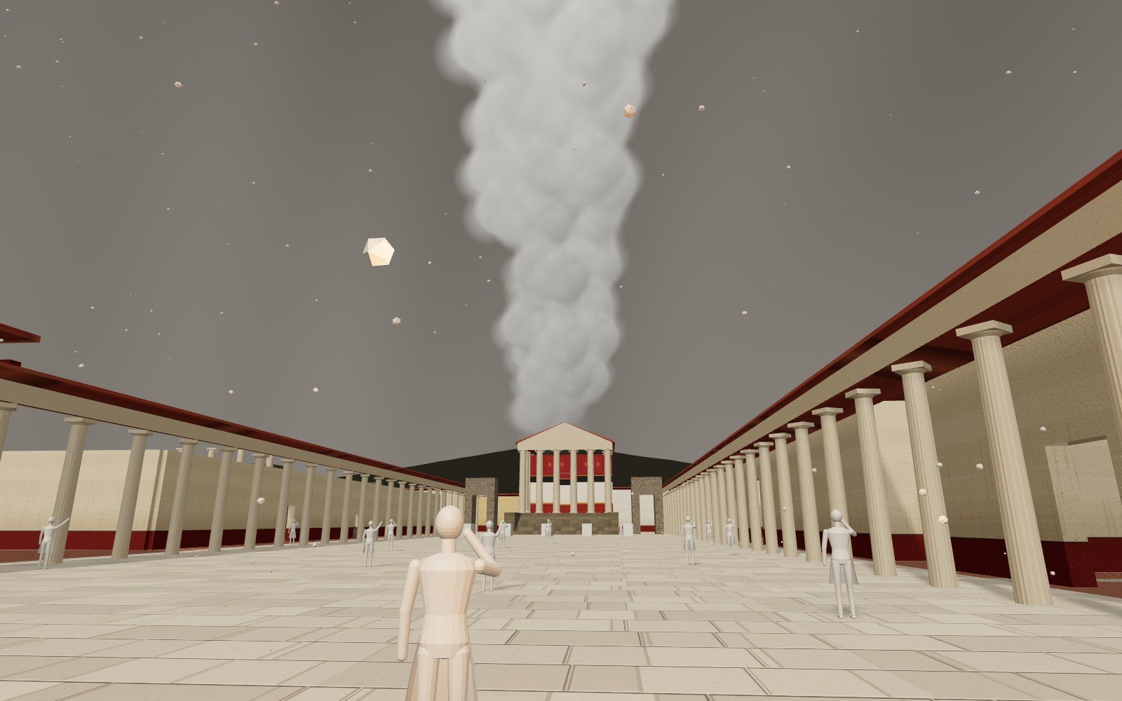
Walk through Pompeii on its last day
A walkable model of Pompeii with a clock from the first column of Vesuvius to the surge of the next morning, then to the ruins of today.
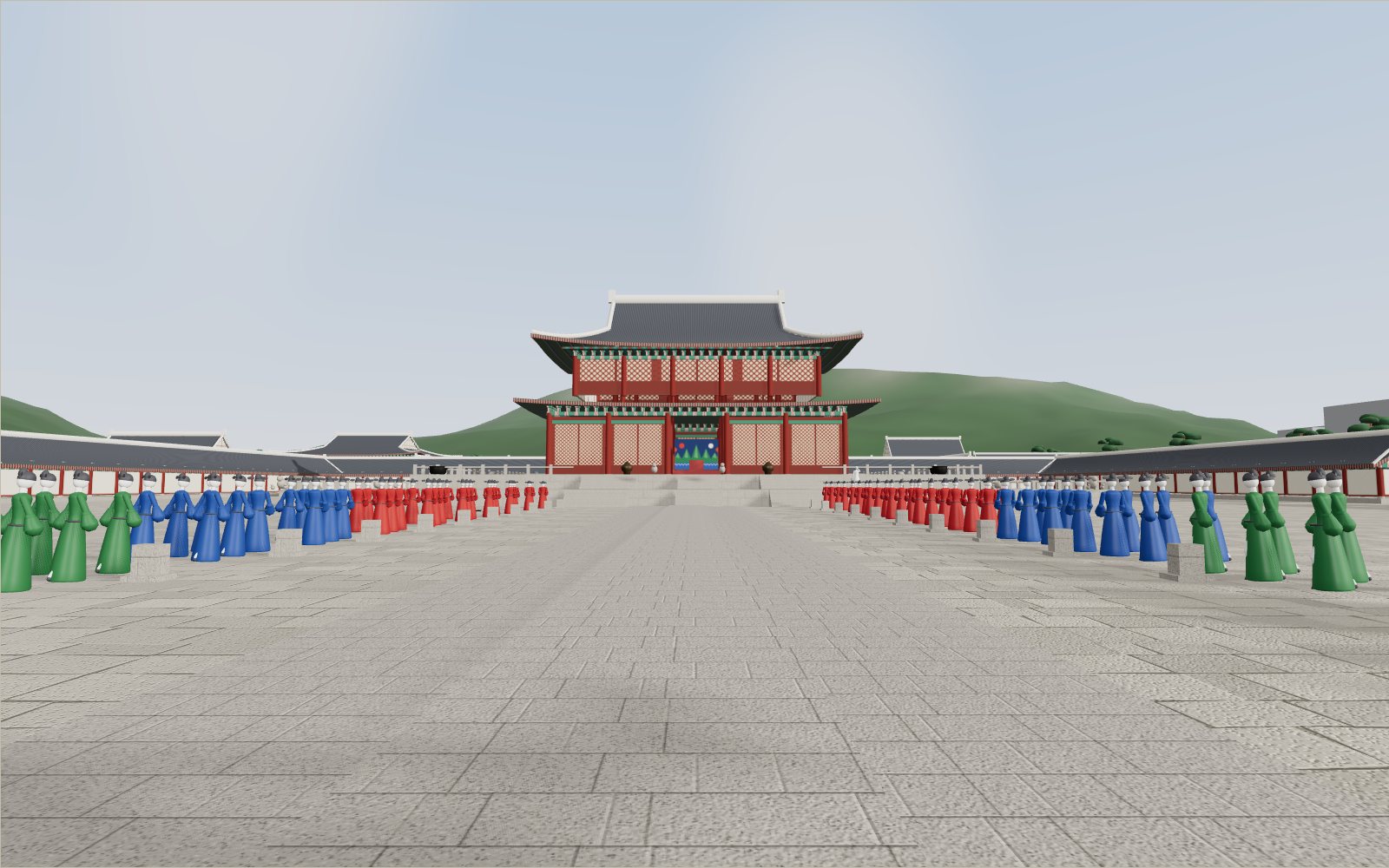
Walk through Gyeongbokgung Palace
In the courtyard of the throne hall, 24 stones told each official where to stand, from the first grade by the hall to the ninth by the gate.
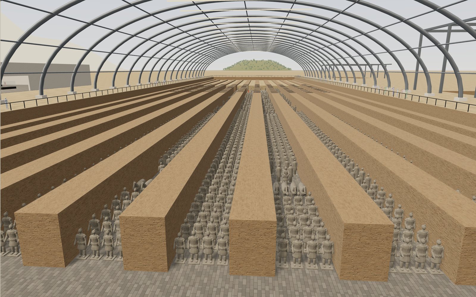
Walk through the Terracotta Army
Pit 1 of the Terracotta Army is 230 m long and holds an estimated 6,000 figures and horses, and every one of them was painted once.
Stone arch bridge: load it and watch how it carries weight
A stone arch has no glue between its blocks, yet it stands on its own once the last stone is set at the top.
How buildings resist earthquakes
Shake a six-storey model at 0.6 seconds, its own period, and its floors bend about 14 times more than at one second. Rubber bearings, dampers and braces each answer that in a different way.
Gothic cathedral: flying buttresses, interactive model
The stone vault of Amiens Cathedral hangs 42.3 metres above the floor, and the walls under it are mostly glass.