Loading the model
This device cannot show the 3D model. You can read the guide steps below as text.
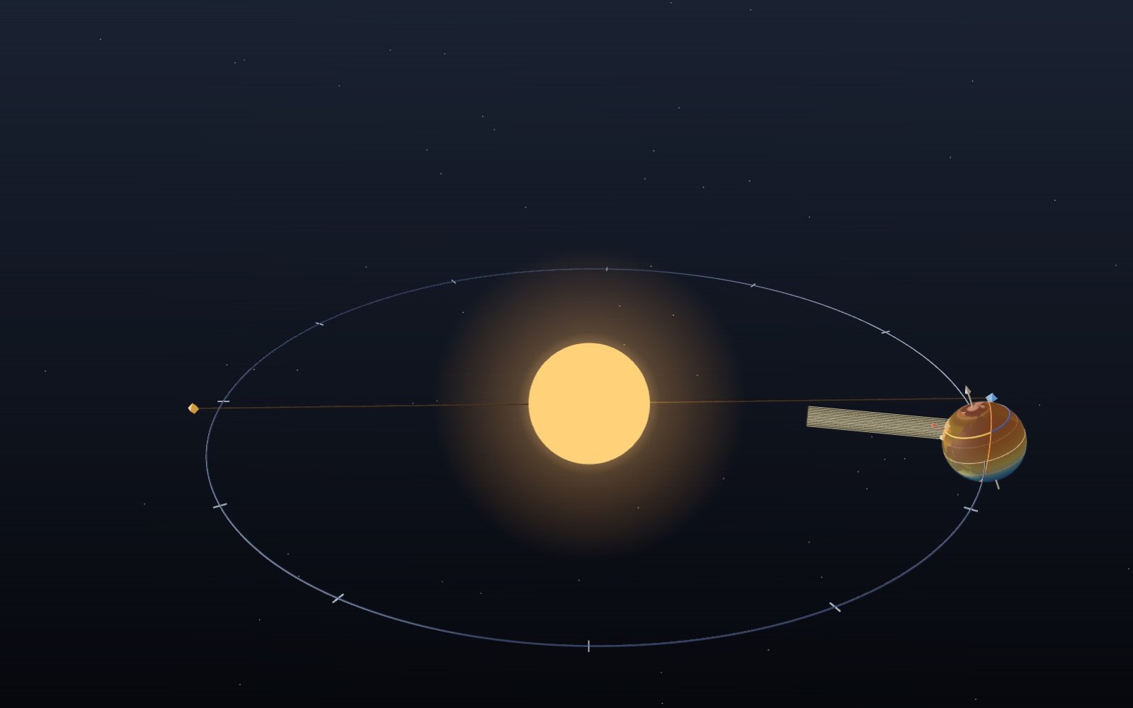
1 / 8 The Earth goes round the Sun One lap takes a year. Press play and four days pass each second. Sizes and distances are not to scale: on this scale the real Earth would be a speck smaller than a pixel. Drag to turn. Scroll or pinch to zoom.
Drag to turn. Scroll or pinch to zoom.
Guide Parts Controls
01 The Earth goes round the Sun One lap takes a year. Press play and four days pass each second. Sizes and distances are not to scale: on this scale the real Earth would be a speck smaller than a pixel. Drag to turn. Scroll or pinch to zoom.
02 The axis keeps its direction The axis leans 23.44° and points to the same spot in the sky all year. The four faint copies show it at the equinoxes and solstices. In June the north end leans towards the Sun, in December away from it.
03 Seoul in June On 21 June the Sun’s declination δ is +23.44°. Noon height = 90° − |37.57° − 23.44°| = 75.9°. The yellow arc covers 14 h 36 min of the day. With refraction counted, as almanacs do, it is 14 h 46 min.
04 Seoul in December On 22 December δ is −23.43°, so the noon Sun climbs only 29.0°. Day length = 2·acos(−tan φ·tan δ)/15 = 9 h 24 min without refraction, 9 h 34 min sunrise to sunset.
05 The same light on a bigger patch The beam has the same cross-section all year. At a noon height of 29° its patch on the ground is 1/sin 29° = 2.06 times longer, so each square metre gets half the light. In June the patch is only 1.03 times longer.
06 The equinox On 20 March the day and night line runs through both poles and the Sun stands over the equator. Every latitude gets 12 hours of geometric daylight. Seoul’s noon Sun stands at 52.4°.
07 Sydney has the opposite season Move to 33.87° S on 22 December and the noon Sun climbs to 79.6° with 14 h 15 min of daylight. When the north end of the axis leans away from the Sun, the south end leans towards it.
08 Closest in January The Earth passes nearest the Sun on 3 January and farthest on 6 July. The gap is 5 million km, about 3.4%, worth 6.9% more sunlight in January. It is too small to make seasons, and it peaks in the northern winter.
Sun Drawn about 35 times too big for the orbit, so it fits on screen. The real Sun is 109 Earths across. Earth Drawn about 2,350 times too big for its orbit. The surface map is drawn in code from simplified outlines, coloured by climate band. Axis Tilted 23.44° from upright to the orbit and pointing the same way in space all year, towards the Pole Star. Orbit Traced from the same solar formulas the readout uses. It is an ellipse, but only 1.7% off a circle, so it looks round. Earth at four dates Faint copies at the March and September equinoxes and the June and December solstices. The axes are parallel. Equator, tropics, polar circles The tropics at 23.44° N and S mark where the Sun can stand overhead; the polar circles at 66.56° mark where it can stay up all day. Day and night line The orange circle splits the lit half from the dark half. It is always square to the Sun direction. Sun overhead The point where the Sun is straight up at this moment. Its latitude is the Sun’s declination δ. Chosen latitude Yellow is the part of the circle in daylight, blue the part in night. The red pin marks local noon. Sunlight beam A square bundle of parallel rays arriving at noon. The lower the Sun, the longer the patch it lights on the ground. Nearest and farthest points Orange: perihelion, 3 January 2026, 147.1 million km. Blue: aphelion, 6 July 2026, 152.1 million km.