FIG. 45How It Works
What is under the street
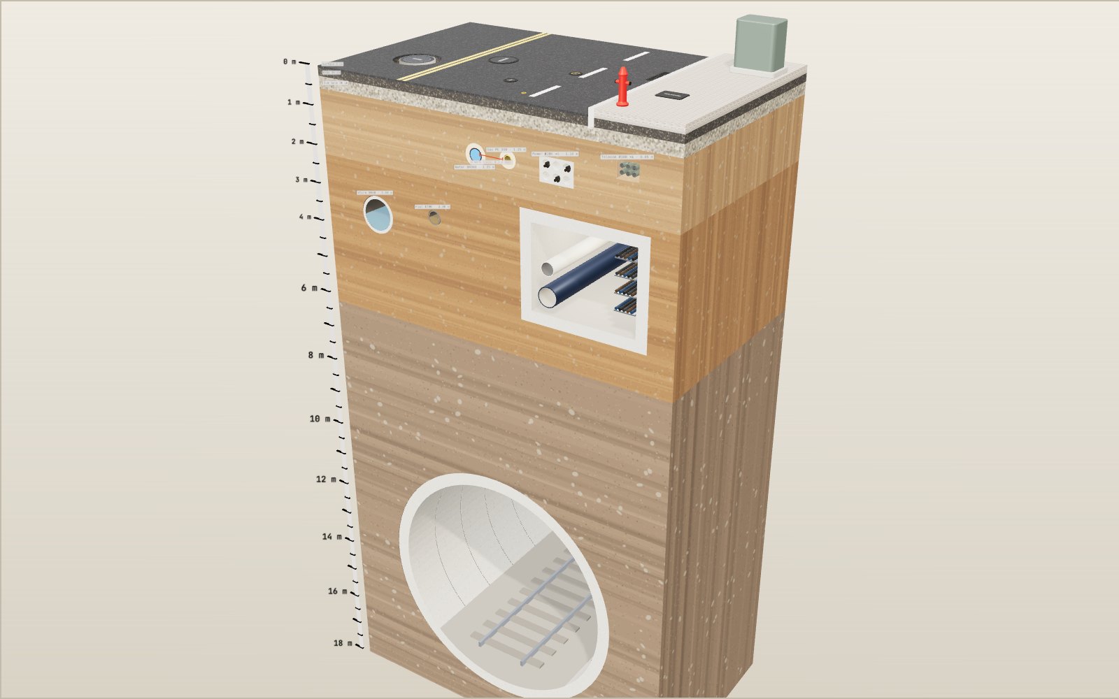
Korean road rules put a water main at least 1.2 metres under the road and a main sewer at least 3 metres down, so four kinds of pipe and cable all lie within the top 2 metres.
This device cannot show the 3D model. You can read the guide steps below as text.
1 / 11 A block of street cut outThis is a 10 m by 6 m piece of a city road, cut down to 18 m. Drag to turn it. Scroll or pinch to zoom. The ruler on the left reads depth below the road surface in metres.
Drag to turn. Scroll or pinch to zoom.
What the model shows
Stand on a busy city street and almost nothing you depend on is visible. The water in your tap, the gas for the stove, the fibre that carries this page and the pipe that takes away what you flush all pass under your feet, usually within two metres of the asphalt. The model above is a block of such a street, 10 m wide, 6 m long and cut down to 18 m, drawn at real size in metres. The left part is the carriageway, the raised strip on the right is the pavement.
Everything you see has a depth and a diameter. Where Korean rules give a minimum depth, the model obeys it and the text says which rule. Where no single rule exists (the thickness of the road layers, the size of the manhole, the depth of the subway), the model uses a representative example and says so. Real streets vary a great deal, and no drawing can tell you what lies under a particular road. That is a job for the records kept by the pipe owners, which is the subject of the last section.
On the Controls tab you can lift the layers off one at a time, make the soil transparent, change the slope of the sewers and dig a hole to see what it reaches. The readout in the top left corner shows the dig depth, the services the hole has reached and the flow speed in the two sewers.
Why a road is built in layers
A car tyre presses on the road over a patch about the size of a hand. If that load went straight into the soil, the soil would rut within weeks. A road solves this by spreading the load through layers that get coarser and cheaper as they go down.
In the model the top layer, the surface course, is 5 cm of dense asphalt. It is waterproof and it takes the wear from tyres, so it is the layer that gets milled off and replaced when a road is resurfaced. Below it is a base course of 20 cm, a stronger asphalt mix with larger stones that does most of the load spreading. Under that is a sub-base of 30 cm of compacted crushed stone. It spreads the load further, drains water away and stops fine soil from being pumped up into the road when traffic flexes it. The natural soil below is called the subgrade.
These thicknesses are a representative example. Real road designs choose each thickness from the expected traffic, the strength of the subgrade and the climate, so a quiet residential lane and a bus route have very different build-ups. The point the model makes holds for both: the road itself ends a little more than half a metre down, and the services start below that.
Who goes where under the street
Every service under a road has a rule about how much soil must cover it. In Korea the main one is Annex 2 attached to the Enforcement Decree of the Road Act, which sets the conditions for putting anything in or under a road. It asks for pipes and cables to go under the pavement or verge where possible, and only main lines to go under the carriageway when there is no other room. It then sets the minimum distance from the road surface to the top of each main line:
| Service | Minimum cover in the Road Act table | In the model |
|---|---|---|
| Telecom ducts | 0.8 m | 0.85 m |
| Power conduits | 1.0 m | 1.10 m |
| Gas main | 1.0 m (gas rules ask for 1.2 m on roads 8 m wide or more) | 1.25 m |
| Water main | 1.2 m | 1.25 m |
| Main sewer | 3 m (1 m where construction makes 3 m impossible) | 3.00 m |
The same table allows the first four to be laid as shallow as 0.6 m where construction makes the normal depth impossible, so old streets often hold pipes much shallower than the table suggests. Buried cables that are not in ducts have their own figures, 0.8 m under a carriageway and 0.6 m under a pavement.
The order follows from what each service needs. Telecom ducts carry thin cables that bend easily, so they can sit near the surface where they are cheap to reach. Power conduits carry more energy and are encased in concrete. The Korean Electrical Code asks for duct-type underground lines to be at least 1.0 m deep where heavy loads pass over them, which matches the road rule. Water mains go deeper partly to stay below the frost line, so the water does not freeze in winter. Sewers go deepest because they have to collect from every building's lowest drain and still fall towards the treatment plant.
Keeping gas away from everything else
The gas main in the model is yellow polyethylene, the usual material for the low and medium pressure pipes in city streets, and it has a strip of warning tape laid above it so that a digger meets the tape before the pipe. The Korean supply rules for city gas set three distances that the model shows.
The first is depth. On a road at least 8 m wide that carries vehicles, the outside of the pipe must be at least 1.2 m below the surface. On other roads the figure is 1.0 m, and inside the grounds of an apartment complex it is 0.6 m.
The second is separation. The outer wall of a buried gas pipe must stay at least 0.3 m from water and sewer pipes, telecom cables and other buried structures, unless it is protected by a sleeve of equal strength. In the model the water main and the gas main sit side by side at the same depth. The red bar on the front face measures the gap between their walls: the water main's outer radius is 0.163 m, the gas pipe's 0.10 m, and their centres are 0.90 m apart, so the clear gap is 0.90 − 0.163 − 0.10 = 0.637 m, a little over twice the minimum.
The reason is practical. If a water main bursts, the jet of water and soil can scour the pipe next to it. If a repair crew digs down to the water main, they need room to work without loading the gas pipe. And a gap means a leak in one cannot easily find a path along the other.
Why the sewer has to run downhill
The water main is under pressure, pushed by pumps and reservoirs on hills, so it can go up and down with the road. The sewers have no such push. Wastewater and rain move only because the pipe runs downhill, and that single fact decides most of the layout under a street.
If the slope is too gentle, the flow is too slow to carry grit and solids, and they settle on the bottom. Over months the pipe clogs and smells. If the slope is too steep, the fast flow can wear the pipe and complicate energy dissipation at transitions. Korean sewer design standards therefore give a speed band. Foul sewers should flow at 0.6 m/s or more, and storm and combined sewers at 0.8 m/s or more, because rain washes sand into them. The upper limit for both is 3.0 m/s.
Speed depends on slope and size. Engineers use Manning's formula for a pipe flowing full:
V = (1/n) × R^(2/3) × S^(1/2)
Here V is the speed in m/s, S is the slope, n is a roughness number (0.013 is the usual value for concrete and plastic sewers), and R is the hydraulic radius, which for a full round pipe is the diameter divided by four.
Numbers you can check
Take the 300 mm foul sewer. R = 0.3 / 4 = 0.075 m, and 0.075^(2/3) = 0.178. To reach 0.6 m/s the slope must be S = (0.6 × 0.013 / 0.178)² = 0.0019, or 1.9 per mille: 19 cm of fall for every 100 m of pipe. At the model's default slope of 5 per mille the full-pipe speed is 0.178 × 0.0707 / 0.013 = 0.97 m/s, safely inside the band. At 1.5 per mille it falls to 0.53 m/s and the model shows sediment building up on the pipe floor.
The 800 mm storm sewer needs much less slope for the same speed. R = 0.2 m and 0.2^(2/3) = 0.342, so 0.8 m/s needs only S = (0.8 × 0.013 / 0.342)² = 0.00092, about 0.9 per mille. Large pipes are more efficient, which is why trunk sewers can run very gently across a whole city. The same formula also gives a ceiling. Above about 13 per mille the storm sewer passes 3.0 m/s when full, and the readout warns that the flow is too fast.
These are full-pipe speeds. A real sewer is rarely full, and a half-full pipe flows at about the same speed as a full one while a nearly empty pipe flows more slowly, which is why designers also check the speed at the smallest expected flow.
Slope has a cost. A sewer falling at 5 per mille drops 50 cm every 100 m, so after a kilometre it is 5 m deeper than where it started. At some point it becomes cheaper to pump the sewage up again, and cities place pumping stations where the pipes would otherwise go too deep. In the model the drawn slope is exaggerated six times so that you can see it over the 6 m length of the block.
Manholes and utility tunnels
A sewer cannot be reached from the road unless something reaches down to it. The manhole in the model is a concrete shaft with an inside diameter of 900 mm, steel rungs and a cast iron cover, dropping 3 m to the top of the storm sewer. Manholes are placed where sewers join, bend or change slope, and at intervals along straight runs so that the pipe between two of them can be inspected with a camera and cleaned with a high-pressure jet. The sizes here are a representative example.
On the right, under the edge of the road, is a utility tunnel: a concrete box about 2.8 m wide inside, with cable trays on one wall and a water main and heating pipes on the other. A tunnel like this costs far more to build than burying the same lines, but once it exists the cables and pipes can be repaired, replaced or added without ever cutting open the road again. Since a 2010 change to the decree under the National Land Planning and Utilization Act, Korea requires one in development projects larger than 2 million square metres, such as new towns and housing districts. Power and telecom lines, water mains and district heating pipes must then move inside, while gas and sewer pipes go in only if a review council agrees. Most older streets have no utility tunnel, and their services are buried directly in the soil as on the left of the model.
The subway, far below
The subway tunnel in the model is a single-track bored tunnel, 7 m across, with its crown 10 m below the road. Its lining is made of concrete rings 1.2 m long, the kind of segments a tunnel boring machine places behind itself as it advances. Both numbers are a representative example. Older lines were often built by digging a trench from the surface and roofing it over, which kept them shallow. Newer lines tend to be bored deeper, where they can pass under the pipes, foundations and other lines above them without disturbing them.
Make the soil transparent and you can see how much ground separates the sewers from the tunnel roof. That gap is not empty space in the planning sense. It is where future pipes may need to go, which is one reason Korea now keeps a national map of what lies underground.
Before you dig: how Korea tracks buried pipes
Set the dig depth to 1.4 m and the red box reaches both the water main and the gas main. In a real street the depth you would hit something at could be far less, because old pipes are often shallower than the rules or not where the drawings say.
On 28 April 1995 a drilling crew at a building site in Sangin-dong, Daegu, boring holes for grouting punched a hole about 8 cm across in a buried city gas main. The gas flowed along a sewer into the excavation for the Daegu subway, about 100 m away, and exploded. 101 people died, among them 42 pupils and a teacher of a nearby middle school on their way to school, and 202 were injured. Today anyone digging near city gas pipes in Korea has to report first through the Korea Gas Safety Corporation's dig reporting system.
Today two systems matter for anyone digging in Korea.
- The Excavation Information Support Centre (EOCS), run by the Korea Gas Safety Corporation. Anyone planning to dig, drive piles or bore holes in an area where city gas, LPG or high-pressure gas pipes are buried must report the work first by phone on 1644-0001, on the website or through the app. The centre asks for reports at least 24 hours ahead, not counting weekends and holidays, and recommends two to three days. The gas company then checks for pipes, marks their position on site, and the centre tells the digger when work may start. Digging before that notice is not allowed.
- The underground space integrated map, built under the Special Act on Underground Safety Management. LX, the Korea Land and Geospatial Informatix Corporation, gathers data from about 225 managing bodies on water, sewer, gas, heating, power, telecom and oil pipelines, plus subways, underpasses, underground car parks and borehole records, and turns them into a 3D map. It is restricted information. Developers planning excavations of 10 m or more receive drawings of their site for the underground safety assessment, but the map is not open to the public.
So the honest answer to "what is under my street?" is that only the owners' records, and the people who mark them on site, can tell you. The model shows what a street like it typically holds.
What the model leaves out
- Service pipes. Every building has its own smaller water, gas and drain connections running across from the mains, and they make real streets far more crowded than the model.
- Gullies, valves and chambers. Rain gullies at the kerb, water valves, gas pressure regulators and cable joint pits are all left out.
- Bedding and backfill. Pipes sit on sand or fine gravel and are surrounded by selected fill; the model only hints at it with a lighter ring around the water and gas pipes.
- Groundwater. Many streets have a water table within a few metres of the surface, which affects how deep sewers and tunnels can go and how excavations must be supported.
- Real geology. The soil here is uniform. Real ground has fill, clay, sand and weathered rock, and a subway may be bored through solid rock.
Flow speed is not the same as capacity
A sewer can carry water quickly and still be too small for a storm. Speed measures how fast a parcel travels; discharge measures how much volume passes a section each second. The connection is Q = A × V. For a full circular pipe, A = πD²/4. This calculation uses the exhibit's internal diameters, not the outside dimensions used to check cover and clearances.
At the default 5‰ slope, the 300 mm foul sewer has A = 0.0707 m² and V ≈ 0.97 m/s. Its calculated full-flow discharge is therefore about 0.068 m³/s, or 68 litres each second. The 800 mm storm sewer has A = 0.503 m² and V ≈ 1.86 m/s, giving about 0.935 m³/s, or 935 litres each second. Those are idealised uniform-flow results using n = 0.013, not measured flows in a real street. Junction losses, downstream water levels and inlet capacity are outside this model.
The storm pipe's diameter is about 2.67 times the foul pipe's, but its full-flow capacity is about 13.7 times as large at the same slope and roughness. Area increases with D² while Manning velocity increases with D^(2/3), so their product increases with D^(8/3). Doubling slope does much less: velocity and discharge rise only by √2, about 1.41. Making a sewer steeper is therefore not an unlimited substitute for making it larger.
The half-full case explains another common confusion. Half a circle has half the flow area and half the wetted perimeter of the full circle. The ratio R = A/P stays the same, so Manning gives the same velocity if slope and roughness stay fixed. Discharge, however, halves. Seeing a healthy velocity on a readout does not establish spare capacity, nor does it say whether rainfall can reach the pipe through the street gullies.
What a depth measurement actually means
The table measures cover to the outside top of a pipe. It does not measure to the pipe centre or the invert, the lowest inside surface where a trickle runs. The water main illustrates the difference. Its top is 1.25 m down and its outside radius is 0.163 m, so its centre is 1.413 m down. With an internal radius of 0.15 m, its invert is 1.563 m down. Using one of these numbers in place of another would shift a drawing without changing the pipe itself.
The displayed 0.637 m gas-to-water gap is a horizontal wall-to-wall gap. The top surfaces are level, but the unequal outside radii put the centres at slightly different heights. It is useful for reading this layout, not a replacement for a surveyed three-dimensional clearance at a crossing. Real design also needs room for joints, supports and maintenance equipment; a dimension that fits two bare pipes does not automatically fit a repair crew.
Minimum cover is not a prediction of the frost depth at your address. Freezing depends on the weather, soil and surface conditions. Nor does adding soil alone solve every problem: a deeper pipe becomes harder to maintain, and a gravity sewer needs a suitable downstream level. This exhibit has no climate control or freezing calculation. Its 1.25 m water cover should be read as a chosen layout value checked against the road table, not as a universal guarantee against frozen water.
London's sewer moved the problem downstream
The Great Stink of 1858 made the Thames unbearable even inside Parliament. London Museum describes how human and industrial waste in the river, exposed during hot weather, helped force funding for Joseph Bazalgette's sewer scheme. Rather than letting local drains discharge beside the crowded city, intercepting sewers collected their flows and carried them farther downstream. Pumping stations were necessary where gravity alone could not deliver the required route.
The system officially opened in 1865, but the whole project was not completed until 1875. These are different milestones, not competing dates. The museum records 318 million bricks and explains that Bazalgette allowed for population growth by building generously sized tunnels. A network expected to last generations cannot be chosen only for today's average dry-weather flow.
There was an important limit: the early system still discharged sewage into the lower Thames. Collecting waste and moving it away from houses did not make that waste clean. Treatment was a further task. Compare that history with the two pipes on screen. Separating foul water from stormwater changes what reaches a treatment plant and what must be handled during heavy rainfall. The model shows that separation locally; it does not simulate London's combined network or claim that a bigger pipe by itself removes pollution.
A map is not permission to excavate
The British Health and Safety Executive's HSG47 warns that plans may have changed scale, surface levels may have been altered, and old services may never have been recorded. An empty patch on a drawing is not proof of empty ground. A line drawn precisely on a screen can still represent uncertain survey information.
The US 811 system supplies a useful comparison with Korea's gas excavation reporting. PHMSA explains that the one-call centre passes the proposed dig location to the affected operators, who check and mark facilities. The caller must wait the required time, respect the marks and dig carefully. Advance notice depends on state law; the Korean reporting interval above should not be transferred to a US job. Calling is a step in a process, not a guarantee that a shovel can immediately go anywhere.
HSG47 separates planning, locating services and safe excavation. Physical identification through trial holes can be needed to verify depth and identity after records and detection have been considered. This is work for competent crews following a site-specific safe system, not a household experiment. A shared utility tunnel changes access arrangements, but it does not remove the need to isolate equipment or manage the hazards of working around live services.
Three checks on screen
Start with Sewer slope at 0‰. The formula makes both full-flow velocities zero because it assumes gravity-driven uniform flow. This does not mean a real flat pipe can never move water: a difference in water level can create an energy gradient even when the pipe bottom is flat. The model does not solve that backwater problem.
Next compare 5‰ with 20‰. The slope increases fourfold and the velocities double, rather than quadruple. The foul readout should change from about 0.97 to 1.93 m/s; the storm readout from about 1.86 to 3.72 m/s. The larger pipe then passes the model's 3.0 m/s warning threshold. Return to 5‰ before comparing the normal animation again. The particles illustrate direction; the numerical readout is the appropriate place to compare the calculated speeds.
Finally turn on See-through soil, set Dig depth to 1.4 m and examine the red box. Its footprint crosses the water and gas mains, so both appear in Reached. It does not span the whole 10 m street width. A cable outside that footprint is not hit merely because it is shallower than 1.4 m. Increase depth toward 4 m to reach the foul sewer below the same footprint, not every buried object. The subway crown remains at 10 m, beyond this control's range. These are geometry checks inside an educational model, not instructions for choosing a safe real excavation depth.
Paint on the road before a dig
Turn on Locate marks in the dig bench and the street gets the paint you see on real roads before roadworks. In the United States, and in many places that copy its system, the colours follow the uniform colour code of the American Public Works Association (APWA): red for power cables and lighting, yellow for gas, oil and steam, orange for telecom, alarm and signal lines, blue for drinking water, green for sewers and drains, purple for reclaimed water and irrigation, pink for temporary survey marks and white for the outline of the planned dig. The white outline of the planned dig comes first; the owners of the lines then paint where their lines run inside and near it.
Each mark comes with a tolerance zone. Where no law sets another width, the APWA guideline takes the width of the line plus 450 mm on each side. Inside it, digging is done with hand tools or a non-invasive method until the line itself is exposed. In the model the pale band around each painted line is that zone. Move the trench in the dig bench and the readout lists every zone it overlaps under Hand dig only. The water main and the gas main sit 0.64 m apart, wall to wall, so their two zones overlap: there is no position between them where a machine may dig freely.
The US one-call number is 811. In Korea the equivalent for gas is the excavation information centre (EOCS) of the Korea Gas Safety Corporation on 1644-0001, described below. The paint is temporary. It tells the digger where to be careful; it does not move the pipes, and the depth is never painted, because records and detectors are not reliable enough to promise one.
What the street surface tells you
Before any paint, the street itself shows a lot of what is below. The model has nine such things, placed as a representative layout. Find them by clicking or tapping on the model; each one lights up the line it belongs to.
- The storm sewer manhole, the cast iron cover over the shaft with steel rungs.
- A second manhole over the foul sewer. Every cover in the model carries the name of its network.
- A gully grate at the kerb, where road water drops into the storm sewer. Korea's environment ministry asks residents not to throw rubbish into gullies, not to cover them with mats or boards and to report blocked ones, because a blocked grate floods the street even when the sewer below has room.
- A small valve box over the water main. Crews turn the valve from the road to shut one section for a repair.
- A valve box over the gas main, with a yellow ring in the model.
- A gas line marker, a small disc set into the asphalt with an arrow along the main.
- A telecom manhole on the pavement, the access to the chamber where cables in the ducts are pulled and spliced.
- A pad-mounted transformer on the pavement, which steps the voltage down for nearby buildings where the power cables run underground.
- A fire hydrant, fed from the water main by a branch pipe.
Reading the surface this way is a habit of utility crews, but it only shows where access points are. A pipe between two covers can bend, and an abandoned line has no cover at all.
Why roads cave in
Most holes that open in city roads are not natural sinkholes in limestone. They start with a pipe. A crack or an open joint in an old sewer or water main lets water run through the soil around it. Running water carries fine soil into the pipe or away along the outside of it, and a hollow forms. It grows upwards, out of sight, because each new collapse of its roof falls into the gap and is washed away in turn. The asphalt is stiff enough to bridge the hollow for a while, so the road can look sound until it fails.
The Years of leaking slider in the model shows this as an illustration. The hollow starts at the crown of the foul sewer, 3.0 m down, and climbs to just under the sub-base, 0.6 m down; at the end the asphalt above starts to sag. The shape and the timing are drawn, not calculated: real hollows depend on the soil, the groundwater and the size of the defect.
The National Assembly Research Service in Korea summarised the Ministry of Land figures in May 2025. From 2015 to 2024 there were 2,119 cases of ground subsidence on record. Damage to buried lines caused 1,252 of them: sewers 901, water pipes 243 and other lines 108. Poor compaction of backfill caused 347, excavation work 189, pipe works 71 and other buried works 33; 227 had other causes. Leaks of all kinds were behind 1,144 cases, 54.0% of the total. Three people died and 77 were injured, and 113 vehicles were damaged. The yearly count rose from 186 in 2015 to 338 in 2018 and has since fallen, to 102 in 2024.
Two recent collapses show how the causes combine. On 8 November 2016 the road in front of Hakata station in Fukuoka caved in over a subway extension tunnel under construction; the hole was about 27 m wide, 30 m long and 15 m deep. The city filled it and reopened the road to traffic on 15 November. On 24 March 2025 a hole 22 m by 18 m and 16 m deep opened in Myeongil-dong, Seoul, above a tunnel being dug for subway Line 9; a motorcyclist died and a driver was injured. The central underground accident investigation committee reported in December 2025 that a wedge of deeply weathered rock, bounded by three intersecting discontinuities that the site investigation had not found, slid and pressed on the tunnel with more load than it was designed for. The groundwater around it had been lowered by an earlier expressway tunnel, from 3.1 to 6.9 m below the surface in 2017 to 18.9 to 25.5 m in 2022, and an old sewer nearby had kept leaking: a survey in 2022 had found cracks and offset joints that were not repaired.
Under other cities
The catalogue in the panel collects 32 places. A few numbers give the scale.
Paris began laying sewers under every public street after the cholera of 1832, and the galleries also carried telephone cables, compressed air pipes and traffic signal cables, an early form of the utility tunnel. Today the city counts 2,676 km of underground galleries; the network carries wastewater and rain in the same pipe. London's answer to the Great Stink of 1858 was Joseph Bazalgette's intercepting sewers, opened in 1865 and finished in 1875 with 318 million bricks. They moved the sewage downstream rather than treating it, and when storms overload them they still overflow into the Thames. The Thames Tideway Tunnel was built to catch those overflows: 25 km long, 7.2 m across at its eastern end, falling 1 m every 790 m so it cleans itself, from 30 m deep in the west to 66 m at Abbey Mills.
Deep storm tunnels now protect many cities. The Metropolitan Area Outer Underground Discharge Channel near Tokyo is an underground river 6.3 km long and about 10 m across, 50 m below Route 16. Chicago's Tunnel and Reservoir Plan has 110 miles of tunnels up to 33 feet across and up to 300 feet deep. Seoul's Sinwol tunnel, finished in 2020, is 40 m down, 10 m across and 4.7 km long, and holds 320,000 m³ of rain. Kuala Lumpur's SMART tunnel, 9.7 km long, runs cars through 3.0 km of it on dry days and floods them out on the worst ones.
Utility tunnels are much rarer. Seoul's first opened under Yeouido in 1978 and is 6.1 km long; the city's seven tunnels total 33.79 km. A national study in 2020 counted 30 utility tunnels in 12 local governments in Korea, 165.62 km in all. Gas was left out of them for safety, and sewers rarely fit because they need a steady fall. Helsinki goes furthest: since 1977 it has blasted about 60 km of shared tunnels into the bedrock for district heating and cooling, power, telecom and water.
Accidents in the tunnels and pipes
Putting lines together does not make them safe by itself. On 24 November 2018 a fire in the cable tunnel under the KT Ahyeon exchange in Seoul cut telecom services across a large part of the city. The tunnel was shorter than 500 m, so the fire rules did not require sprinklers or detection, and one extinguisher was all it had. The government then began checking every telecom tunnel and pushed for sprinklers and cameras in the short ones too. On 4 December 2018 a district heating pipe burst under a road near Baekseok station in Goyang and hot water flooded the street; one person died. The police investigation found that a patch had been welded badly when the pipe was laid in 1991 and had come loose after years of changing pressure.
Questions
How deep are water pipes buried under a road in Korea?
The Road Act table asks for the top of a water main to be at least 1.2 m below the road surface, or 0.6 m where construction makes that impossible. In the model it is 1.25 m. Service pipes to individual buildings are smaller and often shallower.
Why are gas pipes yellow?
Yellow marks the pipe as gas so that anyone who uncovers it knows what it is at a glance. The polyethylene pipes used in city streets are made in that colour, and a strip of warning tape is laid above them so that a digger meets the tape first.
How far must a gas pipe be from a water pipe?
Korean city gas rules ask for at least 0.3 m between the outer wall of a buried gas pipe and other buried pipes and cables, unless it is protected by a sleeve of equal strength. In the model the gap is 0.64 m.
Why are sewers buried deeper than water mains?
Sewers flow by gravity, so they must stay below the lowest drain of every building they serve and keep falling all the way to the treatment plant. The Road Act table puts the top of a main sewer at least 3 m below the road surface.
What happens if a sewer is laid too flat?
The flow slows down, solids and grit settle, and the pipe gradually blocks and smells. Korean design standards aim for at least 0.6 m/s in foul sewers and 0.8 m/s in storm sewers. Move the slope slider below about 2 per mille and the model shows sediment forming in the foul sewer.
Can I find out what is buried under my street?
Not in detail. The national underground map is restricted, and pipe records belong to the utilities. If you plan to dig, report the work to the Excavation Information Support Centre on 1644-0001 and contact the other utilities in the area. They will check and mark their lines on site.
What is a utility tunnel?
A walk-in concrete tunnel under a road that holds cables and pipes together, so they can be repaired or added without digging up the street. It costs more to build, so it is mostly found under the main roads of planned new towns.
Does twice the slope mean twice the flow speed?
No. With size and roughness fixed, Manning velocity follows the square root of slope. Four times the slope gives twice the speed in this model.
Is a half-full sewer half as fast?
No. For a circular pipe at the same slope and roughness, its hydraulic radius is unchanged between half full and full. The calculated velocity is the same, but the half-full discharge is half as much.
Can the red box reach the subway?
No. Dig depth stops at 4 m while the subway crown is 10 m below the surface. The box also covers only part of the street, not every service across its width.
What do the paint colours on the road mean?
They mark buried lines before a dig. Under the APWA uniform colour code red is power, yellow gas, oil or steam, orange telecom, blue drinking water, green sewers and drains, purple reclaimed water, pink survey marks and white the outline of the planned dig. Korea uses its own procedures; the colours in the model follow the APWA code.
What makes a road cave in?
In cities it usually starts with a leaking pipe that washes soil away and leaves a hollow under the asphalt. In Korea damaged sewers caused 901 of the 2,119 subsidence cases recorded from 2015 to 2024; poor backfill and excavation work caused most of the rest.
Why are there not utility tunnels under every street?
They cost far more to build than burying each line, they need a wide road and a plan agreed by every owner, and some lines do not fit: gas is usually kept out for safety and sewers need a steady fall. Korea has 165.62 km of them in 30 places, mostly in new towns.
Terms
- Cover depth: the distance from the road surface to the top of a buried pipe or duct.
- Surface course: the top layer of a road, the asphalt that tyres touch.
- Base course: the layer under the surface course that spreads wheel loads.
- Sub-base: compacted crushed stone between the base course and the soil.
- Subgrade: the natural or filled soil that the road is built on.
- Duct bank: a group of conduits for cables, often cast in concrete.
- Foul sewer: a pipe for wastewater from buildings.
- Storm sewer: a pipe for rainwater from roads and roofs.
- Per mille (‰): parts per thousand; a slope of 5 ‰ falls 5 m in 1 km.
- Manning's formula: V = (1/n) R^(2/3) S^(1/2), the standard estimate of flow speed in open channels and sewers.
- Utility tunnel: a tunnel under a road that carries several services together.
- EOCS: the Excavation Information Support Centre of the Korea Gas Safety Corporation, which handles dig reports near gas pipes.
- Tolerance zone: the band on each side of a marked line where only hand or non-invasive digging is allowed.
- APWA uniform colour code: the paint colours that identify buried lines on the surface before a dig.
- Ground subsidence: a sudden drop of the ground surface, usually over a hollow left by washed-out soil.
- Gully: a grated inlet at the kerb that takes road water into the storm sewer.
Sources
Enforcement Decree of the Road Act, Annex 2, criteria for road occupation permits (cover depths for water, gas, power, telecom and sewer pipes), Korea Ministry of Government Legislation. https://www.law.go.kr/LSW/flDownload.do?flNm=%5B%EB%B3%84%ED%91%9C%202%5D%20%EB%8F%84%EB%A1%9C%EC%A0%90%EC%9A%A9%ED%97%88%EA%B0%80%EC%9D%98%20%EA%B8%B0%EC%A4%80(%EC%A0%9C54%EC%A1%B0%EC%A0%9C5%ED%95%AD%20%EA%B4%80%EB%A0%A8)%0A&flSeq=75325791 (checked 2026-10-16)
Enforcement Rule of the City Gas Business Act, Annex 6, facility standards for general city gas supply (cover depth by road width, 0.3 m separation from other pipes). The detailed figures now sit in the KGS Code FS551. https://www.law.go.kr/LSW/flDownload.do?bylClsCd=110201&flSeq=86177823&gubun (checked 2026-10-16)
Korea Gas Safety Corporation, Excavation Information Support Centre (EOCS), dig reporting system and FAQ. https://www.eocs.or.kr/ and https://www.eocs.or.kr/jsp/center/faq/list.jsp (checked 2026-10-16)
Special Act on Underground Safety Management, Korea Ministry of Government Legislation. https://www.law.go.kr/lsInfoP.do?lsId=012468 (checked 2026-10-16)
LX Korea Land and Geospatial Informatix Corporation, building the underground space integrated map. https://www.lx.or.kr/kor/sub01_04_02_01.do (checked 2026-10-16)
Water Journal, problems in sewer rehabilitation projects (minimum velocity 0.6 m/s and minimum cover 1.0 m in the Ministry of Environment sewer standards). https://www.waterjournal.co.kr/news/articleView.html?idxno=7424 (checked 2026-10-16)
Safety First News, why sewer velocity standards matter (0.6 m/s foul, 0.8 m/s storm and combined, 3.0 m/s maximum). https://www.safety1stnews.com/news/articleView.html?idxno=4367 (checked 2026-10-16)
Water Journal, the Ministry of Land makes utility tunnels mandatory in development projects over 2 million m² (29 June 2010). https://www.waterjournal.co.kr/news/articleView.html?idxno=10752 (checked 2026-10-16)
Pikachuu electrical blog, summary of KEC 334.1 for duct-type underground lines (1.0 m, 0.6 m where no heavy load). https://pikachuu.tistory.com/27 (checked 2026-10-16)
산업인뉴스, [특별기획] 대구지하철공사장 가스폭발 30년, 가스안전 믿을 수 있나? (28 April 1995; a drill at the Daegu Department Store site holed a buried medium-pressure gas main, an 8 cm hole; gas ran along a sewer about 100 m into the subway excavation; 101 dead; 42 pupils and a teacher of Yeongnam Middle School among them). https://www.sanupin-news.kr/news/articleView.html?idxno=11131 (checked 2026-10-17)
서울경제, [오늘의 경제소사] 대구 상인동 가스 폭발 사고 (101 dead, 202 injured). https://www.sedaily.com/article/12669208 (checked 2026-10-17)
Health and Safety Executive (UK), HSG47 Avoiding danger from underground services. https://www.hse.gov.uk/pubns/books/hsg47.htm (checked 2026-10-16)
Call 811, the US call-before-you-dig service. https://call811.com/ (checked 2026-10-16)
Federal Highway Administration, Hydraulic Design Series 4: Introduction to Highway Hydraulics, chapter 7 (full-flow Manning equation for circular pipes, concrete pipe n = 0.013, velocity changes little between half full and full). https://www.fhwa.dot.gov/engineering/hydraulics/pubs/08090/hds4_608.pdf (checked 2026-10-17)
Federal Highway Administration, Precast Concrete Segmental Liners for Large Diameter Road Tunnels: Literature Survey and Synthesis, FHWA-HIF-20-035, 2020 (tunnel boring machine tunnels use precast concrete segmental linings). https://www.fhwa.dot.gov/bridge/tunnel/pubs/hif20035.pdf (checked 2026-10-17)
Calculations on this page: Manning's formula with n = 0.013 for full round pipes; clearances measured between outer walls in the model.
London Museum, How Bazalgette built London’s first super-sewer (1858 Great Stink; opening 1865, completion 1875; 318 million bricks; downstream disposal). https://www.londonmuseum.org.uk/collections/london-stories/how-bazalgette-built-londons-first-super-sewer/ (checked 2026-10-23)
PHMSA, Call Before You Dig! (one-call notification, operator marking, waiting and careful digging). https://primis.phmsa.dot.gov/stakeholder-comms/CBYD (checked 2026-10-23)
HSE, HSG47 full guidance, paragraphs 39 and 76 (limits of plans; trial holes for identification). https://www.hse.gov.uk/pubns/priced/hsg47.pdf (checked 2026-10-23)
American Public Works Association, Uniform Color Code card and Guidelines for Uniform Temporary Marking of Underground Facilities (colours; tolerance zone of the facility width plus 18 in, 450 mm, on each side). https://www.apwa.org/wp-content/uploads/Uniform-Color-Code-1.pdf (direct download blocked for scripts with 403; text checked through the search index copy, 2026-10-27)
국회입법조사처, 지반침하 예방을 위한 입법 및 정책방안, NARS 현안분석, 2025-05-28 (2015~2024 2,119 cases by cause and year, casualties). https://www.nars.go.kr/fileDownload2.do?doc_id=1PTaFGa2maV&fileName (checked 2026-10-27)
국토교통부, 땅꺼짐 사고 조사결과 발표 (명일동, 2025-12-03), 대한민국 정책브리핑. https://www.korea.kr/briefing/policyBriefingView.do?newsId=156732996 and KDI 경제정책자료 summary https://eiec.kdi.re.kr/policy/materialView.do?num=274329 (checked 2026-10-27)
연합뉴스, 명일동 땅꺼짐 사고, 고속도로 터널공사·노후관 관리 미흡이 영향 (2025-12-03; groundwater 3.1 to 6.9 m in 2017 and 18.9 to 25.5 m in 2022). https://www.yna.co.kr/view/AKR20251203094500003 (checked 2026-10-27)
福岡市交通局, 博多駅前2丁目道路陥没 復旧状況 (2016-11; about 27 m by 30 m by 15 m, reopened 15 November 05:00). https://subway.city.fukuoka.lg.jp/subway_webapp/files/uploads/karihuxtukyuu.pdf (checked 2026-10-27)
Ville de Paris, Un crocodile a vécu dans les égouts de Paris en 1984 (2,676 km of galleries, one pipe for wastewater and rain). https://www.paris.fr/pages/un-crocodile-a-vecu-dans-les-egouts-de-paris-en-1984-19564 (checked 2026-10-27)
国土交通省 関東地方整備局 東京国道事務所, 地下空間事業 Q&A (Paris sewers after the cholera of 1832; Kudan utility duct, about 3 m by 2 m, 270 m). https://www.ktr.mlit.go.jp/toukoku/toukoku00035.html (checked 2026-10-27)
Tideway, Annual Report 2025/26 (25 km, 6.5 to 7.2 m, 30 to 66 m deep, 1 m fall per 790 m; Greenwich connection tunnel 4.5 km, 5 m). https://www.tideway.london/media/7697/tideway-annual-report-2025-26.pdf (checked 2026-10-27)
国土交通省 江戸川河川事務所, Metropolitan Area Outer Underground Discharge Channel, Tunnel (6.3 km, about 10 m, 50 m below Route 16). https://www.ktr.mlit.go.jp/edogawa/edogawa00673.html (checked 2026-10-27)
Metropolitan Water Reclamation District of Greater Chicago, Tunnel and Reservoir Plan (TARP) (110 miles, 8 to 33 ft, 150 to 300 ft, over 11 billion gallons). https://mwrd.org/what-we-do/tunnel-and-reservoir-plan-tarp (checked 2026-10-27)
Jabatan Pengairan dan Saliran Wilayah Persekutuan Kuala Lumpur, KLFM A (SMART tunnel 9.7 km, 3.0 km dual use, operating since July 2007, 3 million m³). https://wpkl.water.gov.my/en/about-us/klfm/klfm-a (checked 2026-10-27)
PUB Singapore, Deep Tunnel Sewerage System (206 km; phase 1 48 km tunnel and 60 km link sewers, 2008; phase 2 98 km). https://www.pub.gov.sg/Professionals/Requirements/Used-Water/DTSS (checked 2026-10-27)
PROFEPA, Inspecciona PROFEPA obra del Túnel Emisor Oriente en Hidalgo (2016; 62 km, 7 m, 24 shafts 40 to 180 m deep). https://www.gob.mx/profepa/prensa/inspecciona-profepa-obra-del-tunel-emisor-oriente-en-hidalgo (checked 2026-10-27)
Drainage Services Department, Hong Kong, Happy Valley Underground Stormwater Storage Scheme (60,000 m³, pumps 1.5 m³/s). https://www.dsd.gov.hk/EN/HTML/20515.html (checked 2026-10-27)
대한민국 정책브리핑, 서울 지하에 거대한 물그릇 (신월 빗물저류배수시설: 지하 40 m, 지름 10 m, 길이 4.7 km, 32만 m³). https://www.korea.kr/news/policyNewsView.do?newsId=148930989 (checked 2026-10-27)
기후에너지환경부, 빗물받이 등 도시침수 대응시설 현장 점검 보도자료 (2026-05-14; 막힘없는 빗물받이 3대 실천). https://www.mpm.go.kr/board/file/bbs_0000000000000192/35673/FILE_000000100068047/445a768008cf547d3 (checked 2026-10-27)
서울특별시의회 도시안전건설위원회, 마곡공동구 운영·관리 사무의 서울시설공단 관리대행 동의안 심사보고서 (2019; 공동구 7곳 33.79 km, 여의도 1978 6.1 km, 대전·세종·부산 공동구). https://ms.smc.seoul.kr/attach/record/SEOUL/appendix/a10/A0046574.pdf (checked 2026-10-27)
국토교통부 연구보고서, 공동구 활성화를 위한 종합연구 (2020; 12개 지자체 30곳 165.62 km, 도시가스 미수용, 하수도 수용 곤란). https://www.codil.or.kr/filebank/original/RK/OTKCRK200384/OTKCRK200384.pdf (checked 2026-10-27)
City of Helsinki, Underground resources and master plan in Helsinki (60 km of utility tunnels since 1977, raw water tunnel over 100 km). https://www.hel.fi/static/kv/Geo/CasePankki/0-LAND_USE.pdf (checked 2026-10-27)
London Transport Museum, The Metropolitan line (opened 10 January 1863, 5.6 km, 7 stations, cut and cover). https://www.ltmuseum.co.uk/collections/stories/transport/metropolitan-line (checked 2026-10-27)
연합뉴스, 전국 통신구 실태 점검…CCTV·스프링클러 설치 추진 (KT 아현, 2018-11-26). https://www.yna.co.kr/view/AKR20181126095351017 (checked 2026-10-27)
연합뉴스, 백석역 온수관 사고 원인은 용접 불량…27년 전 부실공사 (2019-01-22). https://www.yna.co.kr/view/AKR20190122024000060 (checked 2026-10-27)
More exhibits
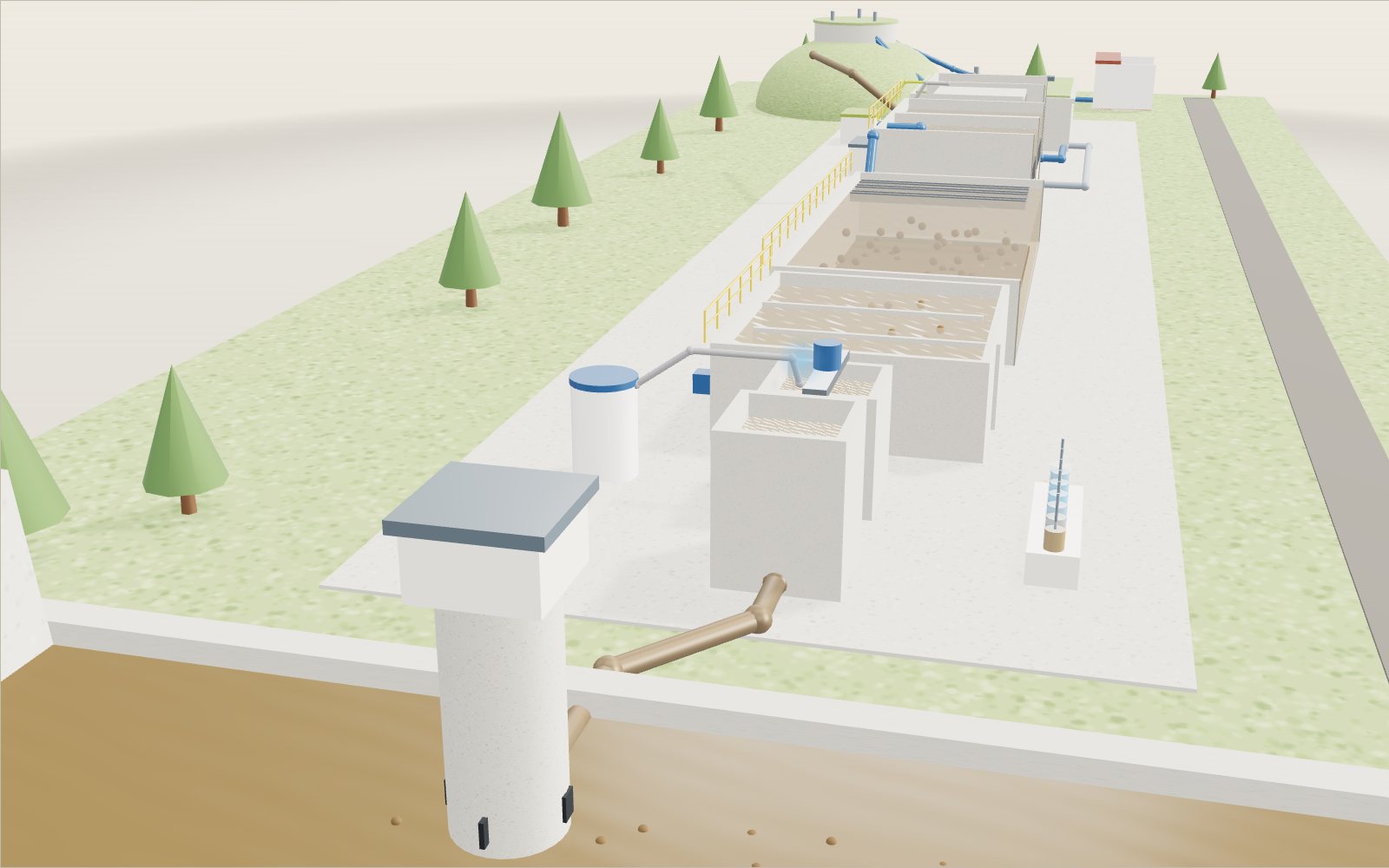
How a water treatment plant turns muddy water clear
A grain of clay two micrometres across would take eleven days to sink through a settling basin, but stuck into a floc by a coagulant it reaches the floor in about two hours.
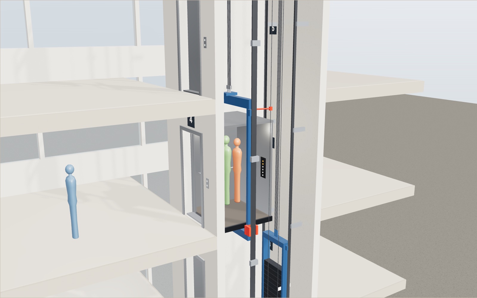
How does an elevator work? Counterweight and safety brake
A lift car full of people can weigh almost two tonnes, yet the motor that raises it only has to lift about a quarter of that, because a counterweight hangs on the other end of the ropes.
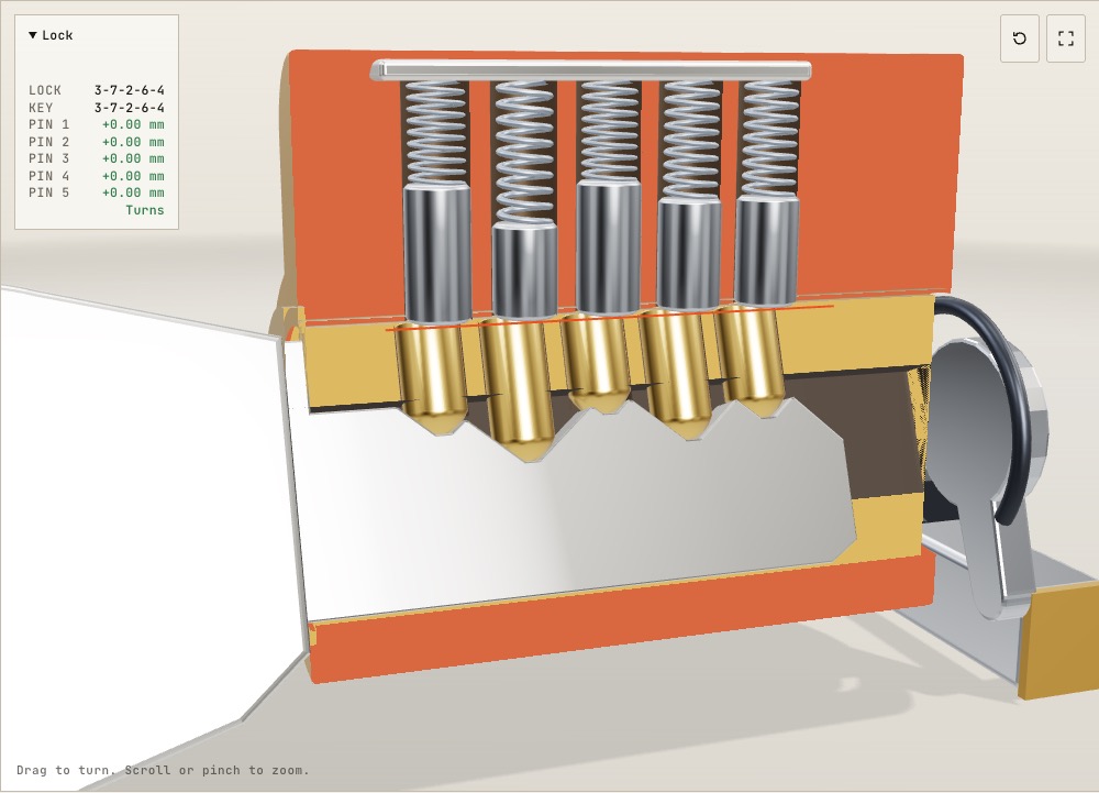
How does a pin tumbler lock work inside? A 3D cutaway
On a common Schlage key one cut depth differs from the next by 0.381 mm, and that small step is enough to keep a wrong key from turning.
How to do CPR, use an AED, help someone choking and use a fire extinguisher
Push 100 to 120 times a minute, about 5 cm deep: with a bystander doing that, survival in Korea in 2024 was 2.36 times higher.
Walk through the Sagrada Família
Inside the Sagrada Família the columns branch like trees 45 m up, and the sun moves blue and orange light across the floor.
Walk through Gyeongbokgung Palace
In the courtyard of the throne hall, 24 stones told each official where to stand, from the first grade by the hall to the ninth by the gate.